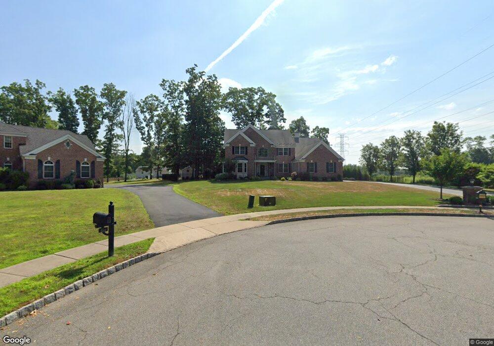
7 Mapleshade Dr Whippany, NJ 07981
Estimated Value: $1,172,199 - $1,748,000
--
Bed
--
Bath
4,128
Sq Ft
$359/Sq Ft
Est. Value
About This Home
This home is located at 7 Mapleshade Dr, Whippany, NJ 07981 and is currently estimated at $1,483,800, approximately $359 per square foot. 7 Mapleshade Dr is a home located in Morris County with nearby schools including Whippany Park High School, Arrow Academy, and Allegro School.
Ownership History
Date
Name
Owned For
Owner Type
Purchase Details
Closed on
Jan 18, 2007
Sold by
Sterling Woods Llc
Bought by
Pilavakis Alexander and Crincoli Denise
Current Estimated Value
Home Financials for this Owner
Home Financials are based on the most recent Mortgage that was taken out on this home.
Original Mortgage
$475,000
Interest Rate
6.15%
Mortgage Type
New Conventional
Create a Home Valuation Report for This Property
The Home Valuation Report is an in-depth analysis detailing your home's value as well as a comparison with similar homes in the area
Home Values in the Area
Average Home Value in this Area
Purchase History
| Date | Buyer | Sale Price | Title Company |
|---|---|---|---|
| Pilavakis Alexander | $990,334 | -- |
Source: Public Records
Mortgage History
| Date | Status | Borrower | Loan Amount |
|---|---|---|---|
| Previous Owner | Pilavakis Alexander | $475,000 |
Source: Public Records
Tax History Compared to Growth
Tax History
| Year | Tax Paid | Tax Assessment Tax Assessment Total Assessment is a certain percentage of the fair market value that is determined by local assessors to be the total taxable value of land and additions on the property. | Land | Improvement |
|---|---|---|---|---|
| 2025 | $17,231 | $817,400 | $252,400 | $565,000 |
| 2024 | $17,157 | $817,400 | $252,400 | $565,000 |
| 2023 | $17,157 | $817,400 | $252,400 | $565,000 |
| 2022 | $15,694 | $817,400 | $252,400 | $565,000 |
| 2021 | $15,465 | $817,400 | $252,400 | $565,000 |
| 2020 | $15,416 | $817,400 | $252,400 | $565,000 |
| 2019 | $15,465 | $817,400 | $252,400 | $565,000 |
| 2018 | $15,195 | $817,400 | $252,400 | $565,000 |
| 2017 | $14,746 | $817,400 | $252,400 | $565,000 |
| 2016 | $14,533 | $817,400 | $252,400 | $565,000 |
| 2015 | $13,953 | $817,400 | $252,400 | $565,000 |
| 2014 | $13,651 | $817,400 | $252,400 | $565,000 |
Source: Public Records
Map
Nearby Homes
- 92 Sunrise Dr
- 709 Brook Hollow Dr Unit 709
- 96 Parsippany Rd
- 26 Gladstone Ct
- 42 Gladstone Ct
- 34 Gladstone Ct
- 14 Gladstone Ct
- 39 Lefke Ln
- Monterey Plan at The Grove - The Monterey Collection
- Pershing Plan at The Grove - The Pershing Collection
- 11 Nemic Ln
- 2003 Vermont Terrace Unit 2003
- 53 Westminster Dr
- 26 David Dr
- 3306 Appleton Way
- 22 Karla Dr
- 91 Rhyan Dr
- 79 Rhyan Dr
- 72 Schindler Ct
- Route 10 E E Route 10 Unit 48 1B
- 5 Mapleshade Dr
- 5 Maple Shade Dr
- 175 Parsippany Rd
- 179 Parsippany Rd
- 3 Mapleshade Dr
- 176 Parsippany Rd
- 34 Woodland Ave
- 183 Parsippany Rd
- 15 Woodland Ave
- 36 Woodland Ave
- 168 Parsippany Rd
- 11 Woodland Ave Unit 2
- 11 Woodland Ave
- 1 Mapleshade Dr
- 187 Parsippany Rd
- 4 Mapleshade Dr
- 90 Sunrise Dr
- 40 Woodland Ave
- 91 Sunrise Dr Unit 1003
- 5 Woodland Ave