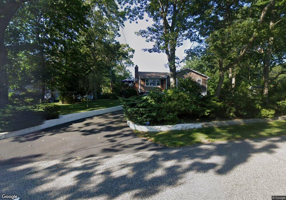
7 Marie Ln Southampton, NY 11968
Estimated Value: $918,000 - $1,858,000
3
Beds
2
Baths
1,116
Sq Ft
$1,097/Sq Ft
Est. Value
About This Home
This home is located at 7 Marie Ln, Southampton, NY 11968 and is currently estimated at $1,224,149, approximately $1,096 per square foot. 7 Marie Ln is a home located in Suffolk County with nearby schools including Southampton Elementary School, Southampton Intermediate School, and Southampton High School.
Ownership History
Date
Name
Owned For
Owner Type
Purchase Details
Closed on
Dec 23, 1999
Sold by
Fiorello Joseph and Fiorello Catherine
Bought by
Doerr Douglas L
Current Estimated Value
Home Financials for this Owner
Home Financials are based on the most recent Mortgage that was taken out on this home.
Original Mortgage
$220,500
Interest Rate
8.14%
Mortgage Type
Purchase Money Mortgage
Purchase Details
Closed on
May 15, 1996
Sold by
Fiorello Joseph S and Fiorello Catherine A
Bought by
Fiorello Joseph and Fiorello Catherine
Create a Home Valuation Report for This Property
The Home Valuation Report is an in-depth analysis detailing your home's value as well as a comparison with similar homes in the area
Home Values in the Area
Average Home Value in this Area
Purchase History
| Date | Buyer | Sale Price | Title Company |
|---|---|---|---|
| Doerr Douglas L | $245,000 | -- | |
| Fiorello Joseph | -- | -- |
Source: Public Records
Mortgage History
| Date | Status | Borrower | Loan Amount |
|---|---|---|---|
| Previous Owner | Doerr Douglas L | $220,500 |
Source: Public Records
Tax History Compared to Growth
Tax History
| Year | Tax Paid | Tax Assessment Tax Assessment Total Assessment is a certain percentage of the fair market value that is determined by local assessors to be the total taxable value of land and additions on the property. | Land | Improvement |
|---|---|---|---|---|
| 2024 | $2,256 | $533,300 | $308,300 | $225,000 |
| 2023 | $2,256 | $533,300 | $308,300 | $225,000 |
| 2022 | $1,927 | $533,300 | $308,300 | $225,000 |
| 2021 | $1,927 | $533,300 | $308,300 | $225,000 |
| 2020 | $2,115 | $533,300 | $308,300 | $225,000 |
| 2019 | $2,115 | $0 | $0 | $0 |
| 2018 | -- | $466,800 | $277,500 | $189,300 |
| 2017 | $1,809 | $426,500 | $237,200 | $189,300 |
| 2016 | $1,873 | $426,500 | $237,200 | $189,300 |
| 2015 | -- | $426,500 | $237,200 | $189,300 |
| 2014 | -- | $426,500 | $237,200 | $189,300 |
Source: Public Records
Map
Nearby Homes
- 80 Knoll Rd
- 33 Woods Ln
- 1610 Majors Path
- 1578 Majors Path
- 12 Fish Cove Rd
- 334 Noyack Rd
- 1205 Majors Path
- 70 Straight Path
- 311 Noyack Rd
- 67 Straight Path
- 7 Ashwood Ct
- 200 Great Hill Rd
- 8 Seaweed Rd
- 70 Cedar Ave
- 42 Locust Ave
- 142 Towd Point Rd
- 61 Hidden Cove Ct
- 210 Towd Point Rd
- 32 Harrison Ave
- 45 Old Sag Harbor Rd