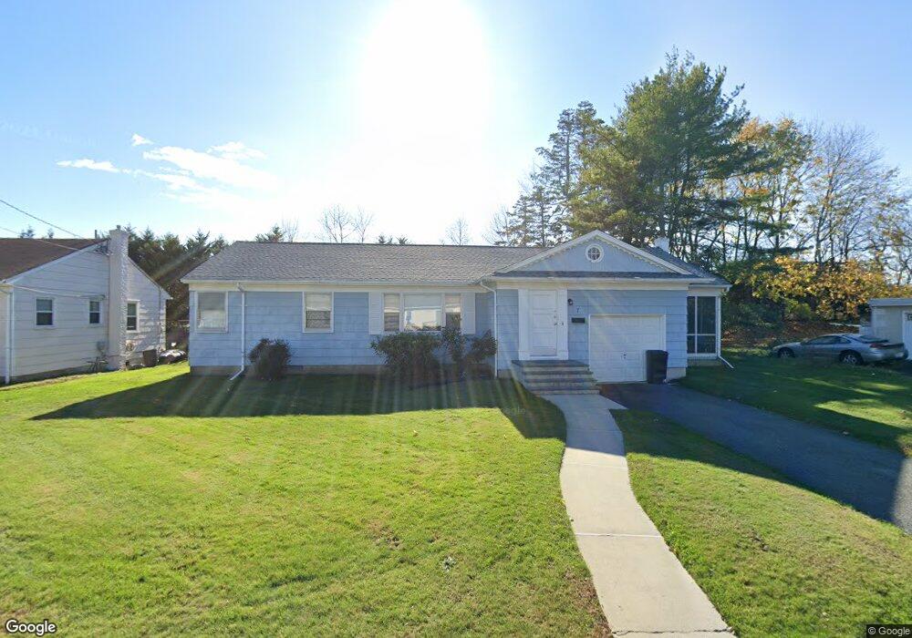
7 Marshall Ct Long Branch, NJ 07740
Estimated Value: $933,867 - $1,139,000
3
Beds
2
Baths
1,679
Sq Ft
$616/Sq Ft
Est. Value
About This Home
This home is located at 7 Marshall Ct, Long Branch, NJ 07740 and is currently estimated at $1,034,717, approximately $616 per square foot. 7 Marshall Ct is a home located in Monmouth County with nearby schools including Long Branch High School, Bet Yaakov of the Jersey Shore, and Holy Trinity School.
Ownership History
Date
Name
Owned For
Owner Type
Purchase Details
Closed on
Sep 28, 2023
Sold by
Simon Meryl Diane and Simon Michael
Bought by
Simon Meryl Diane
Current Estimated Value
Purchase Details
Closed on
Jan 30, 2003
Sold by
Saxon Ruth
Bought by
Simon Meryl and Mayer Michael
Create a Home Valuation Report for This Property
The Home Valuation Report is an in-depth analysis detailing your home's value as well as a comparison with similar homes in the area
Home Values in the Area
Average Home Value in this Area
Purchase History
| Date | Buyer | Sale Price | Title Company |
|---|---|---|---|
| Simon Meryl Diane | -- | None Listed On Document | |
| Simon Meryl Diane | -- | None Listed On Document | |
| Simon Meryl Diane | -- | None Listed On Document | |
| Simon Meryl | $305,000 | -- |
Source: Public Records
Tax History Compared to Growth
Tax History
| Year | Tax Paid | Tax Assessment Tax Assessment Total Assessment is a certain percentage of the fair market value that is determined by local assessors to be the total taxable value of land and additions on the property. | Land | Improvement |
|---|---|---|---|---|
| 2025 | $11,171 | $1,009,800 | $802,600 | $207,200 |
| 2024 | $10,604 | $726,800 | $528,600 | $198,200 |
| 2023 | $10,604 | $682,800 | $493,600 | $189,200 |
| 2022 | $8,954 | $518,300 | $351,600 | $166,700 |
| 2021 | $8,954 | $447,500 | $291,600 | $155,900 |
| 2020 | $8,393 | $401,600 | $246,600 | $155,000 |
| 2019 | $7,006 | $333,300 | $186,600 | $146,700 |
| 2018 | $6,723 | $318,000 | $176,600 | $141,400 |
| 2017 | $6,354 | $308,300 | $169,600 | $138,700 |
| 2016 | $6,401 | $316,700 | $181,600 | $135,100 |
| 2015 | $5,670 | $254,600 | $117,600 | $137,000 |
| 2014 | $6,069 | $287,200 | $165,600 | $121,600 |
Source: Public Records
Map
Nearby Homes
- 211 Cedar Ave
- 266 Lenox Ave
- 631 Hoey Ave
- 3 Reid St
- 324 Cedar Ave
- 65 Cedar Ave Unit C11
- 329 Yorke Ave
- 294 Brighton Ave
- 497 Marvin Dr
- 345 Hollywood Ave
- 35 Sternberger Ave Unit P
- 45 Cedar Ave
- 735 Greens Ave Unit 18A
- 497 Norwood Ave
- 665 2nd Ave Unit 202
- 665 2nd Ave Unit 310
- 665 2nd Ave Unit 303
- 665 2nd Ave Unit 201
- 4 Clarence Ave
- 448 Monmouth Place