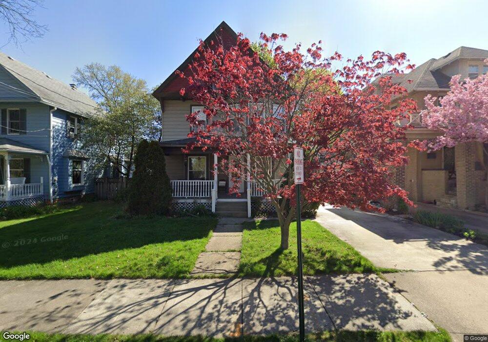
7 Mayfield Ave Akron, OH 44313
Highland Square NeighborhoodEstimated Value: $206,703 - $292,000
3
Beds
2
Baths
1,800
Sq Ft
$140/Sq Ft
Est. Value
About This Home
This home is located at 7 Mayfield Ave, Akron, OH 44313 and is currently estimated at $251,426, approximately $139 per square foot. 7 Mayfield Ave is a home located in Summit County with nearby schools including Case Community Learning Center, Summit Academy School, and Towpath Trail High School.
Ownership History
Date
Name
Owned For
Owner Type
Purchase Details
Closed on
Jul 11, 2011
Sold by
Crabiel Scott W and Crabiel Michele F
Bought by
Pope Robert F and Sarkis Lisa
Current Estimated Value
Home Financials for this Owner
Home Financials are based on the most recent Mortgage that was taken out on this home.
Original Mortgage
$118,877
Interest Rate
4.5%
Mortgage Type
FHA
Purchase Details
Closed on
May 25, 2002
Sold by
Gallagher Christopher G
Bought by
Kerns Michele F and Crabiel Scott W
Home Financials for this Owner
Home Financials are based on the most recent Mortgage that was taken out on this home.
Original Mortgage
$125,530
Interest Rate
7%
Mortgage Type
FHA
Create a Home Valuation Report for This Property
The Home Valuation Report is an in-depth analysis detailing your home's value as well as a comparison with similar homes in the area
Home Values in the Area
Average Home Value in this Area
Purchase History
| Date | Buyer | Sale Price | Title Company |
|---|---|---|---|
| Pope Robert F | $122,000 | Barristers Of Ohio | |
| Kerns Michele F | $127,500 | Midland Commerce Group |
Source: Public Records
Mortgage History
| Date | Status | Borrower | Loan Amount |
|---|---|---|---|
| Closed | Pope Robert F | $118,877 | |
| Closed | Kerns Michele F | $125,530 |
Source: Public Records
Tax History Compared to Growth
Tax History
| Year | Tax Paid | Tax Assessment Tax Assessment Total Assessment is a certain percentage of the fair market value that is determined by local assessors to be the total taxable value of land and additions on the property. | Land | Improvement |
|---|---|---|---|---|
| 2025 | $3,082 | $58,398 | $13,251 | $45,147 |
| 2024 | $3,082 | $58,398 | $13,251 | $45,147 |
| 2023 | $3,082 | $58,398 | $13,251 | $45,147 |
| 2022 | $3,151 | $46,974 | $10,602 | $36,372 |
| 2021 | $3,154 | $46,974 | $10,602 | $36,372 |
| 2020 | $3,106 | $46,970 | $10,600 | $36,370 |
| 2019 | $3,214 | $44,180 | $7,530 | $36,650 |
| 2018 | $3,170 | $44,180 | $7,530 | $36,650 |
| 2017 | $3,178 | $44,180 | $7,530 | $36,650 |
| 2016 | $3,180 | $43,570 | $7,530 | $36,040 |
| 2015 | $3,178 | $43,570 | $7,530 | $36,040 |
| 2014 | $3,152 | $43,570 | $7,530 | $36,040 |
| 2013 | $2,306 | $32,190 | $7,530 | $24,660 |
Source: Public Records
Map
Nearby Homes
- 74 Maplewood Ave
- 166 Marvin Ave
- 956 Wye Dr
- 225 N Highland Ave
- 113 N Highland Ave
- 275 N Portage Path Unit 7g
- 275 N Portage Path Unit 5A
- 333 N Portage Path Unit 6
- 333 N Portage Path Unit 3
- 333 N Portage Path Unit 34
- 939 W Exchange St
- 920 Bloomfield Ave
- 928 Bloomfield Ave
- 1255 Wednesbury Cir Unit 3A
- 316 Grand Ave
- 1066 Emma Ave
- 141 Grand Ave
- 893 Delia Ave
- 127 Hollinger Ave
- 42 Gloucester Ct Unit 3A
- 5 Mayfield Ave
- 11 Mayfield Ave
- 17 Mayfield Ave
- 985 W Market St
- 981 W Market St
- 24 N Rose Blvd
- 27 Mayfield Ave
- 42 N Rose Blvd
- 46 N Rose Blvd
- 1011 W Market St
- 31 Mayfield Ave
- 35 Mayfield Ave
- 1000 W Market St
- 56 N Rose Blvd
- 1006 W Market St
- 1017 W Market St
- 959 W Market St
- 39 Mayfield Ave
- 60 N Rose Blvd
- 15 N Rose Blvd