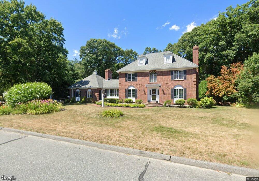
7 Mctaggart St Westborough, MA 01581
Estimated Value: $1,087,560 - $1,274,000
4
Beds
4
Baths
3,842
Sq Ft
$311/Sq Ft
Est. Value
About This Home
This home is located at 7 Mctaggart St, Westborough, MA 01581 and is currently estimated at $1,196,640, approximately $311 per square foot. 7 Mctaggart St is a home located in Worcester County with nearby schools including Westborough High School, Ebridge Montessori School, and Westboro Knowledge Beginnings.
Ownership History
Date
Name
Owned For
Owner Type
Purchase Details
Closed on
May 17, 2019
Sold by
Niedzolkowski James J and Niedzolkowski Ruth M
Bought by
Moran Miranda and Moran Eric
Current Estimated Value
Home Financials for this Owner
Home Financials are based on the most recent Mortgage that was taken out on this home.
Original Mortgage
$410,000
Outstanding Balance
$359,741
Interest Rate
4.1%
Mortgage Type
New Conventional
Estimated Equity
$836,899
Purchase Details
Closed on
Nov 12, 1992
Sold by
Brooks Robert A and Brooks Edith
Bought by
Niedzolkowski James and Niedzolkowski Ruth
Create a Home Valuation Report for This Property
The Home Valuation Report is an in-depth analysis detailing your home's value as well as a comparison with similar homes in the area
Home Values in the Area
Average Home Value in this Area
Purchase History
| Date | Buyer | Sale Price | Title Company |
|---|---|---|---|
| Moran Miranda | $685,000 | -- | |
| Niedzolkowski James | $325,000 | -- |
Source: Public Records
Mortgage History
| Date | Status | Borrower | Loan Amount |
|---|---|---|---|
| Open | Moran Miranda | $410,000 |
Source: Public Records
Tax History Compared to Growth
Tax History
| Year | Tax Paid | Tax Assessment Tax Assessment Total Assessment is a certain percentage of the fair market value that is determined by local assessors to be the total taxable value of land and additions on the property. | Land | Improvement |
|---|---|---|---|---|
| 2025 | $15,699 | $963,700 | $363,500 | $600,200 |
| 2024 | $14,931 | $909,900 | $346,100 | $563,800 |
| 2023 | $14,252 | $846,300 | $326,600 | $519,700 |
| 2022 | $13,233 | $715,700 | $260,100 | $455,600 |
| 2021 | $13,074 | $705,200 | $249,600 | $455,600 |
| 2020 | $12,897 | $704,000 | $264,200 | $439,800 |
| 2019 | $13,887 | $757,600 | $260,000 | $497,600 |
| 2018 | $12,902 | $698,900 | $249,600 | $449,300 |
| 2017 | $12,440 | $698,900 | $249,600 | $449,300 |
| 2016 | $12,494 | $703,100 | $249,600 | $453,500 |
| 2015 | $12,017 | $646,400 | $220,500 | $425,900 |
Source: Public Records
Map
Nearby Homes
- 5 Mctaggart St
- 9 Mctaggart St
- 6 Mctaggart St
- 8 Mctaggart St
- 4 Mctaggart St
- 3 Mctaggart St
- 10 Mctaggart St
- 11 Mctaggart St
- 12 Mctaggart St
- 12 Capt Samuel Forbush Rd
- 6 Heywood Dr
- 14 Capt Samuel Forbush Rd
- 10 Heywood Dr
- 10 Capt Samuel Forbush Rd
- 14 Mctaggart St
- 4 Heywood Dr
- 22 Captain Samuel Forbush
- 8 Capt Samuel Forbush Rd
- 16 Mctaggart St
- 205 W Main St