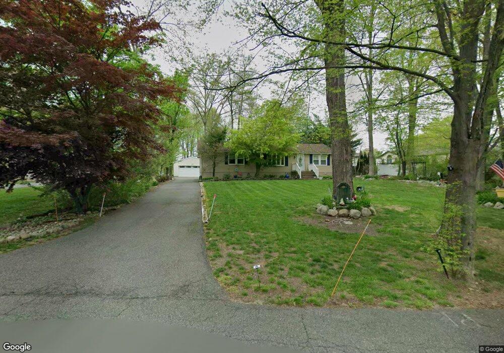
7 Michael Rd Oak Ridge, NJ 07438
Estimated Value: $450,000 - $539,000
--
Bed
--
Bath
1,344
Sq Ft
$373/Sq Ft
Est. Value
About This Home
This home is located at 7 Michael Rd, Oak Ridge, NJ 07438 and is currently estimated at $501,137, approximately $372 per square foot. 7 Michael Rd is a home located in Morris County with nearby schools including Jefferson Township Middle School, Jefferson Township High School, and Alpine Montessori School - Oakridge.
Ownership History
Date
Name
Owned For
Owner Type
Purchase Details
Closed on
Jul 29, 2022
Sold by
Whritenour David
Bought by
Shay Barbara
Current Estimated Value
Home Financials for this Owner
Home Financials are based on the most recent Mortgage that was taken out on this home.
Original Mortgage
$220,500
Interest Rate
5.3%
Mortgage Type
New Conventional
Purchase Details
Closed on
Jan 23, 2001
Sold by
Harris Jesse and Herczku Dennis
Bought by
Whritenour David and Whritenour Barbara
Home Financials for this Owner
Home Financials are based on the most recent Mortgage that was taken out on this home.
Original Mortgage
$175,000
Interest Rate
7.39%
Purchase Details
Closed on
Nov 20, 1996
Sold by
Cook Charles L and Cook Kathryn E
Bought by
Harris Jesse and Herczku Dennis
Home Financials for this Owner
Home Financials are based on the most recent Mortgage that was taken out on this home.
Original Mortgage
$147,000
Interest Rate
7.75%
Create a Home Valuation Report for This Property
The Home Valuation Report is an in-depth analysis detailing your home's value as well as a comparison with similar homes in the area
Home Values in the Area
Average Home Value in this Area
Purchase History
| Date | Buyer | Sale Price | Title Company |
|---|---|---|---|
| Shay Barbara | -- | -- | |
| Whritenour David | $225,000 | Chicago Title Insurance Co | |
| Harris Jesse | $165,000 | -- |
Source: Public Records
Mortgage History
| Date | Status | Borrower | Loan Amount |
|---|---|---|---|
| Previous Owner | Shay Barbara | $220,500 | |
| Previous Owner | Whritenour David | $175,000 | |
| Previous Owner | Harris Jesse | $147,000 |
Source: Public Records
Tax History Compared to Growth
Tax History
| Year | Tax Paid | Tax Assessment Tax Assessment Total Assessment is a certain percentage of the fair market value that is determined by local assessors to be the total taxable value of land and additions on the property. | Land | Improvement |
|---|---|---|---|---|
| 2025 | $10,417 | $347,000 | $150,500 | $196,500 |
| 2024 | $10,153 | $347,000 | $150,500 | $196,500 |
| 2023 | $10,153 | $347,000 | $150,500 | $196,500 |
| 2022 | $9,695 | $347,000 | $150,500 | $196,500 |
| 2021 | $9,695 | $347,000 | $150,500 | $196,500 |
| 2020 | $9,532 | $347,000 | $150,500 | $196,500 |
| 2019 | $9,325 | $339,200 | $149,100 | $190,100 |
| 2018 | $9,103 | $326,500 | $143,800 | $182,700 |
| 2017 | $9,033 | $318,300 | $142,100 | $176,200 |
| 2016 | $8,599 | $319,800 | $142,100 | $177,700 |
| 2015 | $8,435 | $306,400 | $142,100 | $164,300 |
| 2014 | $8,343 | $306,400 | $142,100 | $164,300 |
Source: Public Records
Map
Nearby Homes
- 5 Michael Rd
- 100 School House Rd
- 28 Highland Rd
- 18 Easy Dr
- 4 N Glen Cir
- 22 Winding Hollow Dr
- 35 Stone Row Ln
- 15 Schofield Ct
- 14 Red Oak Terrace
- 44 Ridge Rd Unit 24
- 141 Milton Rd
- 2 Southwoods Ln
- 4 Southwoods Ln
- 116 Rockaway Rd
- 3 Hidden Hills Rd
- 23 Patterson Dr
- 2 Upper Lake Rd
- 30 Little Doe Run
- 25 Little Doe Run
- 7 Pawnee Trail