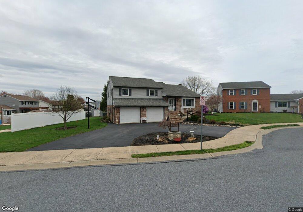
7 Monroe Cir Ephrata, PA 17522
Estimated Value: $361,629 - $407,000
3
Beds
3
Baths
1,470
Sq Ft
$264/Sq Ft
Est. Value
About This Home
This home is located at 7 Monroe Cir, Ephrata, PA 17522 and is currently estimated at $388,657, approximately $264 per square foot. 7 Monroe Cir is a home located in Lancaster County with nearby schools including Ephrata Intermediate School, Clay Elementary School, and Ephrata Senior High School.
Ownership History
Date
Name
Owned For
Owner Type
Purchase Details
Closed on
Sep 21, 2016
Sold by
Spohn Barry A
Bought by
Spohn Barry A and Spohn Sharleen D
Current Estimated Value
Purchase Details
Closed on
Jul 31, 1998
Sold by
Linton Dennis L
Bought by
Spohn Barry A
Home Financials for this Owner
Home Financials are based on the most recent Mortgage that was taken out on this home.
Original Mortgage
$119,850
Outstanding Balance
$25,003
Interest Rate
6.92%
Estimated Equity
$363,654
Create a Home Valuation Report for This Property
The Home Valuation Report is an in-depth analysis detailing your home's value as well as a comparison with similar homes in the area
Home Values in the Area
Average Home Value in this Area
Purchase History
| Date | Buyer | Sale Price | Title Company |
|---|---|---|---|
| Spohn Barry A | -- | None Available | |
| Spohn Barry A | $141,000 | -- |
Source: Public Records
Mortgage History
| Date | Status | Borrower | Loan Amount |
|---|---|---|---|
| Open | Spohn Barry A | $119,850 |
Source: Public Records
Tax History Compared to Growth
Tax History
| Year | Tax Paid | Tax Assessment Tax Assessment Total Assessment is a certain percentage of the fair market value that is determined by local assessors to be the total taxable value of land and additions on the property. | Land | Improvement |
|---|---|---|---|---|
| 2025 | $4,453 | $193,600 | $47,400 | $146,200 |
| 2024 | $4,453 | $193,600 | $47,400 | $146,200 |
| 2023 | $4,339 | $193,600 | $47,400 | $146,200 |
| 2022 | $4,240 | $193,600 | $47,400 | $146,200 |
| 2021 | $4,130 | $193,600 | $47,400 | $146,200 |
| 2020 | $4,130 | $193,600 | $47,400 | $146,200 |
| 2019 | $4,072 | $193,600 | $47,400 | $146,200 |
| 2018 | $3,154 | $193,600 | $47,400 | $146,200 |
| 2017 | $4,213 | $164,200 | $42,400 | $121,800 |
| 2016 | $4,196 | $164,200 | $42,400 | $121,800 |
| 2015 | $838 | $164,200 | $42,400 | $121,800 |
| 2014 | $3,091 | $164,200 | $42,400 | $121,800 |
Source: Public Records
Map
Nearby Homes
- 57 Perseverance Ln
- 124 Morning Dr
- 00 Morning Dr
- 131 Sunrise Ln
- 314 Freedom Dr
- 144 Sunrise Ln
- Atworth Plan at Wyndale
- Lawrence Plan at Wyndale
- Huntington Plan at Wyndale
- Brookfield Plan at Wyndale
- Darien Plan at Wyndale
- Perry Plan at Wyndale
- Kingston Plan at Wyndale
- Silverbrooke Plan at Wyndale
- Stonecroft Plan at Wyndale
- Westbrooke Plan at Wyndale
- Northfield Plan at Wyndale
- Amberbrook Plan at Wyndale
- Baker Plan at Wyndale
- Charlotte Plan at Wyndale
- 6 Monroe Cir
- 9 Monroe Cir
- 243 Buchanan Dr
- 5 Eisenhower Cir
- 5 Monroe Cir
- 233 Buchanan Dr
- 2 Monroe Cir
- 3 Monroe Cir
- 6 Eisenhower Cir
- 4 Monroe Cir
- 303 Buchanan Dr
- 4 Eisenhower Cir
- 223 Buchanan Dr
- 443 Buchanan Dr
- 433 Buchanan Dr
- 453 Buchanan Dr
- 312 Buchanan Dr
- 322 Buchanan Dr
- 242 Buchanan Dr
- 423 Buchanan Dr