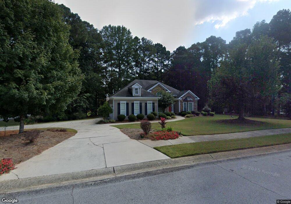
7 Mountain Brooke Dr Carrollton, GA 30116
Estimated Value: $338,000 - $453,000
3
Beds
2
Baths
2,004
Sq Ft
$198/Sq Ft
Est. Value
About This Home
This home is located at 7 Mountain Brooke Dr, Carrollton, GA 30116 and is currently estimated at $397,534, approximately $198 per square foot. 7 Mountain Brooke Dr is a home located in Carroll County with nearby schools including Central Elementary School, Central Middle School, and Central High School.
Ownership History
Date
Name
Owned For
Owner Type
Purchase Details
Closed on
Feb 19, 2025
Sold by
Pitts Robert E
Bought by
Pitts Verenda Jean Tr
Current Estimated Value
Purchase Details
Closed on
Jan 31, 2002
Sold by
Edwards Charles J
Bought by
Pitts Robert E and Pitts Verenda
Purchase Details
Closed on
Dec 21, 1995
Bought by
Edwards Charles J
Purchase Details
Closed on
Oct 31, 1995
Bought by
Edwards Charles J
Purchase Details
Closed on
Jun 1, 1992
Bought by
Eason
Create a Home Valuation Report for This Property
The Home Valuation Report is an in-depth analysis detailing your home's value as well as a comparison with similar homes in the area
Home Values in the Area
Average Home Value in this Area
Purchase History
| Date | Buyer | Sale Price | Title Company |
|---|---|---|---|
| Pitts Verenda Jean Tr | -- | -- | |
| Pitts Robert E | $190,000 | -- | |
| Edwards Charles J | -- | -- | |
| Edwards Charles J | $19,000 | -- | |
| Eason | $14,000 | -- |
Source: Public Records
Tax History Compared to Growth
Tax History
| Year | Tax Paid | Tax Assessment Tax Assessment Total Assessment is a certain percentage of the fair market value that is determined by local assessors to be the total taxable value of land and additions on the property. | Land | Improvement |
|---|---|---|---|---|
| 2024 | $319 | $154,818 | $13,000 | $141,818 |
| 2023 | $319 | $141,838 | $13,000 | $128,838 |
| 2022 | $380 | $116,335 | $13,000 | $103,335 |
| 2021 | $383 | $101,439 | $13,000 | $88,439 |
| 2020 | $385 | $91,184 | $13,000 | $78,184 |
| 2019 | $395 | $84,836 | $13,000 | $71,836 |
| 2018 | $414 | $74,057 | $13,000 | $61,057 |
| 2017 | $419 | $74,057 | $13,000 | $61,057 |
| 2016 | $419 | $74,057 | $13,000 | $61,057 |
| 2015 | $422 | $79,936 | $11,200 | $68,736 |
| 2014 | $426 | $79,936 | $11,200 | $68,736 |
Source: Public Records
Map
Nearby Homes
- 197 Westbrook Rd
- 106 Victoria Way
- 311 Hidden Lakes Dr
- 106 Victoria Vining
- 40 Westbrook Rd
- 143 Oak Leaf Dr Unit 163
- 143 Oak Leaf Dr
- 213 Shady Valley Dr
- 185 White Oak Ct
- 0 Clem Lowell Rd Unit 10479926
- 0 Clem Lowell Rd Unit 147578
- 0 Clem Lowell Rd Unit 7630669
- 184 Whooping Creek Church Rd
- 1745 Stripling Chapel Rd
- 39 Hampton Way
- 252 Mink Hollow Dr
- 158 Foggy Bottom Dr
- 391 Foggy Bottom Dr
- 25 Mountain Brooke Dr
- 126 Wynbrooke Dr
- 105 Wynbrooke Dr
- 8 Mountain Brooke Dr
- 91 Wynbrooke Dr
- 119 Wynbrooke Dr
- 57 Mountain Brooke Dr
- 22 Mountain Brooke Dr
- 129 Wynbrooke Dr
- 36 Mountain Brooke Dr
- 73 Mountain Brooke Dr
- 0 Mountain Brooke Dr Unit 3131332
- 0 Mountain Brooke Dr Unit 8375264
- 0 Mountain Brooke Dr Unit 3232171
- 48 Mountain Brooke Dr
- 11 Wynridge Dr
- 85 Mountain Brooke Dr
- 85 Mountain Brooke Dr Unit 45
- 27 Wynridge Dr
- 53 Wynbrooke Dr