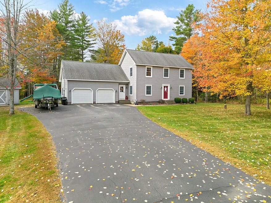
7 Moyse Rd Winterport, ME 04496
Estimated payment $3,080/month
Highlights
- 2.56 Acre Lot
- Wooded Lot
- 1 Fireplace
- Deck
- Saltbox Architecture
- Corner Lot
About This Home
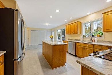
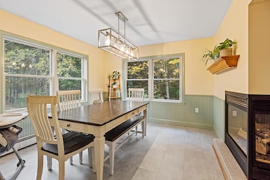
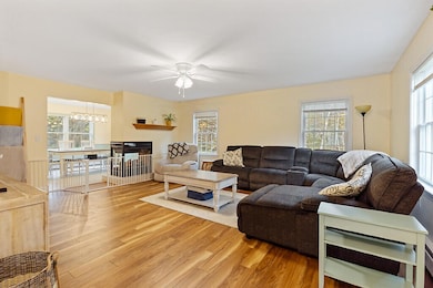
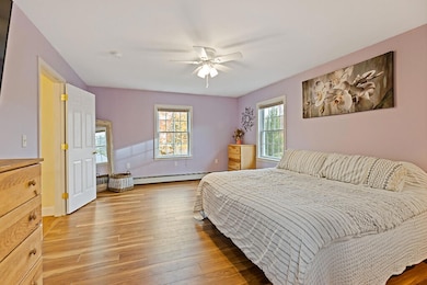
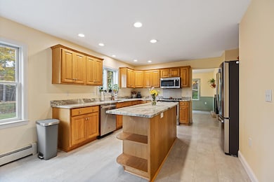
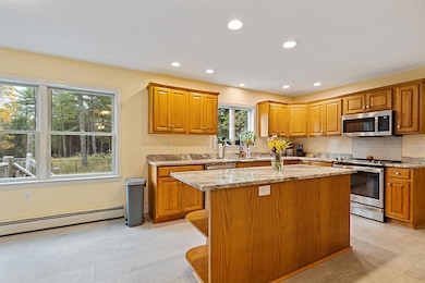
Spacious and inviting, this beautifully maintained home offers over 2,500 square feet of comfortable living space on more than 2.5 acres of land in a quiet Winterport neighborhood. Featuring 3 bedrooms, 2.5 baths, and a bonus room above the attached 2-car garage, there's plenty of room to spread out. The open-concept main living area is warmed by a two-way propane fireplace connecting the dining and living rooms—perfect for cozy evenings or entertaining guests.
Enjoy the convenience of a full foundation offering abundant storage and workshop potential. Relaxing outdoors on the back deck; in the fenced-in backyard is ideal for pets, play, or gatherings. Peaceful and private yet convenient to Bangor and the coast, this property offers the ideal blend of country charm and modern comfort—ready to welcome you home.
Home Details
Home Type
- Single Family
Est. Annual Taxes
- $5,561
Year Built
- Built in 2002
Lot Details
- 2.56 Acre Lot
- Cul-De-Sac
- Rural Setting
- Landscaped
- Corner Lot
- Interior Lot
- Level Lot
- Wooded Lot
- Property is zoned Rural
Parking
- 2 Car Attached Garage
Home Design
- Saltbox Architecture
- Wood Frame Construction
- Shingle Roof
- Vinyl Siding
Interior Spaces
- 2,669 Sq Ft Home
- 1 Fireplace
Flooring
- Laminate
- Tile
Bedrooms and Bathrooms
- 3 Bedrooms
Unfinished Basement
- Basement Fills Entire Space Under The House
- Interior Basement Entry
Outdoor Features
- Deck
Utilities
- No Cooling
- Baseboard Heating
- Private Water Source
- Private Sewer
Community Details
- No Home Owners Association
Listing and Financial Details
- Tax Lot 250.8
- Assessor Parcel Number WTPT-000010R-000000-000250-000008
Map
Home Values in the Area
Average Home Value in this Area
Property History
| Date | Event | Price | List to Sale | Price per Sq Ft |
|---|---|---|---|---|
| 10/29/2025 10/29/25 | Price Changed | $499,000 | -2.2% | $187 / Sq Ft |
| 10/16/2025 10/16/25 | For Sale | $510,000 | -- | $191 / Sq Ft |
Source: Maine Listings
MLS Number: 1641027
APN: WTPT R10-250-8
Disclaimer: Certain information contained herein is derived from information provided by parties other than Homes.com. All information provided is deemed reliable, but is not guaranteed to be accurate and should be independently verified.
![]() Listing data is derived in whole or in part from Maine Real Estate Information System, Inc. (d/b/a Maine Listings) and is for consumers' personal, noncommercial use only. Dimensions are approximate and not guaranteed. All data should be independently verified.
Listing data is derived in whole or in part from Maine Real Estate Information System, Inc. (d/b/a Maine Listings) and is for consumers' personal, noncommercial use only. Dimensions are approximate and not guaranteed. All data should be independently verified.
© 2025 Maine Real Estate Information System, Inc. All Rights Reserved. Equal Housing Opportunity.
Homes.com, LLC, 17600 Laguna Canyon Rd Irvine, CA 92618 (888)-952-6393
![]()
- 160 Baker Rd
- 23 The Landing
- 33 Comikev Ln
- 115 Cove Rd
- Lot #4 Vero's Way
- 5 Vero's Way
- 35 Hackett Rd
- 40 Bartlett Cove Dr
- 420 Main Rd S
- 8 Clark Cir
- 119 Mill Creek Rd
- 38 Bartlett Cove Dr
- 342 Main Rd S
- 8 Bartlett Cove
- 1002 River Rd
- 179 Monroe Rd
- 1 Honey Hill Ln
- 55 Lower Oak Point Rd
- 415 Monroe Rd
- Map1Lot41 Partridge Rd
- 1 Pine Grove Dr
- 114 Lebanon Rd Unit 14
- 104 Main St Unit 3
- 3 Cushing St Unit 2
- 153 Clark Rd Unit A
- 32 Emerson Mill Rd Unit 6
- 32 Emerson Mill Rd Unit 5
- 198 Main Rd N Unit B
- 46 Frances Dr
- 851 Western Ave Unit Apartment 1
- 672 Main Rd N Unit 16
- 332 Loggin Rd Unit . #2
- 120 Elm St Unit 3
- 372 Old County Rd Unit 2
- 398 Old County Rd
- 1841 Hammond St Unit 5
- 112 Meadow Ridge Dr
- 31 March St
- 94 Lincoln St Unit 2
- 94 Lincoln St Unit 2
