7 N 200 W Scipio, UT 84656
Estimated payment $2,116/month
Highlights
- RV Access or Parking
- Vaulted Ceiling
- No HOA
- Mountain View
- Main Floor Primary Bedroom
- Covered Patio or Porch
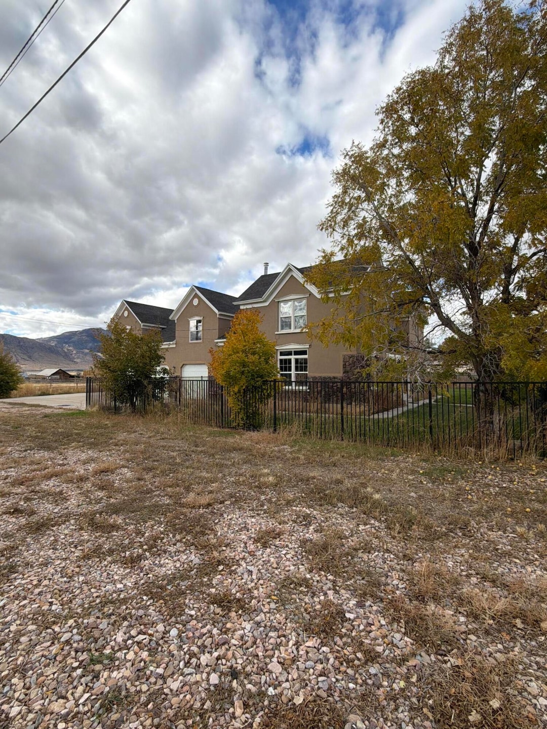
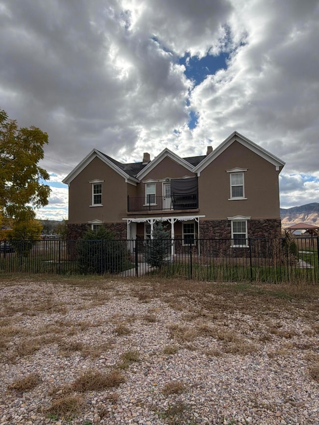
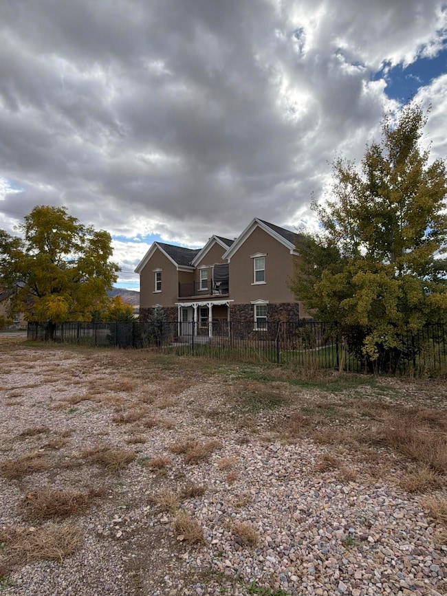
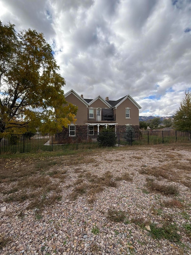
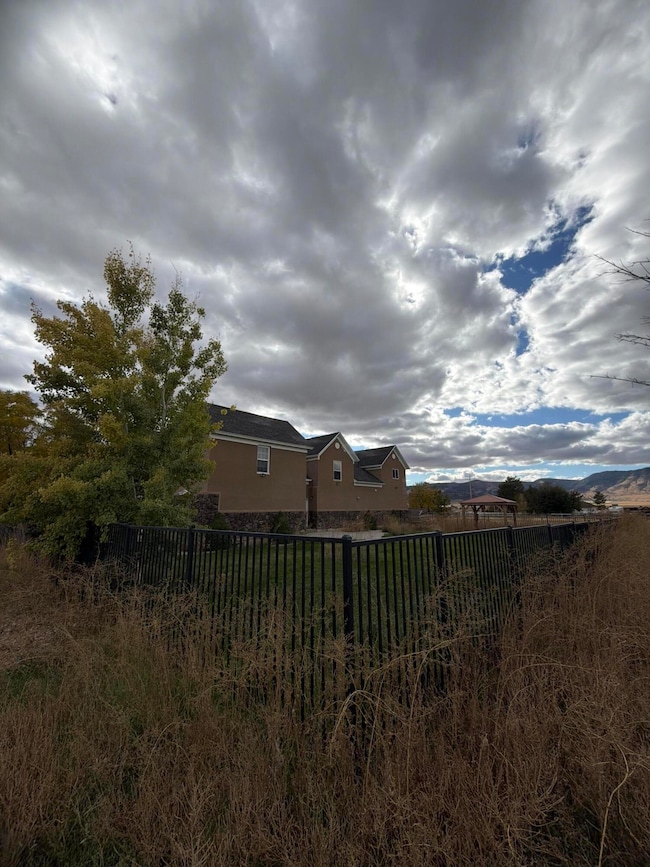
About This Home
Short Sale... Great opportunity for a residential home on .72 ac. lot with horse privileges. Fenced / gated 1/2 ac. pasture. Lg bonus / storage room in basement. Home has been updated.
Any offer will be contingent upon 3rd party approval.
Home Details
Home Type
- Single Family
Est. Annual Taxes
- $2,692
Year Built
- Built in 1870
Lot Details
- 0.72 Acre Lot
- Partially Fenced Property
- Landscaped
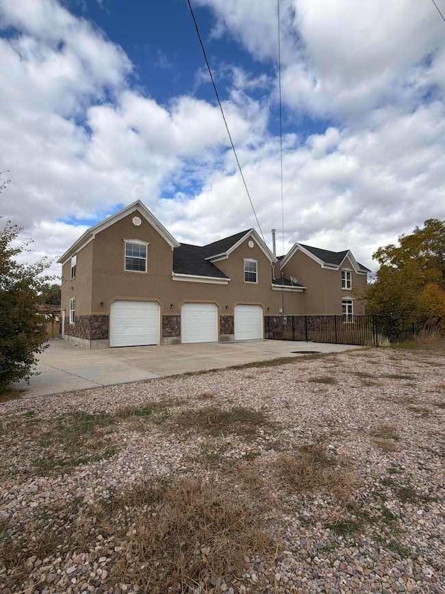
Parking
- Attached Garage
- Garage Door Opener
- RV Access or Parking
Home Design
- Brick Exterior Construction
- Asphalt Roof
- Stucco Exterior
Interior Spaces
- 3,085 Sq Ft Home
- 2-Story Property
- Vaulted Ceiling
- Ceiling Fan
- Mountain Views
- Partial Basement
Kitchen
- Free-Standing Range
- Range Hood
- Microwave
- Dishwasher
- Disposal
Bedrooms and Bathrooms
- 5 Bedrooms
- Primary Bedroom on Main
- Walk-In Closet
- 4 Bathrooms
- Bathtub With Separate Shower Stall
Outdoor Features
- Covered Patio or Porch
- Exterior Lighting
Utilities
- Central Air
- Heating System Uses Natural Gas
- Septic Tank
Community Details
- No Home Owners Association
Listing and Financial Details
- Assessor Parcel Number S-1187
Map
Home Values in the Area
Average Home Value in this Area
Tax History
| Year | Tax Paid | Tax Assessment Tax Assessment Total Assessment is a certain percentage of the fair market value that is determined by local assessors to be the total taxable value of land and additions on the property. | Land | Improvement |
|---|---|---|---|---|
| 2025 | $2,452 | $312,824 | $24,448 | $288,376 |
| 2024 | $2,452 | $293,456 | $18,444 | $275,012 |
| 2023 | $2,692 | $293,456 | $18,444 | $275,012 |
| 2022 | $1,815 | $166,566 | $18,444 | $148,122 |
| 2021 | $1,394 | $122,654 | $13,662 | $108,992 |
| 2020 | $1,295 | $114,769 | $11,880 | $102,889 |
| 2019 | $1,172 | $104,305 | $11,880 | $92,425 |
| 2018 | $1,087 | $99,021 | $11,880 | $87,141 |
| 2017 | $1,137 | $99,021 | $11,880 | $87,141 |
| 2016 | $1,063 | $96,288 | $10,247 | $86,041 |
| 2015 | $1,064 | $96,288 | $10,247 | $86,041 |
| 2014 | -- | $86,470 | $8,910 | $77,560 |
| 2013 | -- | $86,470 | $8,910 | $77,560 |
Property History
| Date | Event | Price | List to Sale | Price per Sq Ft |
|---|---|---|---|---|
| 10/30/2025 10/30/25 | Price Changed | $359,000 | -10.0% | $116 / Sq Ft |
| 10/19/2025 10/19/25 | For Sale | $399,000 | -- | $129 / Sq Ft |
Purchase History
| Date | Type | Sale Price | Title Company |
|---|---|---|---|
| Warranty Deed | -- | Title One | |
| Interfamily Deed Transfer | -- | First American Title Insur |
Mortgage History
| Date | Status | Loan Amount | Loan Type |
|---|---|---|---|
| Open | $408,750 | New Conventional |
Source: Washington County Board of REALTORS®
MLS Number: 25-266106
APN: S-1187
Disclaimer: Certain information contained herein is derived from information provided by parties other than Homes.com. All information provided is deemed reliable, but is not guaranteed to be accurate and should be independently verified.
![]() All information should be verified by the recipient and none is guaranteed as accurate by ARMLS
All information should be verified by the recipient and none is guaranteed as accurate by ARMLS
Listing Information presented by local MLS brokerage: Ten-X, local REALTOR®- Arlene Richardson - (888)-952-6393
- 295 W 100 N
- 85 E 200 Rd N
- 2000 N 500 W
- 9155 Red Canyon Rd Unit 15
- 13051 Red Canyon Rd Unit 3
- 9160 Red Canyon Rd Unit 5
- 700 W 1100 S
- 8300 N 3300 E
- 290 N 200 Rd E
- 361 N 100 W
- 445 S Main St
- 66 W 100 S
- Parcel 4609 4609x1 4609x2
- 26 N Mount Baldy Estates Rd Unit 26
- 117 E 300 S
- 36 W 100 S
- 155 S 200 W
- 420 W 350 N
- 80 N 400 W
- 165 E Center
