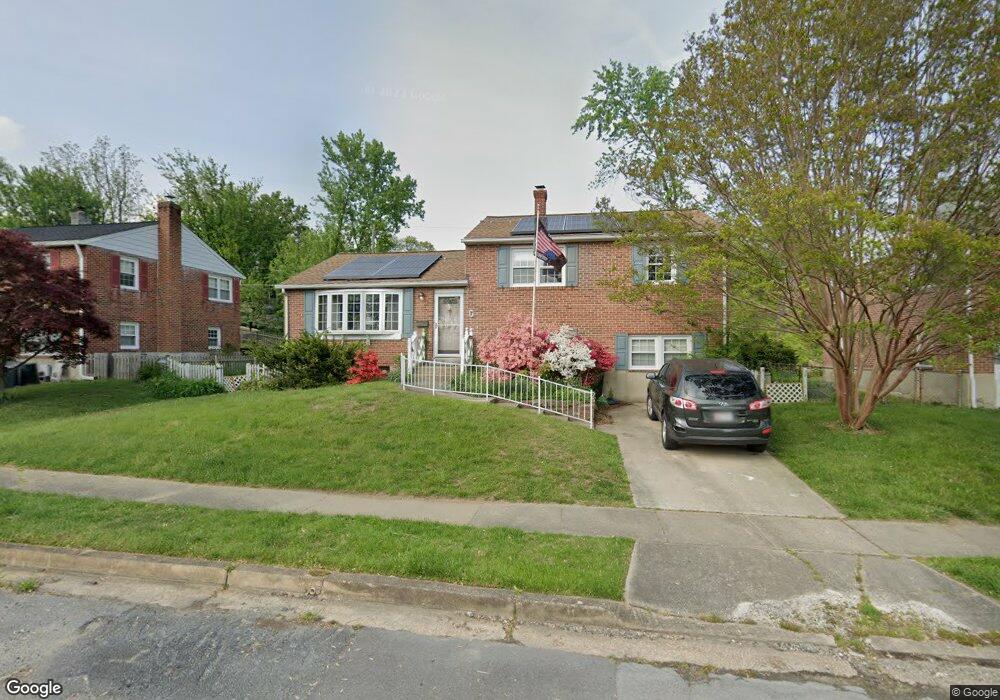
7 N Morerick Ave Catonsville, MD 21228
Estimated Value: $484,000
Studio
2
Baths
2,112
Sq Ft
$229/Sq Ft
Est. Value
About This Home
This home is located at 7 N Morerick Ave, Catonsville, MD 21228 and is currently priced at $484,000, approximately $229 per square foot. 7 N Morerick Ave is a home located in Baltimore County with nearby schools including Westchester Elementary School, Catonsville Middle School, and Catonsville High School.
Ownership History
Date
Name
Owned For
Owner Type
Purchase Details
Closed on
May 25, 2022
Sold by
Cuffari Susan R
Bought by
Cuffari Susan R and Cuffari Vincent R
Current Estimated Value
Purchase Details
Closed on
Oct 28, 2009
Sold by
Cuffari Vincent R
Bought by
Cuffari Susan R
Purchase Details
Closed on
Dec 3, 1992
Sold by
Price Ellen Hoot
Bought by
Cuffari Vincent R
Purchase Details
Closed on
Jul 20, 1981
Sold by
Meckel Arlein E
Bought by
Price Ellen Hoot
Create a Home Valuation Report for This Property
The Home Valuation Report is an in-depth analysis detailing your home's value as well as a comparison with similar homes in the area
Home Values in the Area
Average Home Value in this Area
Purchase History
| Date | Buyer | Sale Price | Title Company |
|---|---|---|---|
| Cuffari Susan R | -- | Grace Michael F | |
| Cuffari Susan R | -- | -- | |
| Cuffari Vincent R | $104,000 | -- | |
| Price Ellen Hoot | $70,500 | -- |
Source: Public Records
Tax History
| Year | Tax Paid | Tax Assessment Tax Assessment Total Assessment is a certain percentage of the fair market value that is determined by local assessors to be the total taxable value of land and additions on the property. | Land | Improvement |
|---|---|---|---|---|
| 2025 | $60 | $370,567 | -- | -- |
| 2024 | $60 | $348,900 | $127,200 | $221,700 |
| 2023 | $1,921 | $339,700 | $0 | $0 |
| 2022 | $4,191 | $330,500 | $0 | $0 |
| 2021 | $3,914 | $321,300 | $127,200 | $194,100 |
| 2020 | $3,914 | $309,533 | $0 | $0 |
| 2019 | $3,790 | $297,767 | $0 | $0 |
| 2018 | $3,658 | $286,000 | $91,200 | $194,800 |
| 2017 | $1,790 | $269,233 | $0 | $0 |
| 2016 | $2,900 | $252,467 | $0 | $0 |
| 2015 | $2,900 | $235,700 | $0 | $0 |
| 2014 | $2,900 | $235,700 | $0 | $0 |
Source: Public Records
Map
Nearby Homes
- 17 Clay Lodge Ln Unit 103
- 1920 Rollingwood Rd
- 1900 Lismore Ln
- 1918 Lismore Ln
- 7 Overhill Rd
- 7 Montrose Ave
- 124 Oakdale Ave
- 2029 Norhurst Way S
- 29 Upman Ct
- 122 Wyndcrest Ave
- 627 Meyers Dr
- 627 Meyers Dr Unit PARCEL 108
- 28 Bryans Mill Way
- 226 Glenmore Ave
- 2 Park Dr
- 343 N Beaumont Ave
- 502 Durango Rd
- 0 Melvin Ave
- 4468 Ilchester Rd
- 2004 Westchester Ave
- 9 N Morerick Ave
- 5 N Morerick Ave
- 1917 Devere Ln
- 11 N Morerick Ave
- 3 N Morerick Ave
- 6 N Morerick Ave
- 8 N Morerick Ave
- 1919 Devere Ln
- 4 N Morerick Ave
- 10 N Morerick Ave
- 1915 Devere Ln
- 13 N Morerick Ave
- 2 N Morerick Ave
- 1 N Morerick Ave
- 1921 Devere Ln
- 115 Rollingbrook Way
- 3 Monmouth Rd
- 5 Monmouth Rd
- 7 Monmouth Rd
- 1 Monmouth Rd
Your Personal Tour Guide
Ask me questions while you tour the home.