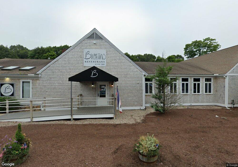
7 Nathan Ellis Hwy North Falmouth, MA 2556
North Falmouth NeighborhoodEstimated Value: $1,722,051
--
Bed
--
Bath
8,444
Sq Ft
$204/Sq Ft
Est. Value
About This Home
This home is located at 7 Nathan Ellis Hwy, North Falmouth, MA 2556 and is currently estimated at $1,722,051, approximately $203 per square foot. 7 Nathan Ellis Hwy is a home located in Barnstable County with nearby schools including North Falmouth Elementary School, Morse Pond School, and Lawrence School.
Ownership History
Date
Name
Owned For
Owner Type
Purchase Details
Closed on
Jun 5, 1998
Sold by
Jssep Rt and Houghton
Bought by
Rmj Rt and Davis
Current Estimated Value
Home Financials for this Owner
Home Financials are based on the most recent Mortgage that was taken out on this home.
Original Mortgage
$300,000
Outstanding Balance
$60,016
Interest Rate
7.05%
Mortgage Type
Commercial
Estimated Equity
$1,662,035
Create a Home Valuation Report for This Property
The Home Valuation Report is an in-depth analysis detailing your home's value as well as a comparison with similar homes in the area
Home Values in the Area
Average Home Value in this Area
Purchase History
| Date | Buyer | Sale Price | Title Company |
|---|---|---|---|
| Rmj Rt | $325,000 | -- | |
| Rmj Rt | $325,000 | -- |
Source: Public Records
Mortgage History
| Date | Status | Borrower | Loan Amount |
|---|---|---|---|
| Open | Rmj Rt | $300,000 | |
| Closed | Rmj Rt | $300,000 | |
| Previous Owner | Rmj Rt | $300,000 |
Source: Public Records
Tax History Compared to Growth
Tax History
| Year | Tax Paid | Tax Assessment Tax Assessment Total Assessment is a certain percentage of the fair market value that is determined by local assessors to be the total taxable value of land and additions on the property. | Land | Improvement |
|---|---|---|---|---|
| 2025 | $9,533 | $1,624,100 | $582,700 | $1,041,400 |
| 2024 | $9,499 | $1,512,500 | $528,800 | $983,700 |
| 2023 | $7,330 | $1,059,200 | $464,000 | $595,200 |
| 2022 | $7,431 | $923,100 | $392,300 | $530,800 |
| 2021 | $7,591 | $893,000 | $375,300 | $517,700 |
| 2020 | $7,718 | $898,500 | $375,300 | $523,200 |
| 2019 | $7,579 | $885,400 | $368,600 | $516,800 |
| 2018 | $7,364 | $856,300 | $351,600 | $504,700 |
| 2017 | $7,102 | $832,600 | $337,300 | $495,300 |
| 2016 | $7,073 | $845,100 | $337,300 | $507,800 |
| 2015 | $6,921 | $845,100 | $337,300 | $507,800 |
| 2014 | $6,721 | $824,700 | $319,700 | $505,000 |
Source: Public Records
Map
Nearby Homes
- 289 Old Main Rd
- 23 Wohelo Dr
- 48 Garnet Ave
- 2 Tricia Rd
- 31 Baxendale Rd
- 267 N Falmouth Hwy
- 14 Ryder Rd
- 24 Fiddlers Cove Rd
- 37 Five Gate Ln
- 213 N Falmouth Hwy Unit 5A
- 213 N Falmouth Hwy Unit 5B
- 213 N Falmouth Hwy Unit 5 A
- 74 Hillside Ave
- 10 Squeteague Harbor Rd
- 250 Scraggy Neck Rd
- 9 Seascape Ln
- 234 Cairn Ridge Rd
- 21 Cloverfield Way
- 0 Nathan Ellis Hwy Unit 72204881
- 0 Nathan Ellis Hwy Unit 70787588
- 0 Nathan Ellis Hwy Unit 70861812
- 0 Nathan Ellis Hwy Unit 70927371
- 0 Nathan Ellis Hwy Unit 71554952
- 0 Nathan Ellis Hwy Unit 71713333
- 0 Nathan Ellis Hwy Unit 8040566
- 0 Nathan Ellis Hwy Unit 21714208
- 30 Beaman Ln
- 16 Beaman Ln
- 15 Beaman Ln
- 557 N Falmouth Hwy
- 22 Nathan Ellis Hwy
- 0 County Unit 20700833
- 0 County Unit B 2014799
- 0 County Unit F 2001573
- 0 County Unit C
- 563 N Falmouth Hwy
- 24 Beaman Ln
- 24 Beaman Ln