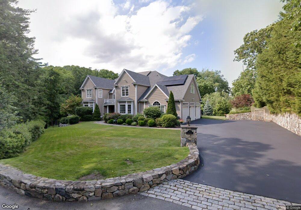
7 Nokomis Way Natick, MA 01760
Estimated Value: $2,084,144 - $2,913,000
4
Beds
4
Baths
5,992
Sq Ft
$391/Sq Ft
Est. Value
About This Home
This home is located at 7 Nokomis Way, Natick, MA 01760 and is currently estimated at $2,341,036, approximately $390 per square foot. 7 Nokomis Way is a home located in Middlesex County with nearby schools including Natick High School, Memorial Elementary School, and J F Kennedy Middle School.
Ownership History
Date
Name
Owned For
Owner Type
Purchase Details
Closed on
Sep 12, 2025
Sold by
Prince Sheila
Bought by
Biggins Thomas J
Current Estimated Value
Home Financials for this Owner
Home Financials are based on the most recent Mortgage that was taken out on this home.
Original Mortgage
$1,680,000
Outstanding Balance
$1,676,348
Interest Rate
5.55%
Mortgage Type
New Conventional
Estimated Equity
$664,688
Purchase Details
Closed on
Dec 27, 2017
Sold by
Prince Sheila
Bought by
Vhs Acquisition Subsid
Purchase Details
Closed on
Aug 18, 2008
Sold by
Brown Michael M and Brown Tamsen M
Bought by
Prince Sheila
Create a Home Valuation Report for This Property
The Home Valuation Report is an in-depth analysis detailing your home's value as well as a comparison with similar homes in the area
Home Values in the Area
Average Home Value in this Area
Purchase History
| Date | Buyer | Sale Price | Title Company |
|---|---|---|---|
| Biggins Thomas J | $2,100,000 | -- | |
| Biggins Thomas J | $2,100,000 | -- | |
| Vhs Acquisition Subsid | $2,734 | -- | |
| Vhs Acquisition Subsid | $2,734 | -- | |
| Prince Sheila | $1,282,500 | -- | |
| Prince Sheila | $1,282,500 | -- | |
| Prince Sheila | $1,282,500 | -- |
Source: Public Records
Mortgage History
| Date | Status | Borrower | Loan Amount |
|---|---|---|---|
| Open | Biggins Thomas J | $1,680,000 | |
| Closed | Biggins Thomas J | $1,680,000 |
Source: Public Records
Tax History Compared to Growth
Tax History
| Year | Tax Paid | Tax Assessment Tax Assessment Total Assessment is a certain percentage of the fair market value that is determined by local assessors to be the total taxable value of land and additions on the property. | Land | Improvement |
|---|---|---|---|---|
| 2025 | $23,267 | $1,945,400 | $684,800 | $1,260,600 |
| 2024 | $22,648 | $1,847,300 | $650,200 | $1,197,100 |
| 2023 | $20,883 | $1,652,100 | $612,500 | $1,039,600 |
| 2022 | $19,859 | $1,488,700 | $500,900 | $987,800 |
| 2021 | $19,070 | $1,401,200 | $474,800 | $926,400 |
| 2020 | $18,804 | $1,381,600 | $455,200 | $926,400 |
| 2019 | $17,574 | $1,382,700 | $456,300 | $926,400 |
| 2018 | $18,065 | $1,384,300 | $436,800 | $947,500 |
| 2017 | $18,261 | $1,353,700 | $423,100 | $930,600 |
| 2016 | $17,395 | $1,281,900 | $423,100 | $858,800 |
| 2015 | $16,603 | $1,201,400 | $423,100 | $778,300 |
Source: Public Records
Map
Nearby Homes
- 10 Sundance Way
- 15 Penobscot Rd
- 94 Woodland St
- 11 Avon St
- 39 Davis Brook Dr
- 67 E Central St & 5 Union St
- 5 Wilson St Unit 5A
- 20 Marion St
- 62 E Central St Unit 305
- 6B Lincoln St Unit 6B
- 4B Lincoln St Unit 4B
- 3 Wilson St Unit 3B
- 15 Church St Unit 3
- 3 Vale St Unit B
- 48 S Main St Unit 7
- 31 Marion St
- 5 Deer Path
- 8 Floral Ave Unit 8
- 18 University Dr
- 191 E Central St
- 5 Nokomis Way
- 9 Nokomis Way
- 9 Nokomis Way Unit A
- 9A Nokomis Way
- 3 Nokomis Way
- 11 Nokomis Way
- 89 Union St
- 13 Nokomis Way
- 1 Moccasin Path
- 91 Union St Unit 91
- 2 Moccasin Path
- 2 Moccasin Path
- 10 Nokomis Way
- 8 Nokomis Way
- 3 Moccasin Path
- 6 Nokomis Way
- 71 Union St
- 71 Union St Unit 71
- 5 Arrow Path
- 1 Nokomis Way