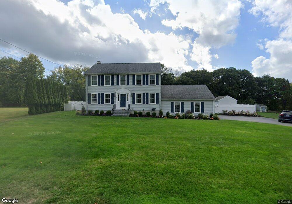
7 Oakdale Farm Rd Whitman, MA 02382
Estimated Value: $817,500 - $948,000
4
Beds
3
Baths
3,515
Sq Ft
$249/Sq Ft
Est. Value
About This Home
This home is located at 7 Oakdale Farm Rd, Whitman, MA 02382 and is currently estimated at $873,625, approximately $248 per square foot. 7 Oakdale Farm Rd is a home located in Plymouth County with nearby schools including St Bridget School.
Ownership History
Date
Name
Owned For
Owner Type
Purchase Details
Closed on
Jul 14, 1995
Sold by
R&R Rt and Mccarthy Richard P
Bought by
Drier Joseph P and Drier Kathleen M
Current Estimated Value
Create a Home Valuation Report for This Property
The Home Valuation Report is an in-depth analysis detailing your home's value as well as a comparison with similar homes in the area
Home Values in the Area
Average Home Value in this Area
Purchase History
| Date | Buyer | Sale Price | Title Company |
|---|---|---|---|
| Drier Joseph P | $194,000 | -- |
Source: Public Records
Mortgage History
| Date | Status | Borrower | Loan Amount |
|---|---|---|---|
| Open | Drier Joseph P | $173,148 | |
| Open | Drier Joseph P | $300,000 | |
| Closed | Drier Joseph P | $73,600 |
Source: Public Records
Tax History Compared to Growth
Tax History
| Year | Tax Paid | Tax Assessment Tax Assessment Total Assessment is a certain percentage of the fair market value that is determined by local assessors to be the total taxable value of land and additions on the property. | Land | Improvement |
|---|---|---|---|---|
| 2025 | $9,868 | $752,100 | $255,500 | $496,600 |
| 2024 | $9,221 | $723,800 | $251,000 | $472,800 |
| 2023 | $8,712 | $642,000 | $218,400 | $423,600 |
| 2022 | $8,654 | $594,400 | $198,100 | $396,300 |
| 2021 | $8,457 | $545,600 | $180,100 | $365,500 |
| 2020 | $8,381 | $528,800 | $174,500 | $354,300 |
| 2019 | $8,047 | $523,200 | $174,500 | $348,700 |
| 2018 | $7,594 | $474,300 | $163,200 | $311,100 |
| 2017 | $7,057 | $468,000 | $163,200 | $304,800 |
| 2016 | $7,109 | $456,000 | $157,600 | $298,400 |
| 2015 | $7,118 | $456,000 | $157,600 | $298,400 |
Source: Public Records
Map
Nearby Homes
- 684 South Ave
- 55 Plymouth St Unit A5
- 170 Pleasant St
- 131 Holly Ridge Dr
- 23 Reed Place
- 40 Lazel St
- 214 Winter St
- 35 Dana St
- 608 Plymouth St
- 1057 Whitman St
- 679 Plymouth St
- 8 Hayford Trail Unit 19
- 7 Hayford Trail Unit 12
- 5 Hayford Trail Unit 11
- 22 Howland Trail Unit 34
- 12 Hayford Trail Unit 17
- 13 Hayford Trail Unit 15
- 417 Birchbark Dr
- 137 Peregrine Rd
- 14 Daniel Teague Dr
- 5 Oakdale Farm Rd
- 9 Oakdale Farm Rd
- 4 Oakdale Farm Rd
- 3 Oakdale Farm Rd
- 169 Plymouth St
- 6 Oakdale Farm Rd
- 187 Plymouth St
- 2 Oakdale Farm Rd
- 3 Pasture Ln
- 199 Plymouth St
- 159 Plymouth St
- 12 Tobin Terrace
- 16 Candlewick Ln
- 18 Candlewick Ln
- 213 Plymouth St
- 5 Pasture Ln
- 26 Candlewick Ln
- 127 Candlewick Ln
- 15 Tobin Terrace
- 2 Pasture Ln