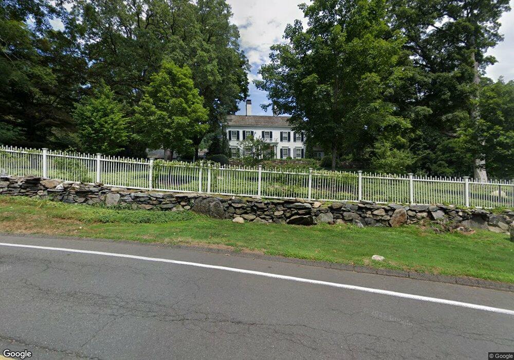
7 Old Redding Rd Weston, CT 06883
Estimated Value: $2,427,000 - $4,063,053
Studio
10
Baths
--
Sq Ft
2.64
Acres
About This Home
This home is located at 7 Old Redding Rd, Weston, CT 06883 and is currently estimated at $3,298,013. 7 Old Redding Rd is a home located in Fairfield County with nearby schools including Hurlbutt Elementary School, Weston Intermediate School, and Weston Middle School.
Ownership History
Date
Name
Owned For
Owner Type
Purchase Details
Closed on
Oct 2, 1996
Sold by
Barata Joe
Bought by
Bannister Holly
Current Estimated Value
Purchase Details
Closed on
May 28, 1993
Sold by
Barata Joe G
Bought by
Corvese Brian and Corvese Barbara
Purchase Details
Closed on
Oct 2, 1991
Sold by
Barata Joseph
Bought by
Newhause Douglas and Bannister Holly
Create a Home Valuation Report for This Property
The Home Valuation Report is an in-depth analysis detailing your home's value as well as a comparison with similar homes in the area
Home Values in the Area
Average Home Value in this Area
Purchase History
| Date | Buyer | Sale Price | Title Company |
|---|---|---|---|
| Bannister Holly | $300,000 | -- | |
| Corvese Brian | $315,000 | -- | |
| Newhause Douglas | $988,000 | -- |
Source: Public Records
Mortgage History
| Date | Status | Borrower | Loan Amount |
|---|---|---|---|
| Open | Newhause Douglas | $325,000 | |
| Closed | Newhause Douglas | $520,000 |
Source: Public Records
Tax History
| Year | Tax Paid | Tax Assessment Tax Assessment Total Assessment is a certain percentage of the fair market value that is determined by local assessors to be the total taxable value of land and additions on the property. | Land | Improvement |
|---|---|---|---|---|
| 2025 | $59,069 | $2,471,490 | $248,150 | $2,223,340 |
| 2024 | $58,006 | $2,471,490 | $248,150 | $2,223,340 |
| 2023 | $53,439 | $1,616,420 | $248,150 | $1,368,270 |
| 2022 | $53,293 | $1,616,420 | $248,150 | $1,368,270 |
| 2021 | $6,494 | $1,616,420 | $248,150 | $1,368,270 |
| 2020 | $52,324 | $1,616,420 | $248,150 | $1,368,270 |
| 2019 | $12,752 | $1,616,420 | $248,150 | $1,368,270 |
| 2018 | $51,277 | $1,744,700 | $314,100 | $1,430,600 |
| 2017 | $12,816 | $1,744,700 | $314,100 | $1,430,600 |
| 2016 | $49,829 | $1,744,700 | $314,100 | $1,430,600 |
| 2015 | $50,021 | $1,744,700 | $314,100 | $1,430,600 |
| 2014 | $49,270 | $1,744,700 | $314,100 | $1,430,600 |
Source: Public Records
Map
Nearby Homes
- 3 Mayflower Ln
- 14 Codfish Ln
- 140 Mile Common Rd
- 85-95 Old Easton Turnpike
- 11 Judges Hollow Rd
- 4 Colony Rd
- 1375 Westport Turnpike
- 200 Long Meadow Rd
- 198 Steep Hill Rd
- 180 Catamount Rd
- 39 Tannery Ln S
- 26 Hill Farm Rd
- 158 Coventry Ln
- 136 Lyons Plain Rd
- 4800 Congress St
- 22 Brett Rd
- 214 Good Hill Rd
- 101 Brambley Hedge Cir
- 1 Greenlea Ln
- 88 Merry Meet Cir
- 14 Old Redding Rd
- 10 Old Redding Rd
- 10 Mayflower Ln
- 12 Mayflower Ln
- 12 Old Redding Rd
- 15 Mayflower Ln
- 45 Old Redding Rd
- 18 Old Redding Rd
- 4 Old Redding Rd
- 4 Mayflower Ln
- 2 Fresh Meadow Rd
- 6 Fresh Meadow Rd
- 6 Fresh Meadow Rd Unit Lot 6
- 180 Redding Rd
- 10 Fresh Meadow Rd
- 9 Codfish Ln
- 24 Old Redding Rd
- 7+11 Mayflower Ln
- 169 Redding Rd
- 169 Redding Rd