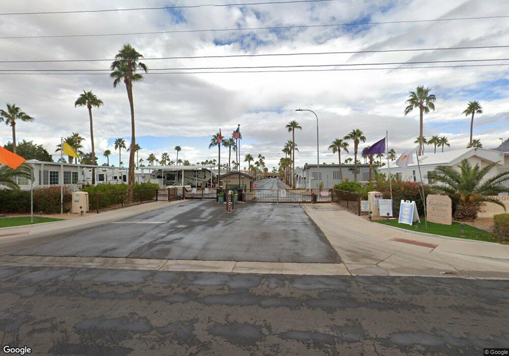
7 Orecart Dr Unit 7 Apache Junction, AZ 85119
Estimated Value: $126,948 - $148,000
Studio
--
Bath
385
Sq Ft
$363/Sq Ft
Est. Value
About This Home
This home is located at 7 Orecart Dr Unit 7, Apache Junction, AZ 85119 and is currently estimated at $139,649, approximately $362 per square foot. 7 Orecart Dr Unit 7 is a home located in Pinal County with nearby schools including Peralta Trail Elementary School, Cactus Canyon Junior High School, and Apache Junction High School.
Ownership History
Date
Name
Owned For
Owner Type
Purchase Details
Closed on
Apr 18, 2022
Sold by
Robert Ohlhauser
Bought by
Banitt Dale Christian
Current Estimated Value
Purchase Details
Closed on
Feb 6, 2008
Sold by
Gillespie Robert W and Gillespie Marie T
Bought by
Ohlhauser Robert D and Ohlhauser Veronica M
Purchase Details
Closed on
Mar 5, 2004
Sold by
Hopps David E and Hopps Delores V
Bought by
Gillespie Robert W and Gillespie Marie T
Purchase Details
Closed on
Dec 4, 2001
Sold by
Frank Conrad G B and Atkinson Helen L
Bought by
Hopps David E and Hopps Delores Y
Home Financials for this Owner
Home Financials are based on the most recent Mortgage that was taken out on this home.
Original Mortgage
$39,500
Interest Rate
7.01%
Mortgage Type
New Conventional
Purchase Details
Closed on
Feb 1, 1995
Sold by
Golden Vista R V Partners Inc
Bought by
Frank Conrad G B and Atkinson Helen L
Create a Home Valuation Report for This Property
The Home Valuation Report is an in-depth analysis detailing your home's value as well as a comparison with similar homes in the area
Home Values in the Area
Average Home Value in this Area
Purchase History
| Date | Buyer | Sale Price | Title Company |
|---|---|---|---|
| Banitt Dale Christian | $130,000 | None Listed On Document | |
| Ohlhauser Robert D | $98,000 | None Available | |
| Gillespie Robert W | $55,000 | Ticor Title Agency Of Az Inc | |
| Hopps David E | $54,500 | First American Title | |
| Frank Conrad G B | $12,500 | Transamerica Title Ins Co |
Source: Public Records
Mortgage History
| Date | Status | Borrower | Loan Amount |
|---|---|---|---|
| Previous Owner | Hopps David E | $39,500 |
Source: Public Records
Tax History
| Year | Tax Paid | Tax Assessment Tax Assessment Total Assessment is a certain percentage of the fair market value that is determined by local assessors to be the total taxable value of land and additions on the property. | Land | Improvement |
|---|---|---|---|---|
| 2025 | $449 | -- | -- | -- |
| 2024 | $424 | -- | -- | -- |
| 2023 | $442 | $3,925 | $2,166 | $1,759 |
| 2022 | $424 | $3,843 | $2,166 | $1,677 |
| 2021 | $432 | $3,828 | $0 | $0 |
| 2020 | $421 | $3,790 | $0 | $0 |
| 2019 | $404 | $3,785 | $0 | $0 |
| 2018 | $396 | $2,529 | $0 | $0 |
| 2017 | $411 | $2,570 | $0 | $0 |
| 2016 | $424 | $2,591 | $900 | $1,691 |
| 2014 | -- | $2,777 | $900 | $1,877 |
Source: Public Records
Map
Nearby Homes
- 3 Ore Cart Dr Unit 3
- 3710 S Goldfield Rd Unit 93
- 3710 S Goldfield Rd Unit 287
- 916 S Mineshaft Dr
- 923 Nickel Dr Unit 923
- 94 Jacknife Dr Unit 94
- 71 S Jacknife Dr Unit 71
- 114 S Kaoline Dr Unit 114
- 124 Kaolin Dr
- 43 Iron Ore Dr
- 155 S Limestone Dr
- 196 Mineshaft Dr
- 167 Limestone Dr Unit 167
- 148 Limestone Dr Unit 148
- 149 Limestone Dr Unit 149
- 972 Oxide Dr Unit 972
- 993 S Prospector Dr Unit 993
- 890 Nightdigger Dr Unit 1106
- 977 S Oxide Dr Unit 977
- 932 Nickel Dr Unit 932
- 6 S Orecart Dr Unit 6
- 5 S Orecart Dr Unit 5
- 137 S Kaolin Dr Unit 137
- 59 Jacknife Dr
- 135 Kaoline Dr Unit 135
- 60 S Jacknife Dr Unit 60
- 175 S Limestone Dr
- 11 Ore Cart Dr
- 1081 Ore Cart Dr
- 1077 Ore Cart Dr
- 1080 Ore Cart Dr Unit 1080
- 54 Iron Ore Dr Unit 54
- 183 S Mineshaft Dr
- 172 Limestone Dr Unit 172
- 184 Mineshaft Dr Unit 184
- 147 S Limestone Dr
- 3710 S Goldfield Rd Unit 94
- 3710 S Goldfield Rd Unit 938
- 3710 S Goldfield Rd Unit 607
- 3710 S Goldfield Rd Unit 127
Your Personal Tour Guide
Ask me questions while you tour the home.
