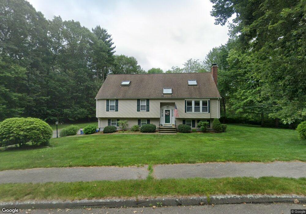
7 Pheasant Hill Rd Walpole, MA 02081
Estimated Value: $718,000 - $1,023,000
5
Beds
4
Baths
1,648
Sq Ft
$536/Sq Ft
Est. Value
About This Home
This home is located at 7 Pheasant Hill Rd, Walpole, MA 02081 and is currently estimated at $883,097, approximately $535 per square foot. 7 Pheasant Hill Rd is a home located in Norfolk County with nearby schools including Fisher School, Walpole Middle School, and Walpole High School.
Ownership History
Date
Name
Owned For
Owner Type
Purchase Details
Closed on
May 29, 2020
Sold by
Murray Mark C and Murray Anne E
Bought by
Murray Nt
Current Estimated Value
Purchase Details
Closed on
Apr 22, 2005
Sold by
Michienzi Frank A and Michienzi Vilma
Bought by
Murray Anne W and Murray Mark C
Home Financials for this Owner
Home Financials are based on the most recent Mortgage that was taken out on this home.
Original Mortgage
$331,000
Interest Rate
5.87%
Mortgage Type
Purchase Money Mortgage
Purchase Details
Closed on
Aug 25, 2000
Sold by
Mclaughlin George F and Mclaughlin Mary T
Bought by
Michienzi Frank A
Home Financials for this Owner
Home Financials are based on the most recent Mortgage that was taken out on this home.
Original Mortgage
$170,000
Interest Rate
8.06%
Mortgage Type
Purchase Money Mortgage
Create a Home Valuation Report for This Property
The Home Valuation Report is an in-depth analysis detailing your home's value as well as a comparison with similar homes in the area
Home Values in the Area
Average Home Value in this Area
Purchase History
| Date | Buyer | Sale Price | Title Company |
|---|---|---|---|
| Murray Nt | -- | None Available | |
| Murray Anne W | $556,500 | -- | |
| Michienzi Frank A | $348,000 | -- |
Source: Public Records
Mortgage History
| Date | Status | Borrower | Loan Amount |
|---|---|---|---|
| Previous Owner | Michienzi Frank A | $230,000 | |
| Previous Owner | Murray Anne W | $331,000 | |
| Previous Owner | Michienzi Frank A | $170,000 | |
| Previous Owner | Michienzi Frank A | $148,000 | |
| Previous Owner | Michienzi Frank A | $150,000 |
Source: Public Records
Tax History
| Year | Tax Paid | Tax Assessment Tax Assessment Total Assessment is a certain percentage of the fair market value that is determined by local assessors to be the total taxable value of land and additions on the property. | Land | Improvement |
|---|---|---|---|---|
| 2025 | $10,252 | $799,100 | $429,600 | $369,500 |
| 2024 | $10,002 | $756,600 | $413,200 | $343,400 |
| 2023 | $9,533 | $686,300 | $359,100 | $327,200 |
| 2022 | $9,014 | $623,400 | $332,400 | $291,000 |
| 2021 | $8,683 | $585,100 | $313,600 | $271,500 |
| 2020 | $8,634 | $576,000 | $306,400 | $269,600 |
| 2019 | $8,396 | $556,000 | $295,500 | $260,500 |
| 2018 | $8,064 | $528,100 | $282,400 | $245,700 |
| 2017 | $7,795 | $508,500 | $271,600 | $236,900 |
| 2016 | $7,764 | $499,000 | $272,900 | $226,100 |
| 2015 | $7,567 | $482,000 | $270,500 | $211,500 |
| 2014 | $7,322 | $464,600 | $270,500 | $194,100 |
Source: Public Records
Map
Nearby Homes
- 8 Mckinley Ave
- 26 Dover Dr
- 241 Fisher St
- 19 and 23 Arlington Ln
- 26 Albemarle Rd
- 38 Garden Pkwy
- 111 Elm St
- 291 Plimpton St
- 7 Tilton Ct Unit Ct
- 56 North St
- 104 Wood End Ln
- 5 Endicott St Unit 3
- 25 Blueberry Ln
- 71 Philip St
- 40 Endean Dr
- 115 High St
- 100 Magnolia Dr
- 70 Endicott St Unit 401
- 11 Stonegate Ln
- 65 Alandale Pkwy
- 11 Pheasant Hill Rd
- 3 Pheasant Hill Rd
- 8 Gigi's Way
- 6 Pheasant Hill Rd
- 690 North St
- 694 North St
- 674 North St
- 686 North St
- 3 Partridge Ln
- 654 North St Unit 656
- Lot A North St
- 15 Pheasant Hill Rd
- 12 Partridge Ln
- 0 North St
- 696 North St
- 7 & 8 Gigi's Way
- 14 Pheasant Hill Rd
- 7 Partridge Ln
- 8 Partridge Ln
- 689 North St
Your Personal Tour Guide
Ask me questions while you tour the home.