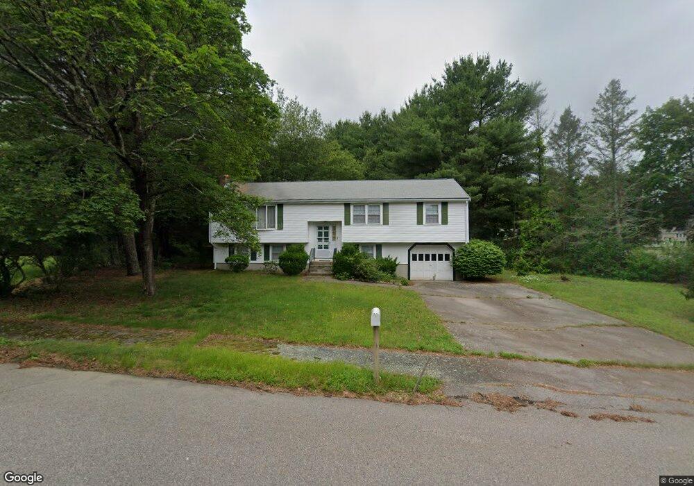
7 Philip Rd Walpole, MA 02081
Estimated Value: $662,262 - $772,000
3
Beds
2
Baths
1,288
Sq Ft
$553/Sq Ft
Est. Value
About This Home
This home is located at 7 Philip Rd, Walpole, MA 02081 and is currently estimated at $712,066, approximately $552 per square foot. 7 Philip Rd is a home located in Norfolk County with nearby schools including Fisher School, Walpole Middle School, and Walpole High School.
Create a Home Valuation Report for This Property
The Home Valuation Report is an in-depth analysis detailing your home's value as well as a comparison with similar homes in the area
Home Values in the Area
Average Home Value in this Area
Tax History Compared to Growth
Tax History
| Year | Tax Paid | Tax Assessment Tax Assessment Total Assessment is a certain percentage of the fair market value that is determined by local assessors to be the total taxable value of land and additions on the property. | Land | Improvement |
|---|---|---|---|---|
| 2025 | $7,122 | $555,100 | $346,800 | $208,300 |
| 2024 | $6,979 | $527,900 | $333,300 | $194,600 |
| 2023 | $6,612 | $476,000 | $289,800 | $186,200 |
| 2022 | $6,277 | $434,100 | $268,400 | $165,700 |
| 2021 | $6,225 | $419,500 | $253,300 | $166,200 |
| 2020 | $6,509 | $434,200 | $238,800 | $195,400 |
| 2019 | $6,448 | $427,000 | $229,400 | $197,600 |
| 2018 | $6,110 | $400,100 | $221,200 | $178,900 |
| 2017 | $5,902 | $385,000 | $212,500 | $172,500 |
| 2016 | $5,773 | $371,000 | $206,300 | $164,700 |
| 2015 | $5,548 | $353,400 | $196,700 | $156,700 |
| 2014 | $5,305 | $336,600 | $196,700 | $139,900 |
Source: Public Records
Map
Nearby Homes
- 66 Gould St
- 291 Plimpton St
- 22 Coolidge Rd
- 19 and 23 Arlington Ln
- 634 Main St Unit 14
- 21 Spear Ave
- 531 Walpole St
- 4 Lost Brook Trail
- 7 Washington Green
- 363 - 367 Washington St
- 4403 Pennington Dr Unit 4403
- 1080 North St
- 20 Rockhill St
- 17 Bridle Path
- 20 Rockhill St
- 486 Washington St
- 2 Alexandra Way
- 70 Endicott St Unit 404
- 70 Endicott St Unit 1306
- 52 Yarmouth Rd