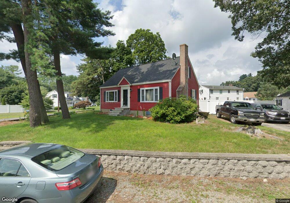
7 Pilling Rd Wilmington, MA 01887
Estimated Value: $661,352 - $737,000
3
Beds
2
Baths
1,387
Sq Ft
$499/Sq Ft
Est. Value
About This Home
This home is located at 7 Pilling Rd, Wilmington, MA 01887 and is currently estimated at $692,588, approximately $499 per square foot. 7 Pilling Rd is a home located in Middlesex County with nearby schools including Wilmington Middle School, Wilmington High School, and Abundant Life Christian School and Childcare.
Ownership History
Date
Name
Owned For
Owner Type
Purchase Details
Closed on
Jan 10, 1997
Sold by
Oglesby James P and Oglesby Suzzette
Bought by
Waterman Denesek
Current Estimated Value
Home Financials for this Owner
Home Financials are based on the most recent Mortgage that was taken out on this home.
Original Mortgage
$154,550
Interest Rate
7.46%
Mortgage Type
Purchase Money Mortgage
Create a Home Valuation Report for This Property
The Home Valuation Report is an in-depth analysis detailing your home's value as well as a comparison with similar homes in the area
Purchase History
| Date | Buyer | Sale Price | Title Company |
|---|---|---|---|
| Waterman Denesek | $157,500 | -- |
Source: Public Records
Mortgage History
| Date | Status | Borrower | Loan Amount |
|---|---|---|---|
| Open | Waterman Denesek | $248,000 | |
| Closed | Waterman Denesek | $180,000 | |
| Closed | Waterman Denesek | $154,550 | |
| Previous Owner | Waterman Denesek | $103,000 |
Source: Public Records
Tax History
| Year | Tax Paid | Tax Assessment Tax Assessment Total Assessment is a certain percentage of the fair market value that is determined by local assessors to be the total taxable value of land and additions on the property. | Land | Improvement |
|---|---|---|---|---|
| 2025 | $6,857 | $598,900 | $327,000 | $271,900 |
| 2024 | $6,595 | $577,000 | $327,000 | $250,000 |
| 2023 | $6,253 | $523,700 | $277,400 | $246,300 |
| 2022 | $6,016 | $461,700 | $231,200 | $230,500 |
| 2021 | $5,829 | $421,200 | $210,100 | $211,100 |
| 2020 | $5,632 | $414,700 | $210,100 | $204,600 |
| 2019 | $5,607 | $407,800 | $205,500 | $202,300 |
| 2018 | $5,310 | $368,500 | $195,700 | $172,800 |
| 2017 | $5,001 | $346,100 | $186,400 | $159,700 |
| 2016 | $4,709 | $321,900 | $177,600 | $144,300 |
| 2015 | $4,506 | $313,600 | $177,600 | $136,000 |
| 2014 | $4,417 | $310,200 | $169,100 | $141,100 |
Source: Public Records
Map
Nearby Homes
- 10 Pilling Rd
- 17 Carson Ave
- 9 Marie Dr
- 41 Marcus Rd
- 220 Martins Landing Unit 309
- 260 Martins Landing Unit 508
- 200 Martins Landing Unit 102
- 250 Martins Landing Unit 402
- 320 Martins Landing Unit 401
- 320 Martins Landing Unit 102
- 320 Martins Landing Unit 107
- 320 Martins Landing Unit 210
- 320 Martins Landing Unit 404
- 320 Martins Landing Unit 209
- 320 Martins Landing Unit 410
- 15 Mystic Ave
- 12 Parkview Terrace
- 12 Hamlin Ln
- 28 Nutter Rd
- 3 Greenbriar Dr Unit 303