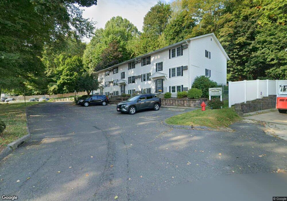
7 Prew Ave Unit 4B Holyoke, MA 01040
Estimated Value: $111,000 - $127,445
1
Bed
1
Bath
523
Sq Ft
$226/Sq Ft
Est. Value
About This Home
This home is located at 7 Prew Ave Unit 4B, Holyoke, MA 01040 and is currently estimated at $118,148, approximately $225 per square foot. 7 Prew Ave Unit 4B is a home located in Hampden County with nearby schools including Holyoke High School, Holyoke Community Charter School, and Blessed Sacrament School.
Ownership History
Date
Name
Owned For
Owner Type
Purchase Details
Closed on
Jan 29, 2007
Sold by
Roux Steven P
Bought by
Roux Ruth A and Roux Steven P
Current Estimated Value
Purchase Details
Closed on
Oct 17, 1997
Sold by
Adamchek Julie
Bought by
Roux Steven P
Purchase Details
Closed on
Oct 5, 1988
Sold by
Demont John V
Bought by
Skrok Julie A
Home Financials for this Owner
Home Financials are based on the most recent Mortgage that was taken out on this home.
Original Mortgage
$53,900
Interest Rate
10.64%
Mortgage Type
Purchase Money Mortgage
Create a Home Valuation Report for This Property
The Home Valuation Report is an in-depth analysis detailing your home's value as well as a comparison with similar homes in the area
Home Values in the Area
Average Home Value in this Area
Purchase History
| Date | Buyer | Sale Price | Title Company |
|---|---|---|---|
| Roux Ruth A | -- | -- | |
| Roux Steven P | $21,000 | -- | |
| Skrok Julie A | $59,900 | -- |
Source: Public Records
Mortgage History
| Date | Status | Borrower | Loan Amount |
|---|---|---|---|
| Previous Owner | Skrok Julie A | $53,900 |
Source: Public Records
Tax History
| Year | Tax Paid | Tax Assessment Tax Assessment Total Assessment is a certain percentage of the fair market value that is determined by local assessors to be the total taxable value of land and additions on the property. | Land | Improvement |
|---|---|---|---|---|
| 2025 | $1,180 | $67,600 | $0 | $67,600 |
| 2024 | $1,101 | $58,100 | $0 | $58,100 |
| 2023 | $1,090 | $58,100 | $0 | $58,100 |
| 2022 | $1,119 | $58,100 | $0 | $58,100 |
| 2021 | $1,002 | $52,000 | $0 | $52,000 |
| 2020 | $872 | $45,700 | $0 | $45,700 |
| 2019 | $851 | $44,100 | $0 | $44,100 |
| 2018 | $844 | $44,100 | $0 | $44,100 |
| 2017 | $845 | $44,100 | $0 | $44,100 |
| 2016 | $723 | $37,800 | $0 | $37,800 |
| 2015 | $720 | $37,800 | $0 | $37,800 |
Source: Public Records
Map
Nearby Homes
- 10 View St
- 133-135 Brown Ave
- 26 Vernon St
- 2129 Northampton St
- 934 Main St
- 18 Harrison Ave
- 25-27 Elmwood Ave
- 551 Lafleur Dr
- 958 Main St
- 42 Lawler St
- 124 Walter St
- 60 Chapin St Unit D
- 69 Gates St
- 0 High St
- 621 Chicopee St
- 24 Billings St
- 286 Westfield Rd
- 39 State St
- 337 Westfield Rd
- 20 Mount Carmel Ave
- 5 Prew Ave Unit 6C
- 5 Prew Ave Unit 5C
- 5 Prew Ave Unit 4C
- 5 Prew Ave Unit 3C
- 5 Prew Ave Unit 2C
- 5 Prew Ave Unit 1C
- 7 Prew Ave Unit 6B
- 7 Prew Ave Unit 5B
- 7 Prew Ave Unit 3B
- 7 Prew Ave Unit 2B
- 7 Prew Ave Unit 1B
- 9 Prew Ave Unit 6A
- 9 Prew Ave Unit 5A
- 9 Prew Ave Unit 3A
- 9 Prew Ave Unit 2A
- 9 Prew Ave Unit 1A
- 7 Prew Ave Unit 2
- 7 Prew Ave Unit B-1
- 39 Temple St
- 0 Prew Ave
Your Personal Tour Guide
Ask me questions while you tour the home.