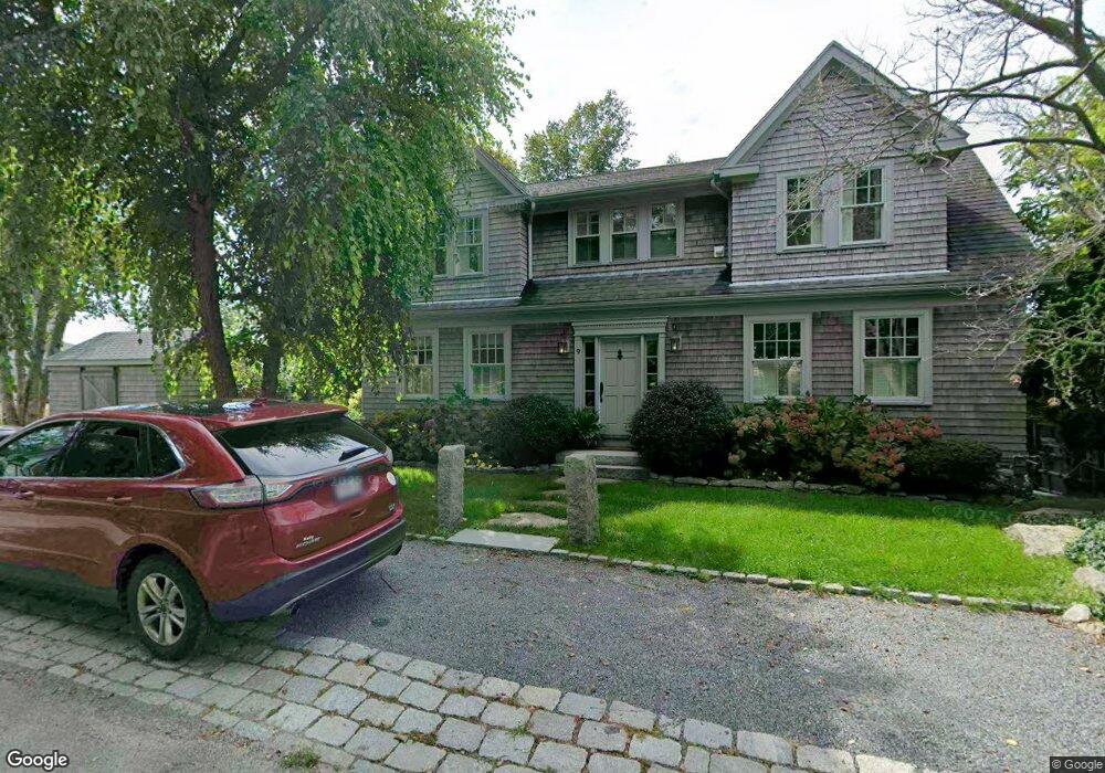
7 Quincy Ct Gloucester, MA 01930
Annisquam NeighborhoodEstimated Value: $1,007,000 - $1,772,917
1
Bed
2
Baths
1,746
Sq Ft
$864/Sq Ft
Est. Value
About This Home
This home is located at 7 Quincy Ct, Gloucester, MA 01930 and is currently estimated at $1,509,229, approximately $864 per square foot. 7 Quincy Ct is a home with nearby schools including Plum Cove School, Ralph B O'maley Middle School, and Gloucester High School.
Ownership History
Date
Name
Owned For
Owner Type
Purchase Details
Closed on
Apr 14, 2014
Sold by
Burke William H
Bought by
Burke Ft and Burke
Current Estimated Value
Purchase Details
Closed on
Dec 13, 2013
Sold by
Bent Peter V
Bought by
Martin Crosby M and Parrott Laurie A
Purchase Details
Closed on
Jun 14, 2013
Sold by
Bent Peter V
Bought by
Burke William H
Create a Home Valuation Report for This Property
The Home Valuation Report is an in-depth analysis detailing your home's value as well as a comparison with similar homes in the area
Home Values in the Area
Average Home Value in this Area
Purchase History
| Date | Buyer | Sale Price | Title Company |
|---|---|---|---|
| Burke Ft | -- | -- | |
| Burke Ft | -- | -- | |
| Martin Crosby M | $620,000 | -- | |
| Burke William H | $1,925,000 | -- |
Source: Public Records
Mortgage History
| Date | Status | Borrower | Loan Amount |
|---|---|---|---|
| Closed | Martin Crosby M | $0 |
Source: Public Records
Tax History
| Year | Tax Paid | Tax Assessment Tax Assessment Total Assessment is a certain percentage of the fair market value that is determined by local assessors to be the total taxable value of land and additions on the property. | Land | Improvement |
|---|---|---|---|---|
| 2025 | $16,483 | $1,695,800 | $1,175,100 | $520,700 |
| 2024 | $15,956 | $1,639,900 | $1,119,200 | $520,700 |
| 2023 | $14,934 | $1,410,200 | $954,400 | $455,800 |
| 2022 | $14,422 | $1,229,500 | $829,400 | $400,100 |
| 2021 | $13,930 | $1,119,800 | $754,900 | $364,900 |
| 2020 | $13,802 | $1,119,400 | $754,900 | $364,500 |
| 2019 | $13,307 | $1,048,600 | $719,800 | $328,800 |
| 2018 | $13,002 | $1,005,600 | $702,200 | $303,400 |
| 2017 | $10,821 | $820,400 | $668,600 | $151,800 |
| 2016 | $9,330 | $685,500 | $639,300 | $46,200 |
| 2015 | -- | $671,000 | $624,800 | $46,200 |
Source: Public Records
Map
Nearby Homes
- 672 Washington St
- 226 Atlantic St
- 167 Atlantic St
- 7 Colburn St
- 2 Finch Ln
- 43 High St Unit B
- 10 Emerald St
- 6 Monroe Ct
- 98 Maplewood Ave
- 16 Cleveland Place Unit 11
- 40 Sargent St
- 16 Hodgkins Rd Unit 2
- 19 Trask St Unit 2
- 5 Samoset Rd Unit B
- 27 Hodgkins Rd
- 15 Harvard St
- 33 Maplewood Ave Unit 16
- 84 Centennial Ave
- 10 Oak St Unit 3
- 20 Beacon St Unit 2
- 6 Cambridge Ave
- 8 Cambridge Ave
- 4 Cambridge Ave
- 12 Cambridge Ave
- 5 Cambridge Ave
- 14 Cambridge Ave
- 3 Cambridge Ave
- 1 Cambridge Ave
- 2 Cambridge Ave
- 2 Cambridge Ave
- 2 Cambridge Ave Unit 2
- 16 Cambridge Ave
- 16 Cambridge Ave Unit 1
- 3 Leonard St
- 4 Leonard St
- 1 Adams Ave
- 1 Adams Ave Unit 1
- 2 Adams Ave
- 9 Planters Neck Rd
- 11 Planters Neck Rd