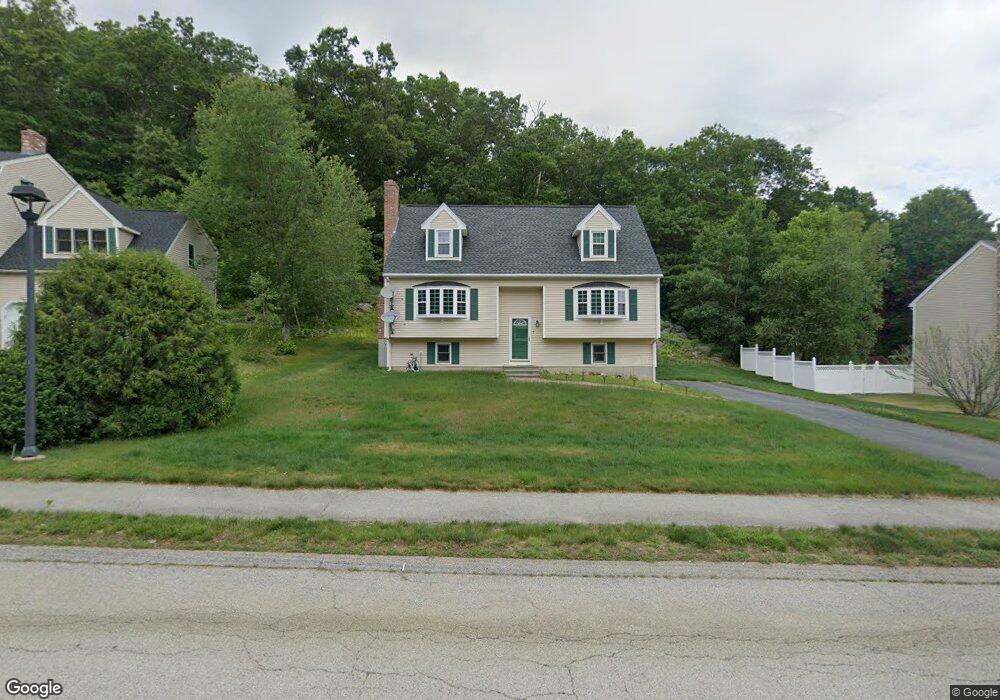
7 Rollie Shepard Dr Millbury, MA 01527
Estimated Value: $574,101 - $638,000
3
Beds
2
Baths
1,748
Sq Ft
$355/Sq Ft
Est. Value
About This Home
This home is located at 7 Rollie Shepard Dr, Millbury, MA 01527 and is currently estimated at $619,775, approximately $354 per square foot. 7 Rollie Shepard Dr is a home located in Worcester County with nearby schools including Elmwood Street Elementary School, Raymond E. Shaw Elementary School, and Millbury Junior/Senior High School.
Ownership History
Date
Name
Owned For
Owner Type
Purchase Details
Closed on
Dec 17, 1999
Sold by
Zanadu Inc
Bought by
Nguyen Thomas H
Current Estimated Value
Home Financials for this Owner
Home Financials are based on the most recent Mortgage that was taken out on this home.
Original Mortgage
$167,850
Interest Rate
7.81%
Mortgage Type
Purchase Money Mortgage
Create a Home Valuation Report for This Property
The Home Valuation Report is an in-depth analysis detailing your home's value as well as a comparison with similar homes in the area
Home Values in the Area
Average Home Value in this Area
Purchase History
| Date | Buyer | Sale Price | Title Company |
|---|---|---|---|
| Nguyen Thomas H | $182,250 | -- | |
| Nguyen Thomas H | $182,250 | -- |
Source: Public Records
Mortgage History
| Date | Status | Borrower | Loan Amount |
|---|---|---|---|
| Open | Nguyen Thomas H | $128,000 | |
| Closed | Nguyen Thomas H | $164,000 | |
| Closed | Nguyen Thomas H | $163,000 | |
| Closed | Nguyen Thomas H | $167,850 |
Source: Public Records
Tax History Compared to Growth
Tax History
| Year | Tax Paid | Tax Assessment Tax Assessment Total Assessment is a certain percentage of the fair market value that is determined by local assessors to be the total taxable value of land and additions on the property. | Land | Improvement |
|---|---|---|---|---|
| 2025 | $6,862 | $512,500 | $124,500 | $388,000 |
| 2024 | $6,296 | $475,900 | $115,200 | $360,700 |
| 2023 | $5,425 | $375,400 | $80,600 | $294,800 |
| 2022 | $5,400 | $360,000 | $80,600 | $279,400 |
| 2021 | $5,022 | $325,500 | $80,600 | $244,900 |
| 2020 | $4,907 | $320,100 | $80,600 | $239,500 |
| 2019 | $4,974 | $313,800 | $80,300 | $233,500 |
| 2018 | $3,007 | $298,400 | $80,300 | $218,100 |
| 2017 | $4,352 | $264,900 | $80,300 | $184,600 |
| 2016 | $4,337 | $263,500 | $80,300 | $183,200 |
| 2015 | $4,286 | $260,400 | $81,800 | $178,600 |
| 2014 | $4,070 | $238,000 | $85,600 | $152,400 |
Source: Public Records
Map
Nearby Homes
- 3 May St
- 86 Wheelock Ave
- 2 Diane St
- 90 Macarthur Dr
- 12 Irene Ct
- 11 Westview Ave
- 1 Pineland Ave
- 1 Broadmeadow Ave
- 12 Alstead Path
- 46 John Dr Unit 46
- 5 Edward Dr
- 11 Maplewood Rd
- 21 Lordvale Blvd Unit 406
- 330 Millbury Ave
- 28 Lincoln Ln
- 27 A-B Grafton St
- 5 Lincoln Ln Unit 5
- 76 Samuel Dr
- 3 Stidsen Way
- 497 Massasoit Rd
- 9 Rollie Shepard Dr
- 6 Rollie Shepard Dr
- 3 Rollie Shepard Dr
- 11 Rollie Shepard Dr
- 27 Macarthur Dr
- 25 Macarthur Dr
- 8 Rollie Shepard Dr
- 1 Rollie Shepard Dr
- 1 Bill Graham Ln
- 31 Macarthur Dr
- 10 Rollie Shepard Dr
- 3 Bill Graham Ln
- 35 Macarthur Dr
- 23 Macarthur Dr
- 34 Macarthur Dr
- 2 Bill Graham Ln
- 41 Macarthur Dr
- 12 Rollie Shepard Dr
- 56 Tiffany Cir
- 55 Tiffany Cir