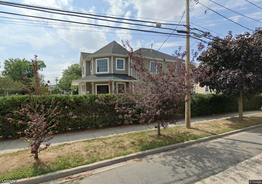
7 Saint James Place Lynbrook, NY 11563
Estimated Value: $871,000 - $898,722
--
Bed
1
Bath
2,556
Sq Ft
$346/Sq Ft
Est. Value
About This Home
This home is located at 7 Saint James Place, Lynbrook, NY 11563 and is currently estimated at $884,861, approximately $346 per square foot. 7 Saint James Place is a home with nearby schools including Lynbrook Senior High School and Our Lady Of Peace School.
Ownership History
Date
Name
Owned For
Owner Type
Purchase Details
Closed on
Aug 22, 2014
Sold by
Rkg Building Inc
Bought by
Singh Avtar
Current Estimated Value
Home Financials for this Owner
Home Financials are based on the most recent Mortgage that was taken out on this home.
Original Mortgage
$380,250
Outstanding Balance
$289,202
Interest Rate
4.12%
Mortgage Type
New Conventional
Estimated Equity
$595,659
Create a Home Valuation Report for This Property
The Home Valuation Report is an in-depth analysis detailing your home's value as well as a comparison with similar homes in the area
Home Values in the Area
Average Home Value in this Area
Purchase History
| Date | Buyer | Sale Price | Title Company |
|---|---|---|---|
| Singh Avtar | $507,000 | Highland Title | |
| Singh Avtar | $507,000 | Highland Title | |
| Singh Avtar | $507,000 | Highland Title | |
| Singh Avtar | $507,000 | Highland Title |
Source: Public Records
Mortgage History
| Date | Status | Borrower | Loan Amount |
|---|---|---|---|
| Open | Singh Avtar | $380,250 | |
| Closed | Singh Avtar | $380,250 |
Source: Public Records
Tax History Compared to Growth
Tax History
| Year | Tax Paid | Tax Assessment Tax Assessment Total Assessment is a certain percentage of the fair market value that is determined by local assessors to be the total taxable value of land and additions on the property. | Land | Improvement |
|---|---|---|---|---|
| 2025 | $15,159 | $657 | $189 | $468 |
| 2024 | $1,346 | $642 | $185 | $457 |
| 2023 | $12,909 | $646 | $185 | $461 |
| 2022 | $12,909 | $657 | $189 | $468 |
| 2021 | $17,954 | $668 | $184 | $484 |
| 2020 | $12,005 | $767 | $421 | $346 |
| 2019 | $11,868 | $822 | $314 | $508 |
| 2018 | $11,781 | $1,182 | $0 | $0 |
| 2017 | $13,274 | $1,182 | $451 | $731 |
| 2016 | $14,983 | $451 | $451 | $0 |
| 2015 | $670 | $451 | $451 | $0 |
| 2014 | $670 | $451 | $451 | $0 |
Source: Public Records
Map
Nearby Homes
- 9 Watkins St
- 60 Hempstead Ave Unit 1K
- 60 Hempstead Ave Unit 1H
- 60 Hempstead Ave Unit 1O
- 60 Hempstead Ave Unit 1J
- 114 Atlantic Ave Unit 89
- 266 Earle Ave
- 40 Daley Place Unit 124
- 40 Daley Place Unit 233
- 45 Lynbrook Ave
- 106 Atlantic Ave Unit 28
- 59 Manor Rd
- 65 Earle Ave
- 92 Walnut St
- 30 Daley Place Unit 247
- 20 Daley Place Unit 104
- 20 Daley Place Unit 225
- 20 Daley Place Unit 127
- 54 Lynbrook Ave
- 75 Noble St Unit 219
- 5 Saint James Place
- 5 St James Place
- 183 Earle Ave
- 3 St James Place
- 3 Saint James Place
- 182 Earle Ave
- 20 Saint James Place
- 252 Merrick Rd
- 250 Merrick Rd
- 246 Merrick Rd Unit 254
- 244 Merrick Rd
- 248 Merrick Rd
- 244 Merrick Rd Unit 254
- 246 Merrick Rd
- 246 Merrick Rd
- 252 Merrick Rd
- 250 Merrick Rd
- 175 Vincent Ave
- 179 Vincent Ave
- 272 Merrick Rd