Estimated Value: $652,000 - $737,000
3
Beds
3
Baths
1,720
Sq Ft
$396/Sq Ft
Est. Value
About This Home
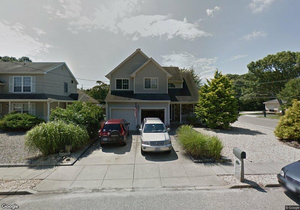
This home is located at 7 Sandy Point Dr, Brick, NJ 08723 and is currently estimated at $680,400, approximately $395 per square foot. 7 Sandy Point Dr is a home located in Ocean County with nearby schools including Emma Havens Young Elementary School, Lake Riviera Middle School, and Brick Township High School.
Ownership History
Date
Name
Owned For
Owner Type
Purchase Details
Closed on
Mar 11, 2025
Sold by
Laporta Michael B and Laporta Susan C
Bought by
Laporta Family Living Trust and Laporta
Current Estimated Value
Purchase Details
Closed on
Jun 15, 2009
Sold by
Raczkiewicz Robert L
Bought by
Laporta Michael B and Laporta Susan C
Home Financials for this Owner
Home Financials are based on the most recent Mortgage that was taken out on this home.
Original Mortgage
$272,000
Interest Rate
4.91%
Mortgage Type
Stand Alone First
Purchase Details
Closed on
May 31, 1995
Sold by
Kruger Oddvar
Bought by
Raczkiewicz Robert and Raczkiewicz Donna
Home Financials for this Owner
Home Financials are based on the most recent Mortgage that was taken out on this home.
Original Mortgage
$122,000
Interest Rate
8.2%
Create a Home Valuation Report for This Property
The Home Valuation Report is an in-depth analysis detailing your home's value as well as a comparison with similar homes in the area
Home Values in the Area
Average Home Value in this Area
Purchase History
| Date | Buyer | Sale Price | Title Company |
|---|---|---|---|
| Laporta Family Living Trust | -- | None Listed On Document | |
| Laporta Family Living Trust | -- | None Listed On Document | |
| Laporta Michael B | $340,000 | Old Republic National Title | |
| Raczkiewicz Robert | $129,000 | -- |
Source: Public Records
Mortgage History
| Date | Status | Borrower | Loan Amount |
|---|---|---|---|
| Previous Owner | Laporta Michael B | $272,000 | |
| Previous Owner | Raczkiewicz Robert | $122,000 |
Source: Public Records
Tax History
| Year | Tax Paid | Tax Assessment Tax Assessment Total Assessment is a certain percentage of the fair market value that is determined by local assessors to be the total taxable value of land and additions on the property. | Land | Improvement |
|---|---|---|---|---|
| 2025 | $8,485 | $328,500 | $119,700 | $208,800 |
| 2024 | $8,065 | $328,500 | $119,700 | $208,800 |
| 2023 | $7,960 | $328,500 | $119,700 | $208,800 |
| 2022 | $7,960 | $328,500 | $119,700 | $208,800 |
| 2021 | $7,792 | $328,500 | $119,700 | $208,800 |
| 2020 | $7,693 | $328,500 | $119,700 | $208,800 |
| 2019 | $7,565 | $328,500 | $119,700 | $208,800 |
| 2018 | $7,391 | $328,500 | $119,700 | $208,800 |
| 2017 | $7,167 | $327,400 | $119,700 | $207,700 |
| 2016 | $7,131 | $327,400 | $119,700 | $207,700 |
| 2015 | $6,944 | $327,400 | $119,700 | $207,700 |
| 2014 | $6,888 | $327,400 | $119,700 | $207,700 |
Source: Public Records
Map
Nearby Homes
- 53 Driftwood Dr
- 41 Adamston Dr
- 00 Adamston Dr
- 327 Mantoloking Rd
- 00 Mantoloking Rd
- 15 Hulse Landing Rd
- 599 Point Ave
- 603 Point Ave
- 648 Point Ave
- 660 Point Ave
- 53 Country Club Ct
- 599 Parker Ave
- 701 Princeton Ave
- 546 Princeton Ave
- 556 Parker Ave
- 665 Bancroft Rd
- 502 Princeton Ave
- 61 Reservation Row
- 474 Burnt Bark Rd
- 776 South Dr
- 9 Sandy Point Dr
- 11 Sandy Point Dr
- 8 Cranberry Cove Rd
- 8 Sandy Point Dr
- 13 Sandy Point Dr
- 10 Sandy Point Dr
- 1 Brower Dr
- 4 Cranberry Cove Rd
- 16 Sandy Point Dr
- 15 Sandy Point Dr
- 3 Sandy Point Dr
- 272 Mantoloking Rd
- 3 Brower Dr
- 18 Sandy Point Dr
- 17 Sandy Point Dr
- 20 Sandy Point Dr
- 20 Sandy Point Dr Unit WINTER RENTAL
- 20 Sandy Point Dr Unit JULY RENTAL
- 20 Sandy Point Dr Unit SUMMER RENTAL
- 28 Mary Ann Dr
Your Personal Tour Guide
Ask me questions while you tour the home.