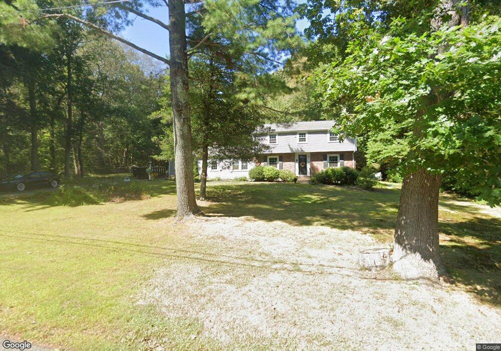
7 Satuit Trail Scituate, MA 02066
Estimated Value: $882,997 - $1,271,000
4
Beds
2
Baths
1,914
Sq Ft
$546/Sq Ft
Est. Value
About This Home
This home is located at 7 Satuit Trail, Scituate, MA 02066 and is currently estimated at $1,045,749, approximately $546 per square foot. 7 Satuit Trail is a home located in Plymouth County with nearby schools including Jenkins Elementary School, Lester J. Gates Middle School, and Scituate High School.
Ownership History
Date
Name
Owned For
Owner Type
Purchase Details
Closed on
Aug 12, 2019
Sold by
C & C Rt
Bought by
Sugrue Christopher D and Sugrue Lisa M
Current Estimated Value
Purchase Details
Closed on
Jan 15, 1999
Sold by
Entwistle B L Est
Bought by
Rohnstock Michael B and Rohnstock Jennifer C
Home Financials for this Owner
Home Financials are based on the most recent Mortgage that was taken out on this home.
Original Mortgage
$212,000
Interest Rate
6.7%
Mortgage Type
Purchase Money Mortgage
Create a Home Valuation Report for This Property
The Home Valuation Report is an in-depth analysis detailing your home's value as well as a comparison with similar homes in the area
Home Values in the Area
Average Home Value in this Area
Purchase History
| Date | Buyer | Sale Price | Title Company |
|---|---|---|---|
| Sugrue Christopher D | $769,000 | -- | |
| Rohnstock Michael B | $265,000 | -- |
Source: Public Records
Mortgage History
| Date | Status | Borrower | Loan Amount |
|---|---|---|---|
| Previous Owner | Rohnstock Michael B | $397,500 | |
| Previous Owner | Rohnstock Michael B | $310,000 | |
| Previous Owner | Rohnstock Michael B | $290,000 | |
| Previous Owner | Rohnstock Michael B | $212,000 |
Source: Public Records
Tax History
| Year | Tax Paid | Tax Assessment Tax Assessment Total Assessment is a certain percentage of the fair market value that is determined by local assessors to be the total taxable value of land and additions on the property. | Land | Improvement |
|---|---|---|---|---|
| 2025 | $7,374 | $738,100 | $400,300 | $337,800 |
| 2024 | $7,253 | $700,100 | $363,900 | $336,200 |
| 2023 | $7,405 | $664,500 | $349,200 | $315,300 |
| 2022 | $7,405 | $586,800 | $322,500 | $264,300 |
| 2021 | $7,233 | $542,600 | $307,100 | $235,500 |
| 2020 | $7,016 | $519,700 | $295,300 | $224,400 |
| 2019 | $6,928 | $504,200 | $289,500 | $214,700 |
| 2018 | $6,858 | $491,600 | $298,600 | $193,000 |
| 2017 | $6,656 | $472,400 | $286,600 | $185,800 |
| 2016 | $6,342 | $448,500 | $262,700 | $185,800 |
| 2015 | $5,719 | $436,600 | $250,800 | $185,800 |
Source: Public Records
Map
Nearby Homes
- 334 Chief Justice Cushing Hwy
- 98 Satuit Trail
- 94 Old Oaken Bucket Rd
- 14 Old Country Way Unit C
- 14 Old Country Way Unit B
- 19 Ford Place Unit 1
- 19 Ford Place Unit 2
- 21 Jenkins Place
- 138 Judge Cushing Rd
- 34 Ladds Way
- 9 Cushing Park Rd
- 115 Elm St
- 111 Elm St
- 20 Grace Way Unit 20
- 6 Grace Way Unit 6
- 27 Grace Way
- 25 Grace Way
- 15 Bearce Ln
- 34 Cudworth Rd
- 327 Country Way
- 11 Satuit Trail
- 10 Satuit Trail
- 332 Chief Justice Cushing Hwy
- 20 Satuit Trail
- 19 Satuit Trail
- 322 Chief Justice Cushing Hwy
- 322 Chief Justice Cushing Hwy Unit cottage A
- 322 Chief Justice Cushing Hwy Unit A
- 4 Briggs Ln
- 52 Old Oaken Bucket Rd
- 315 Chief Justice Cushing Hwy
- 303 Chief Justice Cushing Hwy
- 25 Satuit Trail
- 28 Satuit Trail
- 319 Chief Justice Cushing Hwy
- 5 Wamsutta Rd
- 10 Briggs Ln
- 11 Wamsutta Rd
- 107 Satuit Trail
- 109 Satuit Trail
Your Personal Tour Guide
Ask me questions while you tour the home.