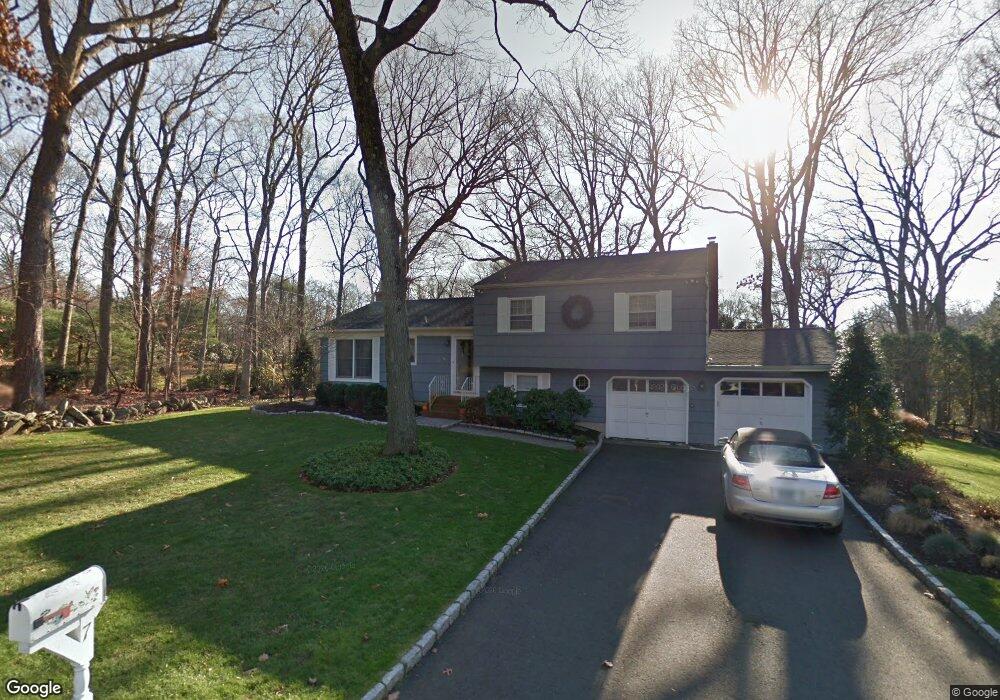
7 Scot Alan Ln Westport, CT 06880
Compo NeighborhoodEstimated Value: $1,065,407 - $1,249,000
3
Beds
2
Baths
1,274
Sq Ft
$877/Sq Ft
Est. Value
About This Home
This home is located at 7 Scot Alan Ln, Westport, CT 06880 and is currently estimated at $1,116,852, approximately $876 per square foot. 7 Scot Alan Ln is a home located in Fairfield County with nearby schools including Saugatuck Elementary School, Bedford Middle School, and Staples High School.
Ownership History
Date
Name
Owned For
Owner Type
Purchase Details
Closed on
Aug 25, 1997
Sold by
Meltzer Michael and Meltzer Karin
Bought by
Morris Peggy
Current Estimated Value
Home Financials for this Owner
Home Financials are based on the most recent Mortgage that was taken out on this home.
Original Mortgage
$283,200
Outstanding Balance
$40,296
Interest Rate
7.42%
Mortgage Type
Unknown
Estimated Equity
$1,076,556
Purchase Details
Closed on
Apr 27, 1994
Sold by
Clark Dorothy and Kranzler Stephanie
Bought by
Meltzer Michael and Meltzer Karin
Home Financials for this Owner
Home Financials are based on the most recent Mortgage that was taken out on this home.
Original Mortgage
$248,000
Interest Rate
6%
Create a Home Valuation Report for This Property
The Home Valuation Report is an in-depth analysis detailing your home's value as well as a comparison with similar homes in the area
Home Values in the Area
Average Home Value in this Area
Purchase History
| Date | Buyer | Sale Price | Title Company |
|---|---|---|---|
| Morris Peggy | $354,000 | -- | |
| Morris Peggy | $354,000 | -- | |
| Meltzer Michael | $328,000 | -- | |
| Meltzer Michael | $328,000 | -- |
Source: Public Records
Mortgage History
| Date | Status | Borrower | Loan Amount |
|---|---|---|---|
| Open | Meltzer Michael | $283,200 | |
| Closed | Meltzer Michael | $283,200 | |
| Previous Owner | Meltzer Michael | $248,000 | |
| Previous Owner | Meltzer Michael | $248,000 |
Source: Public Records
Tax History Compared to Growth
Tax History
| Year | Tax Paid | Tax Assessment Tax Assessment Total Assessment is a certain percentage of the fair market value that is determined by local assessors to be the total taxable value of land and additions on the property. | Land | Improvement |
|---|---|---|---|---|
| 2025 | $7,802 | $413,700 | $303,800 | $109,900 |
| 2024 | $7,703 | $413,700 | $303,800 | $109,900 |
| 2023 | $7,591 | $413,700 | $303,800 | $109,900 |
| 2022 | $7,476 | $413,700 | $303,800 | $109,900 |
| 2021 | $7,476 | $413,700 | $303,800 | $109,900 |
| 2020 | $7,152 | $428,000 | $307,100 | $120,900 |
| 2019 | $7,216 | $428,000 | $307,100 | $120,900 |
| 2018 | $6,475 | $428,000 | $307,100 | $120,900 |
| 2017 | $7,216 | $428,000 | $307,100 | $120,900 |
| 2016 | $7,216 | $428,000 | $307,100 | $120,900 |
| 2015 | $6,248 | $345,400 | $223,000 | $122,400 |
| 2014 | $6,196 | $345,400 | $223,000 | $122,400 |
Source: Public Records
Map
Nearby Homes
- 102 Compo Rd S
- 9 Crescent Park Rd
- 26 Crescent Park Rd
- 28 Crescent Park Rd
- 32 Webb Rd
- 785 Post Rd E Unit 301
- 785 Post Rd E Unit 303
- 785 Post Rd E Unit 302
- 785 Post Rd E Unit 201
- 785 Post Rd E Unit 304
- 785 Post Rd E Unit 102
- 785 Post Rd E Unit 104
- 785 Post Rd E Unit 204
- 2 Webb Rd
- 25 Ellery Ln
- 24 Edgemarth Hill Rd
- 3 Laurel Ln
- 21 Wright St
- 109 Greens Farms Rd
- 171 Compo Rd S