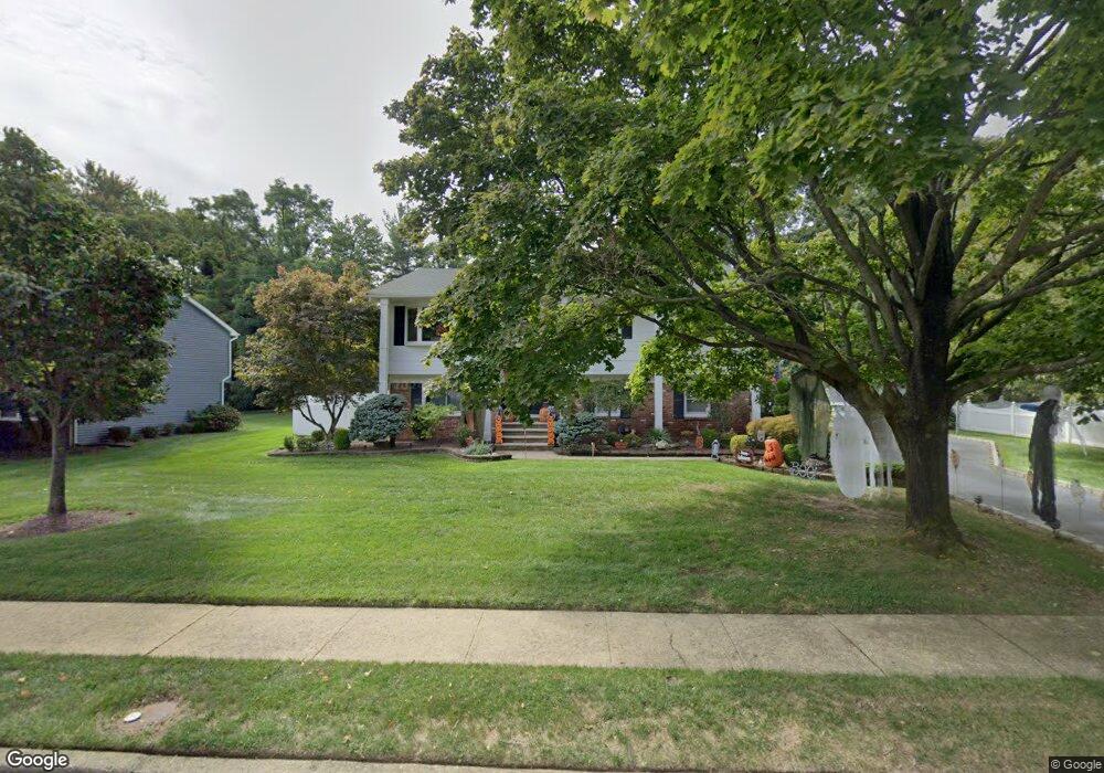
7 Scott Rd Port Monmouth, NJ 07758
New Monmouth NeighborhoodEstimated Value: $733,000 - $755,000
4
Beds
3
Baths
2,155
Sq Ft
$345/Sq Ft
Est. Value
About This Home
This home is located at 7 Scott Rd, Port Monmouth, NJ 07758 and is currently estimated at $744,376, approximately $345 per square foot. 7 Scott Rd is a home located in Monmouth County with nearby schools including Harmony Elementary School, Thorne Middle School, and Middletown High School North.
Ownership History
Date
Name
Owned For
Owner Type
Purchase Details
Closed on
May 28, 1999
Sold by
Collins Gertrude
Bought by
Perez Ariel
Current Estimated Value
Home Financials for this Owner
Home Financials are based on the most recent Mortgage that was taken out on this home.
Original Mortgage
$197,900
Interest Rate
7.65%
Mortgage Type
Purchase Money Mortgage
Create a Home Valuation Report for This Property
The Home Valuation Report is an in-depth analysis detailing your home's value as well as a comparison with similar homes in the area
Home Values in the Area
Average Home Value in this Area
Purchase History
| Date | Buyer | Sale Price | Title Company |
|---|---|---|---|
| Perez Ariel | $219,900 | -- | |
| Perez Ariel | $219,900 | -- |
Source: Public Records
Mortgage History
| Date | Status | Borrower | Loan Amount |
|---|---|---|---|
| Previous Owner | Perez Ariel | $197,900 |
Source: Public Records
Tax History Compared to Growth
Tax History
| Year | Tax Paid | Tax Assessment Tax Assessment Total Assessment is a certain percentage of the fair market value that is determined by local assessors to be the total taxable value of land and additions on the property. | Land | Improvement |
|---|---|---|---|---|
| 2025 | $10,270 | $764,500 | $448,100 | $316,400 |
| 2024 | $9,700 | $624,300 | $313,700 | $310,600 |
| 2023 | $9,700 | $558,100 | $325,500 | $232,600 |
| 2022 | $9,533 | $540,200 | $318,700 | $221,500 |
| 2021 | $9,533 | $458,300 | $263,200 | $195,100 |
| 2020 | $8,546 | $399,700 | $209,000 | $190,700 |
| 2019 | $8,532 | $404,000 | $209,000 | $195,000 |
| 2018 | $9,004 | $415,500 | $209,000 | $206,500 |
| 2017 | $9,023 | $412,200 | $209,000 | $203,200 |
| 2016 | $8,533 | $400,400 | $202,000 | $198,400 |
| 2015 | $8,804 | $398,900 | $202,000 | $196,900 |
| 2014 | $8,642 | $381,900 | $202,000 | $179,900 |
Source: Public Records
Map
Nearby Homes