
Z
Seller's Agent in 2026
Zachary Machin
eXp Realty
10 in this area
32 Total Sales
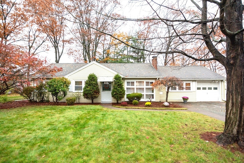
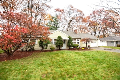
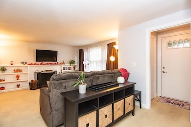
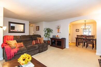
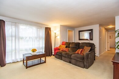
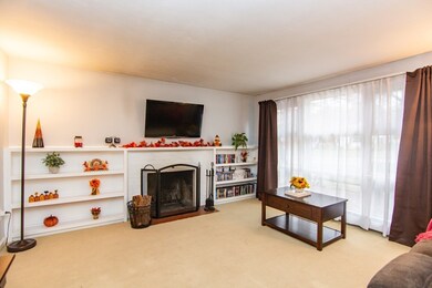
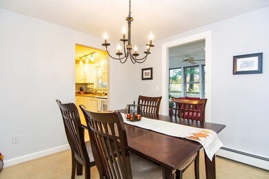
Well maintained ranch Nestled at 7 Sheffield Rd, Natick, MA, in the Wethersfield neighborhood, located close to Ben-Hem and Wilson!, This single-family residence presents a wonderful opportunity to establish roots in a desirable location. Within this home, the three bedrooms offer private retreats, each presenting a canvas for personalization and comfort. Imagine peaceful mornings and restful nights within these walls, crafting spaces that reflect your unique style and aspirations. The property includes a one-car garage, a valuable asset that provides secure parking and additional storage space. All three bedrooms at located on one side of the home away from the living room / entertaining space. The expansive 10,036 square-foot lot invites outdoor activities and possibilities with a fully fenced in back yard on a quiet street. Just minutes to Bennet-Hemenway Elementary, Wilson middle, Natick Center, Routes 27, 9 & 90, and 2 Commuter Rail stations as well as shops, restaurants and parks
| Date | Type | Sale Price | Title Company |
|---|---|---|---|
| Quit Claim Deed | $730,000 | -- | |
| Deed | $336,000 | -- | |
| Deed | $336,000 | -- | |
| Deed | $334,900 | -- | |
| Deed | $334,900 | -- | |
| Deed | $158,000 | -- | |
| Deed | $158,000 | -- |
| Date | Status | Loan Amount | Loan Type |
|---|---|---|---|
| Open | $480,000 | New Conventional | |
| Previous Owner | $268,800 | Purchase Money Mortgage | |
| Previous Owner | $267,920 | Purchase Money Mortgage |
| Date | Event | Price | List to Sale | Price per Sq Ft |
|---|---|---|---|---|
| 01/16/2026 01/16/26 | Sold | $730,000 | +4.4% | $568 / Sq Ft |
| 11/14/2025 11/14/25 | Pending | -- | -- | -- |
| 11/13/2025 11/13/25 | For Sale | $699,000 | -- | $544 / Sq Ft |
| Year | Tax Paid | Tax Assessment Tax Assessment Total Assessment is a certain percentage of the fair market value that is determined by local assessors to be the total taxable value of land and additions on the property. | Land | Improvement |
|---|---|---|---|---|
| 2025 | $7,392 | $618,100 | $450,100 | $168,000 |
| 2024 | $7,155 | $583,600 | $425,100 | $158,500 |
| 2023 | $7,005 | $554,200 | $400,100 | $154,100 |
| 2022 | $6,789 | $508,900 | $365,100 | $143,800 |
| 2021 | $0 | $479,900 | $345,100 | $134,800 |
| 2020 | $5,966 | $464,900 | $330,100 | $134,800 |
| 2019 | $5,742 | $464,900 | $330,100 | $134,800 |
| 2018 | $5,225 | $400,400 | $300,000 | $100,400 |
| 2017 | $4,905 | $363,600 | $265,100 | $98,500 |
| 2016 | $4,718 | $347,700 | $250,100 | $97,600 |
| 2015 | $4,679 | $338,600 | $250,100 | $88,500 |
Z
Seller's Agent in 2026
Zachary Machin
eXp Realty
10 in this area
32 Total Sales
C
Buyer's Agent in 2026
Corkin Cantor Group
Coldwell Banker Realty - Newton
(617) 969-2447
2 in this area
37 Total Sales
Source: MLS Property Information Network (MLS PIN)
MLS Number: 73454608
APN: NATI-000013-000000-000332
Disclaimer: Certain information contained herein is derived from information provided by parties other than Homes.com. All information provided is deemed reliable, but is not guaranteed to be accurate and should be independently verified.
![]() The property listing data and information, or the Images, set forth herein were provided to MLS Property Information Network, Inc. from third party sources, including sellers, lessors and public records, and were compiled by MLS Property Information Network, Inc. The property listing data and information, and the Images, are for the personal, non-commercial use of consumers having a good faith interest in purchasing or leasing listed properties of the type displayed to them and may not be used for any purpose other than to identify prospective properties which such consumers may have a good faith interest in purchasing or leasing. MLS Property Information Network, Inc. and its subscribers disclaim any and all representations and warranties as to the accuracy of the property listing data and information, or as to the accuracy of any of the Images, set forth herein.
The property listing data and information, or the Images, set forth herein were provided to MLS Property Information Network, Inc. from third party sources, including sellers, lessors and public records, and were compiled by MLS Property Information Network, Inc. The property listing data and information, and the Images, are for the personal, non-commercial use of consumers having a good faith interest in purchasing or leasing listed properties of the type displayed to them and may not be used for any purpose other than to identify prospective properties which such consumers may have a good faith interest in purchasing or leasing. MLS Property Information Network, Inc. and its subscribers disclaim any and all representations and warranties as to the accuracy of the property listing data and information, or as to the accuracy of any of the Images, set forth herein.
Ask me questions while you tour the home.