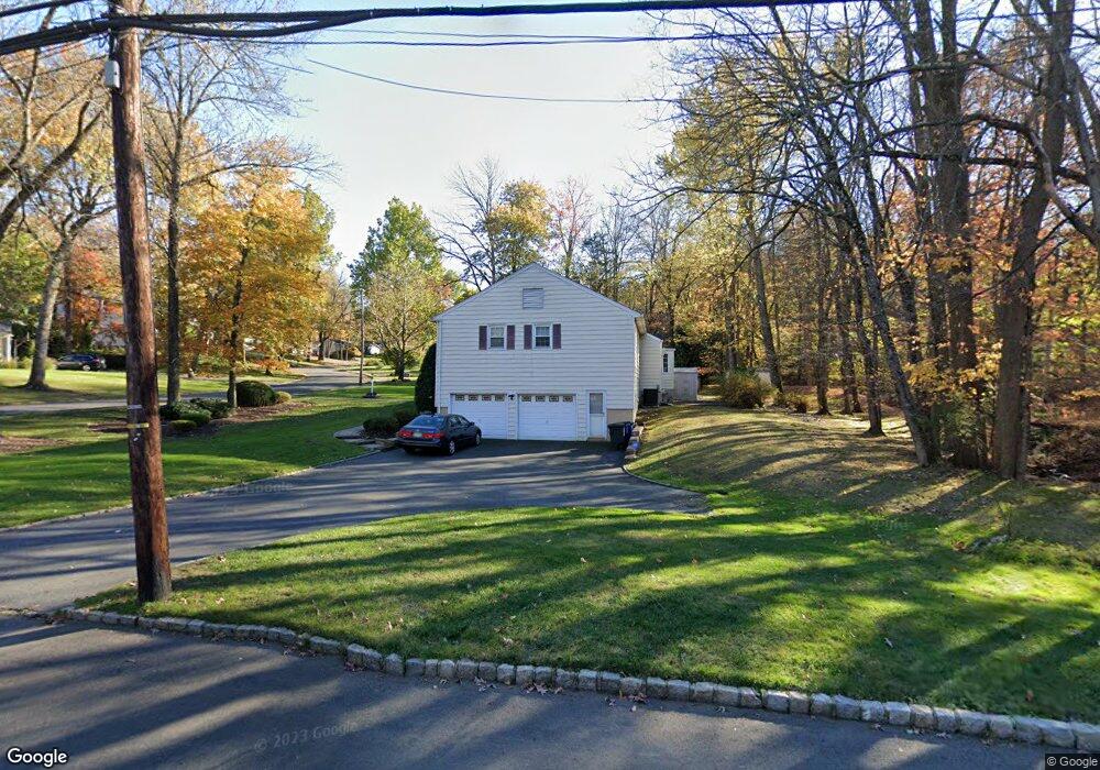
7 Sherbrook Dr Berkeley Heights, NJ 07922
Estimated Value: $1,059,379 - $1,341,000
Studio
--
Bath
2,732
Sq Ft
$453/Sq Ft
Est. Value
About This Home
This home is located at 7 Sherbrook Dr, Berkeley Heights, NJ 07922 and is currently estimated at $1,237,345, approximately $452 per square foot. 7 Sherbrook Dr is a home located in Union County with nearby schools including Columbia Middle School, Governor Livingston High School, and Scotch Plains Baptist Christian Day School.
Ownership History
Date
Name
Owned For
Owner Type
Purchase Details
Closed on
Jun 5, 2002
Sold by
Trombley Bernard J and Fitzsimon Martha L
Bought by
Bucci Antonio and Bucci Deborah
Current Estimated Value
Home Financials for this Owner
Home Financials are based on the most recent Mortgage that was taken out on this home.
Original Mortgage
$150,000
Outstanding Balance
$63,423
Interest Rate
6.81%
Mortgage Type
Stand Alone First
Estimated Equity
$1,173,922
Purchase Details
Closed on
Apr 25, 1997
Sold by
Papageorge John L and Papageorge Mary
Bought by
Trombley Bernard J and Fitzsimon Martha L
Home Financials for this Owner
Home Financials are based on the most recent Mortgage that was taken out on this home.
Original Mortgage
$300,000
Interest Rate
7.77%
Create a Home Valuation Report for This Property
The Home Valuation Report is an in-depth analysis detailing your home's value as well as a comparison with similar homes in the area
Home Values in the Area
Average Home Value in this Area
Purchase History
| Date | Buyer | Sale Price | Title Company |
|---|---|---|---|
| Bucci Antonio | $510,000 | Chicago Title Insurance Co | |
| Trombley Bernard J | $320,000 | -- |
Source: Public Records
Mortgage History
| Date | Status | Borrower | Loan Amount |
|---|---|---|---|
| Open | Bucci Antonio | $150,000 | |
| Previous Owner | Trombley Bernard J | $300,000 |
Source: Public Records
Tax History
| Year | Tax Paid | Tax Assessment Tax Assessment Total Assessment is a certain percentage of the fair market value that is determined by local assessors to be the total taxable value of land and additions on the property. | Land | Improvement |
|---|---|---|---|---|
| 2025 | $15,986 | $372,900 | $168,300 | $204,600 |
| 2024 | $15,755 | $372,900 | $168,300 | $204,600 |
| 2023 | $15,755 | $372,900 | $168,300 | $204,600 |
| 2022 | $15,658 | $372,900 | $168,300 | $204,600 |
| 2021 | $15,572 | $372,900 | $168,300 | $204,600 |
| 2020 | $15,654 | $372,900 | $168,300 | $204,600 |
| 2019 | $15,576 | $372,900 | $168,300 | $204,600 |
| 2018 | $15,252 | $372,900 | $168,300 | $204,600 |
| 2017 | $15,065 | $372,900 | $168,300 | $204,600 |
| 2016 | $14,800 | $372,900 | $168,300 | $204,600 |
| 2015 | $14,718 | $372,900 | $168,300 | $204,600 |
| 2014 | $14,334 | $372,900 | $168,300 | $204,600 |
Source: Public Records
Map
Nearby Homes
- 585 Plainfield Ave
- 155 Dogwood Ln
- 91 Hillcrest Rd
- 223 Chaucer Dr
- 165 Jasmine Unit 613
- 177 Jasmine Dr Unit 1214
- 179 Jasmine Dr Unit 1215
- 173 Jasmine Dr Unit 1212
- 127 Myrtle Rd
- 41 Eaton Ct
- 204 Honeysuckle Ln
- 221 Myrtle Rd
- 102 Iris Ct
- 50 Mountain Ave
- 277 Jasmine Dr Unit 1224
- 46 Coolidge Dr
- 08-09 Castle Place
- 235 Plainfield Ave
- 264 Ridge Rd
- 220 Horseshoe Rd
- 17 Sherbrook Dr
- 8 Sherbrook Dr
- 953 Mountain Ave
- 968 Mountain Ave
- 945 Mountain Ave
- 25 Sherbrook Dr
- 961 Mountain Ave
- 18 Sherbrook Dr
- 964 Mountain Ave
- 937 Mountain Ave
- 971 Mountain Ave
- 35 Sherbrook Dr
- 980 Mountain Ave
- 924 Mountain Ave
- 976 Mountain Ave
- 45 Sherbrook Dr
- 923 Mountain Ave
- 992 Mountain Ave
- 912 Mountain Ave
- 972 Mountain Ave