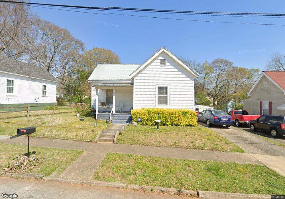
7 Sirrine St Lagrange, GA 30241
Estimated Value: $75,000 - $97,000
1
Bed
1
Bath
873
Sq Ft
$102/Sq Ft
Est. Value
About This Home
This home is located at 7 Sirrine St, Lagrange, GA 30241 and is currently estimated at $88,790, approximately $101 per square foot. 7 Sirrine St is a home located in Troup County with nearby schools including Franklin Forest Elementary School, Hollis Hand Elementary School, and Ethel W. Kight Elementary School.
Ownership History
Date
Name
Owned For
Owner Type
Purchase Details
Closed on
Jun 23, 2025
Sold by
Trimble Joyce A
Bought by
Jtc Partners Llc
Current Estimated Value
Purchase Details
Closed on
Oct 24, 2007
Sold by
Trimble William R
Bought by
Trimble Joyce A
Purchase Details
Closed on
Jan 31, 2003
Sold by
William R Trimble
Bought by
Trimble William R
Purchase Details
Closed on
Nov 22, 2002
Sold by
Pannell Thomas R
Bought by
William R Trimble
Purchase Details
Closed on
Sep 25, 1994
Sold by
Pike R W
Bought by
Pannell Thomas R
Purchase Details
Closed on
Jul 1, 1985
Sold by
Kathleen Jimmie L and Kathleen Willis
Bought by
Pike R W
Purchase Details
Closed on
May 6, 1983
Sold by
Harris
Bought by
Kathleen Jimmie L and Kathleen Willis
Purchase Details
Closed on
May 2, 1983
Bought by
Harris
Purchase Details
Closed on
Apr 28, 1983
Purchase Details
Closed on
Jul 16, 1982
Purchase Details
Closed on
Jan 1, 1958
Sold by
Dunson Mills
Create a Home Valuation Report for This Property
The Home Valuation Report is an in-depth analysis detailing your home's value as well as a comparison with similar homes in the area
Home Values in the Area
Average Home Value in this Area
Purchase History
| Date | Buyer | Sale Price | Title Company |
|---|---|---|---|
| Jtc Partners Llc | -- | -- | |
| Trimble Joyce A | -- | -- | |
| Trimble William R | -- | -- | |
| William R Trimble | $49,000 | -- | |
| Pannell Thomas R | $25,000 | -- | |
| Pike R W | $22,000 | -- | |
| Kathleen Jimmie L | -- | -- | |
| Harris | -- | -- | |
| -- | -- | -- | |
| -- | $16,500 | -- | |
| -- | -- | -- |
Source: Public Records
Tax History Compared to Growth
Tax History
| Year | Tax Paid | Tax Assessment Tax Assessment Total Assessment is a certain percentage of the fair market value that is determined by local assessors to be the total taxable value of land and additions on the property. | Land | Improvement |
|---|---|---|---|---|
| 2024 | $134 | $23,400 | $3,400 | $20,000 |
| 2023 | $2 | $19,560 | $3,400 | $16,160 |
| 2022 | $92 | $18,640 | $3,400 | $15,240 |
| 2021 | $93 | $18,160 | $2,840 | $15,320 |
| 2020 | $247 | $18,160 | $2,840 | $15,320 |
| 2019 | $228 | $17,520 | $2,840 | $14,680 |
| 2018 | $232 | $17,660 | $2,820 | $14,840 |
| 2017 | $232 | $17,660 | $2,820 | $14,840 |
| 2016 | $221 | $17,276 | $2,820 | $14,456 |
| 2015 | $222 | $17,276 | $2,820 | $14,456 |
| 2014 | $198 | $16,516 | $2,820 | $13,696 |
| 2013 | -- | $17,350 | $2,820 | $14,530 |
Source: Public Records
Map
Nearby Homes