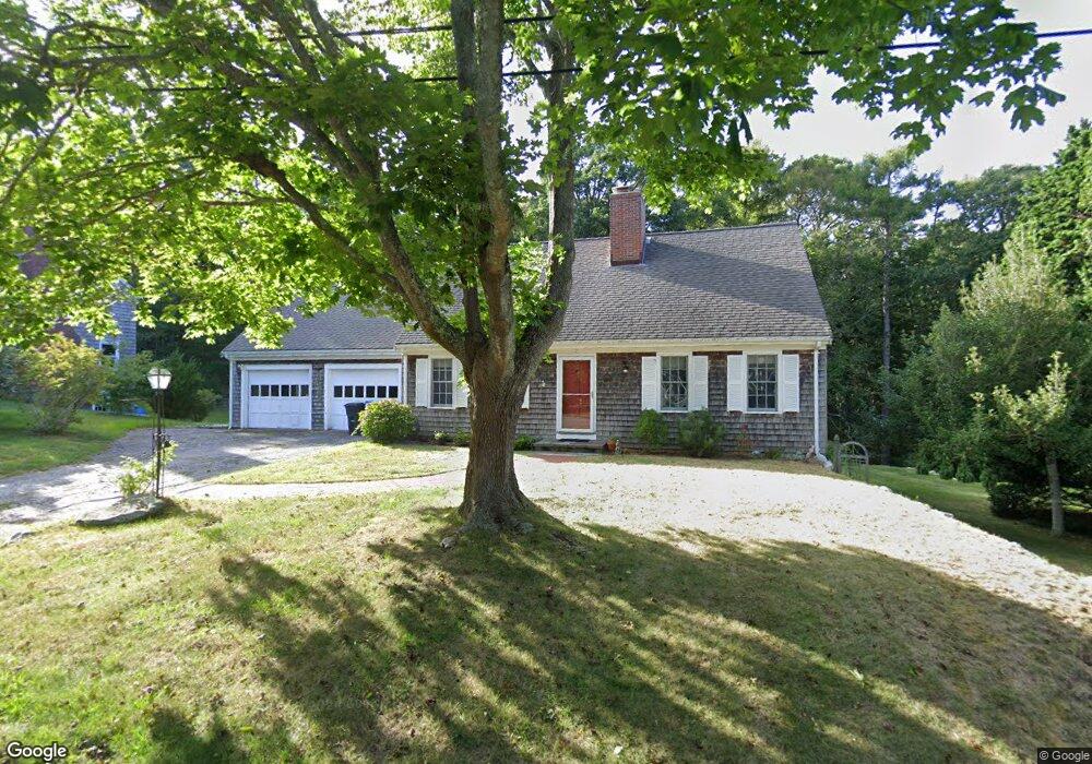
7 Snapper Ln Falmouth, MA 02540
Falmouth Village NeighborhoodEstimated Value: $1,006,083 - $1,616,000
3
Beds
3
Baths
1,801
Sq Ft
$667/Sq Ft
Est. Value
About This Home
This home is located at 7 Snapper Ln, Falmouth, MA 02540 and is currently estimated at $1,201,021, approximately $666 per square foot. 7 Snapper Ln is a home located in Barnstable County with nearby schools including Mullen-Hall School, Lawrence School, and Morse Pond School.
Ownership History
Date
Name
Owned For
Owner Type
Purchase Details
Closed on
Apr 20, 2004
Sold by
Wetherell Barbara
Bought by
Osgood Nancy
Current Estimated Value
Home Financials for this Owner
Home Financials are based on the most recent Mortgage that was taken out on this home.
Original Mortgage
$260,000
Outstanding Balance
$116,063
Interest Rate
5.58%
Mortgage Type
Purchase Money Mortgage
Estimated Equity
$1,084,958
Purchase Details
Closed on
Oct 8, 1993
Sold by
Bush F Louise Est and Bush
Bought by
Wetherell Richard
Create a Home Valuation Report for This Property
The Home Valuation Report is an in-depth analysis detailing your home's value as well as a comparison with similar homes in the area
Home Values in the Area
Average Home Value in this Area
Purchase History
| Date | Buyer | Sale Price | Title Company |
|---|---|---|---|
| Osgood Nancy | $502,500 | -- | |
| Osgood Nancy | $502,500 | -- | |
| Wetherell Richard | $172,500 | -- | |
| Wetherell Richard | $172,500 | -- |
Source: Public Records
Mortgage History
| Date | Status | Borrower | Loan Amount |
|---|---|---|---|
| Open | Osgood Nancy | $260,000 | |
| Closed | Wetherell Richard | $260,000 |
Source: Public Records
Tax History
| Year | Tax Paid | Tax Assessment Tax Assessment Total Assessment is a certain percentage of the fair market value that is determined by local assessors to be the total taxable value of land and additions on the property. | Land | Improvement |
|---|---|---|---|---|
| 2025 | $4,793 | $816,600 | $329,500 | $487,100 |
| 2024 | $4,661 | $742,200 | $299,600 | $442,600 |
| 2023 | $4,724 | $682,600 | $299,600 | $383,000 |
| 2022 | $4,679 | $581,200 | $273,200 | $308,000 |
| 2021 | $4,360 | $512,900 | $261,300 | $251,600 |
| 2020 | $4,201 | $489,100 | $237,500 | $251,600 |
| 2019 | $4,136 | $483,200 | $237,500 | $245,700 |
| 2018 | $4,069 | $473,100 | $237,500 | $235,600 |
| 2017 | $3,958 | $464,000 | $237,500 | $226,500 |
| 2016 | $3,884 | $464,000 | $237,500 | $226,500 |
| 2015 | $3,800 | $464,000 | $237,500 | $226,500 |
| 2014 | $3,772 | $462,800 | $237,600 | $225,200 |
Source: Public Records
Map
Nearby Homes
- 176 Mill Rd Unit 4
- 69 Two Ponds Rd
- 9 Hedge Ln
- 182 Woods Hole Rd
- 407 Sippewissett Rd
- 30 Katherine Lee Bates Rd
- 110 Mariners Ln
- 70 Lakeview Ave
- 33 Oakwood Ave
- 276 Shore St
- 39 Upland Ave
- 16 Lt Hauser Ln Unit 3
- 480 Main St Unit 13
- 480 Main St Unit 1
- 100 Dillingham Ave Unit 101A
- 100 Dillingham Ave Unit A101
- 12 Woodrise Unit 12
- 110 Dillingham Ave Unit 312
- 110 Dillingham Ave Unit 214
- 40 Woodrise Unit 40
Your Personal Tour Guide
Ask me questions while you tour the home.