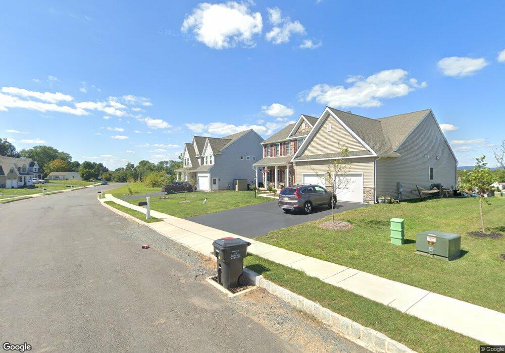
7 Sovereign Dr Douglassville, PA 19518
Union NeighborhoodEstimated Value: $631,965 - $815,000
4
Beds
4
Baths
3,592
Sq Ft
$200/Sq Ft
Est. Value
About This Home
This home is located at 7 Sovereign Dr, Douglassville, PA 19518 and is currently estimated at $719,491, approximately $200 per square foot. 7 Sovereign Dr is a home with nearby schools including Daniel Boone Area Primary Center, Daniel Boone Area Middle School, and Daniel Boone Area High School.
Ownership History
Date
Name
Owned For
Owner Type
Purchase Details
Closed on
Aug 17, 2018
Sold by
The Rutt Family Sonshine Lp Iii
Bought by
Mayer Brett A and Mayer Lauren A
Current Estimated Value
Home Financials for this Owner
Home Financials are based on the most recent Mortgage that was taken out on this home.
Original Mortgage
$281,891
Outstanding Balance
$244,811
Interest Rate
4.5%
Mortgage Type
New Conventional
Estimated Equity
$474,680
Purchase Details
Closed on
Nov 21, 2011
Sold by
Heritage Union Greene Inc
Bought by
Coba Inc
Create a Home Valuation Report for This Property
The Home Valuation Report is an in-depth analysis detailing your home's value as well as a comparison with similar homes in the area
Home Values in the Area
Average Home Value in this Area
Purchase History
| Date | Buyer | Sale Price | Title Company |
|---|---|---|---|
| Mayer Brett A | $402,702 | None Available | |
| Coba Inc | $9,200 | None Available |
Source: Public Records
Mortgage History
| Date | Status | Borrower | Loan Amount |
|---|---|---|---|
| Open | Mayer Brett A | $281,891 |
Source: Public Records
Tax History Compared to Growth
Tax History
| Year | Tax Paid | Tax Assessment Tax Assessment Total Assessment is a certain percentage of the fair market value that is determined by local assessors to be the total taxable value of land and additions on the property. | Land | Improvement |
|---|---|---|---|---|
| 2025 | $3,175 | $250,700 | $52,400 | $198,300 |
| 2024 | $11,166 | $250,700 | $52,400 | $198,300 |
| 2023 | $9,594 | $250,700 | $52,400 | $198,300 |
| 2022 | $10,953 | $250,700 | $52,400 | $198,300 |
| 2021 | $10,753 | $250,700 | $52,400 | $198,300 |
| 2020 | $10,753 | $250,700 | $52,400 | $198,300 |
| 2019 | $11,475 | $272,300 | $58,200 | $214,100 |
| 2018 | $54 | $1,300 | $1,300 | $0 |
| 2017 | $53 | $1,300 | $1,300 | $0 |
| 2016 | $14 | $1,300 | $1,300 | $0 |
| 2015 | $14 | $1,300 | $1,300 | $0 |
| 2014 | $14 | $1,300 | $1,300 | $0 |
Source: Public Records
Map
Nearby Homes
- 1461 Benjamin Franklin Hwy
- 1748 Honeysuckle Ln
- Lot 3 Benjamin Franklin Hwy
- Lot 4 Benjamin Franklin Hwy
- Lot 1 N Monocacy Cre Benjamin Franklin Hwy
- 0 Squirrel Hollow Rd
- 39 Westin Rd
- 86 Westin Rd
- 150 Random Rd
- 145 Random Rd
- 1538 Temple Rd
- 0 Red Corner Rd Unit PABK2062922
- 0 Red Corner Rd Unit PABK2056854
- 131 Squirrel Hollow Rd
- 25 Random Rd
- 94 Random Rd
- 0 W Rte 422 Unit PABK2064208
- 1845 Evans Rd
- 536 & 538 W Vine St
- 109 Old Airport Rd
- 11 Sovereign Dr
- 8 Sovereign Dr
- 10 Sovereign Dr
- 75 Black Matt Rd
- 12 Sovereign Dr
- 6 Sovereign Dr
- 13 Sovereign Dr
- 4 Sovereign Dr
- 14 Sovereign Dr
- 2 Sovereign Dr
- 15 Sovereign Dr
- 5 Queen St
- 16 Sovereign Dr
- 17 Sovereign Dr
- 6 Queen St
- 66 Black Matt Rd
- 18 Sovereign Dr
- 71 Black Matt Rd
- 109 Edison Rd
- 9 Queen St