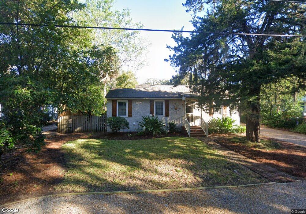
7 Stewart Ave Saint Simons Island, GA 31522
Estimated Value: $520,000 - $771,000
2
Beds
2
Baths
1,080
Sq Ft
$581/Sq Ft
Est. Value
About This Home
This home is located at 7 Stewart Ave, Saint Simons Island, GA 31522 and is currently estimated at $627,627, approximately $581 per square foot. 7 Stewart Ave is a home located in Glynn County with nearby schools including St. Simons Elementary School, Glynn Middle School, and Glynn Academy.
Ownership History
Date
Name
Owned For
Owner Type
Purchase Details
Closed on
Dec 23, 2019
Sold by
Tucker Anne
Bought by
Lueptow Properties Llc
Current Estimated Value
Purchase Details
Closed on
Apr 28, 2006
Sold by
Vanvanwaters William Van
Bought by
Tucker Anne
Home Financials for this Owner
Home Financials are based on the most recent Mortgage that was taken out on this home.
Original Mortgage
$216,000
Interest Rate
6.33%
Mortgage Type
New Conventional
Create a Home Valuation Report for This Property
The Home Valuation Report is an in-depth analysis detailing your home's value as well as a comparison with similar homes in the area
Home Values in the Area
Average Home Value in this Area
Purchase History
| Date | Buyer | Sale Price | Title Company |
|---|---|---|---|
| Lueptow Properties Llc | -- | -- | |
| Tucker Anne | $270,000 | -- |
Source: Public Records
Mortgage History
| Date | Status | Borrower | Loan Amount |
|---|---|---|---|
| Previous Owner | Tucker Anne | $216,000 |
Source: Public Records
Tax History Compared to Growth
Tax History
| Year | Tax Paid | Tax Assessment Tax Assessment Total Assessment is a certain percentage of the fair market value that is determined by local assessors to be the total taxable value of land and additions on the property. | Land | Improvement |
|---|---|---|---|---|
| 2025 | $5,150 | $205,360 | $98,720 | $106,640 |
| 2024 | $4,655 | $185,600 | $78,960 | $106,640 |
| 2023 | $4,423 | $174,920 | $70,520 | $104,400 |
| 2022 | $3,450 | $132,600 | $28,200 | $104,400 |
| 2021 | $2,778 | $102,600 | $28,200 | $74,400 |
| 2020 | $2,804 | $102,600 | $28,200 | $74,400 |
| 2019 | $2,804 | $102,600 | $28,200 | $74,400 |
| 2018 | $2,804 | $102,600 | $28,200 | $74,400 |
| 2017 | $2,458 | $89,360 | $28,200 | $61,160 |
| 2016 | $1,659 | $63,920 | $28,200 | $35,720 |
| 2015 | $1,665 | $63,920 | $28,200 | $35,720 |
| 2014 | $1,665 | $63,920 | $28,200 | $35,720 |
Source: Public Records
Map
Nearby Homes
- 202 Vassar Point Dr
- 211 Mcintosh Ave
- 104 Youngwood Dr
- 2404 Frederica Rd
- 516 Postell Dr
- 242 Mcintosh Ave
- 121 Killgriffe St
- 524 Wesley Oak Cir
- 295 Mcintosh Ave
- 210 Settlers Rd
- 105 Ledbetter Ave
- 217 Settlers Rd
- 125 Worthing Rd
- 123 Redfern Dr
- 214 Hermitage Way
- 207 Military Rd
- 303 Wymberly Rd
- 102 Sapelo St
- 302 Wormslow Ct
- 1704 Frederica Rd Unit 237
- 8 Stewart Ave
- 8 Stewart Ave
- 103 Shadman Ln
- 9 Stewart Ave
- 5 Stewart Ave
- 16 Stewart Ave
- 104 Vassar Point Dr
- 15 Stewart Ave
- 17 Stewart Ave
- 10 Stewart Ave
- 14 Stewart Ave
- 4 Stewart Ave
- 102 Shadman Ln
- 102 Vassar Point Dr
- 18 Stewart Ave
- 106 Vassar Point Dr
- 13 Stewart Ave
- 11 Stewart Ave
- 19 Stewart Ave
- 3 Stewart Ave