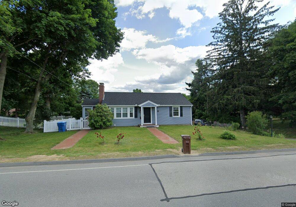
7 Swanson Rd Auburn, MA 01501
Stoneville NeighborhoodEstimated Value: $329,000 - $387,000
3
Beds
1
Bath
974
Sq Ft
$374/Sq Ft
Est. Value
About This Home
This home is located at 7 Swanson Rd, Auburn, MA 01501 and is currently estimated at $363,800, approximately $373 per square foot. 7 Swanson Rd is a home located in Worcester County with nearby schools including Auburn Senior High School and Shrewsbury Montessori School - Auburn Campus.
Ownership History
Date
Name
Owned For
Owner Type
Purchase Details
Closed on
May 29, 2020
Sold by
Genatossio Louis F and Genatossio Barbara A
Bought by
Moore Rt
Current Estimated Value
Purchase Details
Closed on
Oct 6, 2011
Sold by
Kureisa Ruth E and Kuraisa Ruth E
Bought by
Moore Donald H and Moore Jeanne H
Create a Home Valuation Report for This Property
The Home Valuation Report is an in-depth analysis detailing your home's value as well as a comparison with similar homes in the area
Home Values in the Area
Average Home Value in this Area
Purchase History
| Date | Buyer | Sale Price | Title Company |
|---|---|---|---|
| Moore Rt | -- | None Available | |
| Genatossio Barbara A | -- | None Available | |
| Moore Donald H | $125,000 | -- |
Source: Public Records
Tax History Compared to Growth
Tax History
| Year | Tax Paid | Tax Assessment Tax Assessment Total Assessment is a certain percentage of the fair market value that is determined by local assessors to be the total taxable value of land and additions on the property. | Land | Improvement |
|---|---|---|---|---|
| 2025 | $43 | $298,900 | $113,200 | $185,700 |
| 2024 | $4,263 | $285,500 | $107,400 | $178,100 |
| 2023 | $4,107 | $258,600 | $97,600 | $161,000 |
| 2022 | $3,879 | $230,600 | $97,600 | $133,000 |
| 2021 | $3,797 | $209,300 | $86,100 | $123,200 |
| 2020 | $3,763 | $209,300 | $86,100 | $123,200 |
| 2019 | $3,509 | $190,500 | $85,200 | $105,300 |
| 2018 | $3,282 | $178,000 | $79,700 | $98,300 |
| 2017 | $3,129 | $170,600 | $72,300 | $98,300 |
| 2016 | $2,983 | $164,900 | $75,600 | $89,300 |
| 2015 | $2,876 | $166,600 | $75,600 | $91,000 |
| 2014 | $2,702 | $156,300 | $72,000 | $84,300 |
Source: Public Records
Map
Nearby Homes