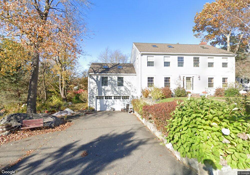
7 Thurston Point Rd Gloucester, MA 01930
Riverview NeighborhoodEstimated Value: $1,013,000 - $1,384,000
5
Beds
3
Baths
3,214
Sq Ft
$382/Sq Ft
Est. Value
About This Home
This home is located at 7 Thurston Point Rd, Gloucester, MA 01930 and is currently estimated at $1,229,129, approximately $382 per square foot. 7 Thurston Point Rd is a home located in Essex County with nearby schools including Beeman Memorial, Ralph B O'maley Middle School, and Gloucester High School.
Ownership History
Date
Name
Owned For
Owner Type
Purchase Details
Closed on
Nov 13, 1992
Sold by
Vadala Peter T and Vadala Denise
Bought by
Rogers Ii Harold and Rogers Linda
Current Estimated Value
Create a Home Valuation Report for This Property
The Home Valuation Report is an in-depth analysis detailing your home's value as well as a comparison with similar homes in the area
Home Values in the Area
Average Home Value in this Area
Purchase History
| Date | Buyer | Sale Price | Title Company |
|---|---|---|---|
| Rogers Ii Harold | $85,000 | -- |
Source: Public Records
Mortgage History
| Date | Status | Borrower | Loan Amount |
|---|---|---|---|
| Open | Rogers Ii Harold | $270,000 | |
| Closed | Rogers Ii Harold | $265,000 |
Source: Public Records
Tax History
| Year | Tax Paid | Tax Assessment Tax Assessment Total Assessment is a certain percentage of the fair market value that is determined by local assessors to be the total taxable value of land and additions on the property. | Land | Improvement |
|---|---|---|---|---|
| 2025 | $10,581 | $1,088,600 | $281,400 | $807,200 |
| 2024 | $10,461 | $1,075,100 | $267,900 | $807,200 |
| 2023 | $9,999 | $944,200 | $239,300 | $704,900 |
| 2022 | $9,708 | $827,600 | $203,300 | $624,300 |
| 2021 | $9,366 | $752,900 | $184,900 | $568,000 |
| 2020 | $9,467 | $767,800 | $184,900 | $582,900 |
| 2019 | $9,138 | $720,100 | $184,900 | $535,200 |
| 2018 | $8,901 | $688,400 | $184,900 | $503,500 |
| 2017 | $8,762 | $664,300 | $176,000 | $488,300 |
| 2016 | $8,497 | $624,300 | $176,500 | $447,800 |
| 2015 | $8,048 | $589,600 | $176,500 | $413,100 |
Source: Public Records
Map
Nearby Homes
- 2 Finch Ln
- 672 Washington St
- 6 Monroe Ct
- 226 Atlantic St
- 98 Maplewood Ave
- 16 Cleveland Place Unit 11
- 15 Harvard St
- 40 Sargent St
- 5 Samoset Rd Unit B
- 84 Centennial Ave
- 33 Maplewood Ave Unit 16
- 20 Beacon St Unit 2
- 20 Beacon St Unit 1
- 10 Oak St Unit 3
- 4 Mount Vernon St
- 118 Prospect St
- 33 Middle St
- 55 Mansfield St Unit A
- 55 Mansfield St Unit B
- 55 Mansfield St
- 9 Thurston Point Rd
- 5 Thurston Point Rd
- 8 Thurston Point Rd
- 6 Thurston Point Rd
- 11 Thurston Point Rd
- 3 Thurston Point Rd
- 4 Thurston Point Rd
- 4 Smokey Way
- 16 Honeysuckle Rd
- 16 Thurston Point Rd
- 18 Honeysuckle Rd
- 14 Honeysuckle Rd
- 20 Thurston Point Rd
- 74 Wheeler St
- 72 Wheeler St
- 20 Honeysuckle Rd
- 13 Thurston Point Rd
- 12 Honeysuckle Rd
- 13R Thurston Point Rd
- 76 Wheeler St