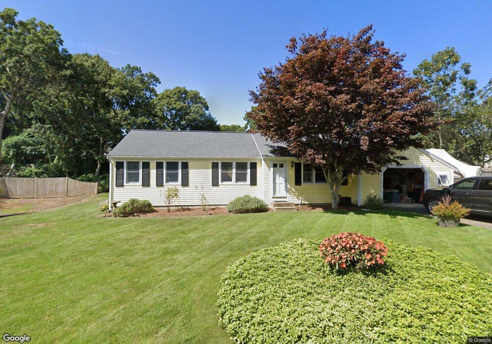
7 Waggon Rd Yarmouth Port, MA 02675
Yarmouth Port NeighborhoodEstimated Value: $522,000 - $638,000
3
Beds
2
Baths
800
Sq Ft
$723/Sq Ft
Est. Value
About This Home
This home is located at 7 Waggon Rd, Yarmouth Port, MA 02675 and is currently estimated at $578,713, approximately $723 per square foot. 7 Waggon Rd is a home located in Barnstable County with nearby schools including Dennis-Yarmouth Regional High School and St. Pius X. School.
Ownership History
Date
Name
Owned For
Owner Type
Purchase Details
Closed on
Oct 4, 2016
Sold by
Brown David E
Bought by
Brown David E and Brown Roberta M
Current Estimated Value
Purchase Details
Closed on
Aug 17, 1993
Sold by
Wagon Road Rt and Molinaro Raymond
Bought by
Brown Nancy Allison and Brown David E
Purchase Details
Closed on
Sep 12, 1991
Sold by
City Sb Of Pittsfield
Bought by
Molinaro Raymond and Molinaro Patricia
Purchase Details
Closed on
Aug 21, 1989
Sold by
Regan J Peter
Bought by
Almonte Louis R
Create a Home Valuation Report for This Property
The Home Valuation Report is an in-depth analysis detailing your home's value as well as a comparison with similar homes in the area
Home Values in the Area
Average Home Value in this Area
Purchase History
| Date | Buyer | Sale Price | Title Company |
|---|---|---|---|
| Brown David E | -- | -- | |
| Brown Nancy Allison | $108,000 | -- | |
| Molinaro Raymond | $90,900 | -- | |
| Almonte Louis R | $125,000 | -- |
Source: Public Records
Mortgage History
| Date | Status | Borrower | Loan Amount |
|---|---|---|---|
| Previous Owner | Almonte Louis R | $232,000 | |
| Previous Owner | Almonte Louis R | $215,000 |
Source: Public Records
Tax History Compared to Growth
Tax History
| Year | Tax Paid | Tax Assessment Tax Assessment Total Assessment is a certain percentage of the fair market value that is determined by local assessors to be the total taxable value of land and additions on the property. | Land | Improvement |
|---|---|---|---|---|
| 2025 | $3,156 | $445,800 | $166,000 | $279,800 |
| 2024 | $2,962 | $401,400 | $144,400 | $257,000 |
| 2023 | $3,049 | $376,000 | $131,200 | $244,800 |
| 2022 | $2,937 | $319,900 | $125,200 | $194,700 |
| 2021 | $2,774 | $290,200 | $125,200 | $165,000 |
| 2020 | $2,881 | $288,100 | $132,500 | $155,600 |
| 2019 | $2,681 | $265,400 | $132,500 | $132,900 |
| 2018 | $2,504 | $243,300 | $110,400 | $132,900 |
| 2017 | $2,383 | $237,800 | $110,400 | $127,400 |
| 2016 | $2,285 | $229,000 | $101,600 | $127,400 |
| 2015 | $2,302 | $229,300 | $97,200 | $132,100 |
Source: Public Records
Map
Nearby Homes
- 44 Stratford Ln
- 43 Canterbury Rd
- 86 Pompano Rd
- 6 Nimble Hill Dr
- 34 Kates Path
- 34 Kates Path Unit 34
- 64 Kates Path
- 17 Kates Path Unit A
- 228 Kates Path
- 25 Oak Glen Village Unit 25
- 25 Oak Glen
- 42 John Hall Cartway Unit 42
- 50 John Hall Cartway
- 50 John Hall Cartway Unit 50
- 59 Massachusetts 6a Unit 19-2
- 7 Forest Gate Unit 7
- 111 Merchant Ave
- 1 Barnacle Rd
- 59 Main St Unit 19-2
- 59 Route 6a Unit 29-4