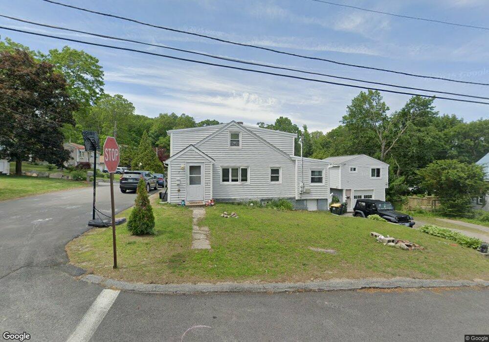
7 Waltham St Smithfield, RI 02917
Estimated Value: $523,000 - $558,654
--
Bed
--
Bath
--
Sq Ft
7,841
Sq Ft Lot
About This Home
This home is located at 7 Waltham St, Smithfield, RI 02917 and is currently estimated at $536,164. 7 Waltham St is a home located in Providence County with nearby schools including Old County Road School, Vincent J. Gallagher Middle School, and Smithfield High School.
Ownership History
Date
Name
Owned For
Owner Type
Purchase Details
Closed on
May 31, 2022
Sold by
Macdonald Dawn D
Bought by
Forte David
Current Estimated Value
Home Financials for this Owner
Home Financials are based on the most recent Mortgage that was taken out on this home.
Original Mortgage
$386,650
Outstanding Balance
$365,925
Interest Rate
5%
Mortgage Type
FHA
Estimated Equity
$170,239
Purchase Details
Closed on
Oct 31, 2006
Sold by
Macdonald Kevi M
Bought by
Macdonald Dawn D
Purchase Details
Closed on
Jun 19, 1992
Sold by
Moll Robert E
Bought by
Macdonald Kevin M
Purchase Details
Closed on
Dec 31, 1991
Sold by
Gtt Corp
Bought by
Moll Robert E
Create a Home Valuation Report for This Property
The Home Valuation Report is an in-depth analysis detailing your home's value as well as a comparison with similar homes in the area
Home Values in the Area
Average Home Value in this Area
Purchase History
| Date | Buyer | Sale Price | Title Company |
|---|---|---|---|
| Forte David | $400,000 | None Available | |
| Forte David | $400,000 | None Available | |
| Forte David | $400,000 | None Available | |
| Forte David | $400,000 | None Available | |
| Macdonald Dawn D | -- | -- | |
| Macdonald Kevin M | $122,500 | -- | |
| Moll Robert E | $56,000 | -- | |
| Macdonald Dawn D | -- | -- | |
| Macdonald Kevin M | $122,500 | -- | |
| Moll Robert E | $56,000 | -- |
Source: Public Records
Mortgage History
| Date | Status | Borrower | Loan Amount |
|---|---|---|---|
| Open | Forte David | $386,650 | |
| Closed | Forte David | $386,650 | |
| Previous Owner | Moll Robert E | $198,955 | |
| Previous Owner | Moll Robert E | $146,500 |
Source: Public Records
Tax History Compared to Growth
Tax History
| Year | Tax Paid | Tax Assessment Tax Assessment Total Assessment is a certain percentage of the fair market value that is determined by local assessors to be the total taxable value of land and additions on the property. | Land | Improvement |
|---|---|---|---|---|
| 2025 | $5,603 | $452,200 | $146,700 | $305,500 |
| 2024 | $3,832 | $265,400 | $131,000 | $134,400 |
| 2023 | $3,641 | $265,400 | $131,000 | $134,400 |
| 2022 | $3,546 | $265,400 | $131,000 | $134,400 |
| 2021 | $3,469 | $202,500 | $113,500 | $89,000 |
| 2020 | $3,404 | $202,500 | $113,500 | $89,000 |
| 2019 | $3,404 | $202,500 | $113,500 | $89,000 |
| 2018 | $2,787 | $158,700 | $80,100 | $78,600 |
| 2017 | $2,787 | $158,700 | $80,100 | $78,600 |
| 2016 | $2,655 | $158,700 | $80,100 | $78,600 |
| 2015 | $3,024 | $172,100 | $73,600 | $98,500 |
| 2012 | $3,124 | $195,000 | $87,000 | $108,000 |
Source: Public Records
Map
Nearby Homes
- 2 Old County Village Way Unit A
- 4 Old County Village Way Unit B
- 3 Old County Village Way
- 16 Louise Ann Dr
- 48 Pheasant Run Unit A
- 18 Homestead Ave
- 15 Higgins St Unit 123
- 302 Waterman Ave
- 29 Julien St
- 24 Whipple Rd
- 1 Old County Village Way Unit E
- 6 Wadsworth Ave
- 12 Wadsworth Ave
- 5 Meadow Ct
- 100 Mountaindale Rd
- 117 Farnum Pike
- 15 Woodland Ave
- 27 Dean Ave
- 53 Scenery Ln Unit 53
- 2 Arcade St
- 15 Kensington St
- 12 Kensington St
- 1 Oakdale St
- 5 Oakdale St
- 8 Kensington St
- 14 Kensington St
- 4 Oakdale St
- 3 Kensington St
- 12 Oakdale St
- 7 Oakdale St
- 3 Oakdale St
- 18 Kensington St
- 17 Leland Mowry Dr
- 4 Kensington St
- 501 Pinewood Dr
- 16 Oakdale St
- 502 Pinewood Dr
- 2 Kensington St
- 208 Pinewood Dr
- 206 Pinewood Dr