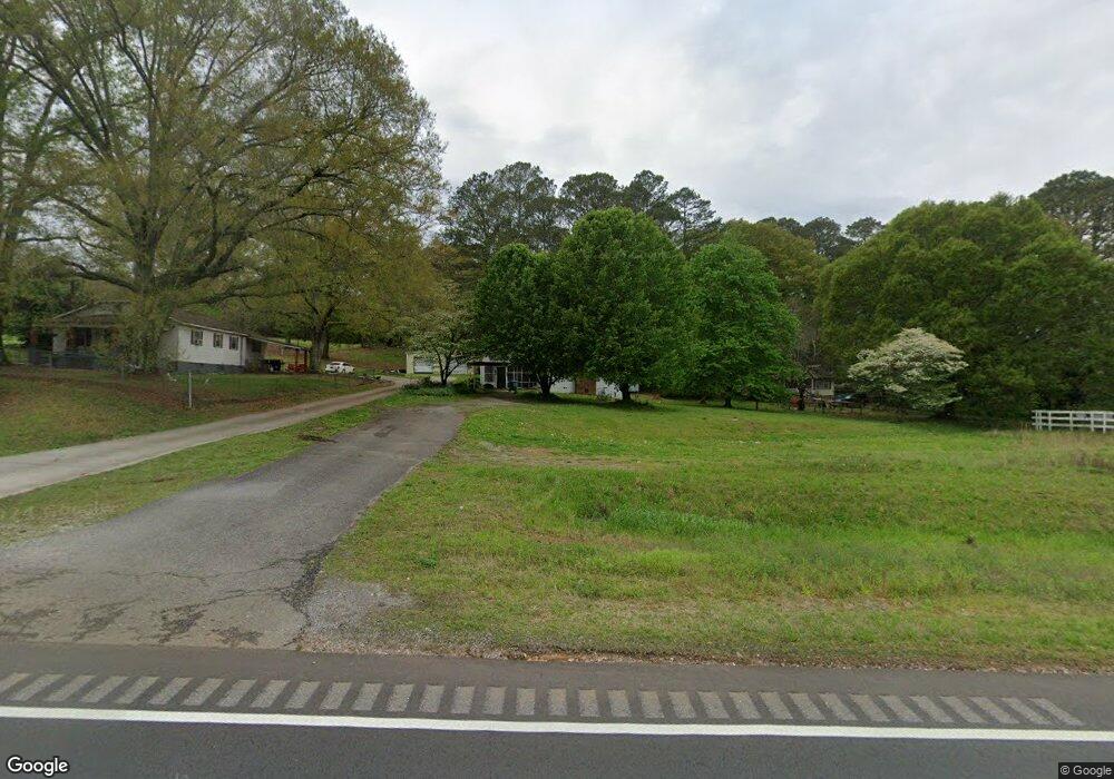
7 West Rd Cedartown, GA 30125
Estimated Value: $113,000 - $200,000
2
Beds
1
Bath
884
Sq Ft
$169/Sq Ft
Est. Value
About This Home
This home is located at 7 West Rd, Cedartown, GA 30125 and is currently estimated at $149,428, approximately $169 per square foot. 7 West Rd is a home located in Polk County with nearby schools including Vineyard Harvester Christian Academy.
Ownership History
Date
Name
Owned For
Owner Type
Purchase Details
Closed on
Mar 11, 2020
Sold by
Ingram Sheila
Bought by
Collier David
Current Estimated Value
Purchase Details
Closed on
Apr 1, 2019
Sold by
West Mary Jo
Bought by
Ingram Sheila and Peek Lynn
Purchase Details
Closed on
Jul 26, 2001
Sold by
Burns Terry
Bought by
West Mary Jo B Guice
Purchase Details
Closed on
Aug 14, 1989
Sold by
West Jimmy J
Bought by
Guice Mary Jo B West
Purchase Details
Closed on
Jul 18, 1960
Bought by
West Jimmy
Create a Home Valuation Report for This Property
The Home Valuation Report is an in-depth analysis detailing your home's value as well as a comparison with similar homes in the area
Home Values in the Area
Average Home Value in this Area
Purchase History
| Date | Buyer | Sale Price | Title Company |
|---|---|---|---|
| Collier David | $50,000 | -- | |
| Ingram Sheila | -- | -- | |
| Ingram Sheila | -- | -- | |
| West Mary Jo B Guice | -- | -- | |
| Estate Of William Henry Burns Terry Burn | -- | -- | |
| Guice Mary Jo B West | -- | -- | |
| West Jimmy | -- | -- |
Source: Public Records
Tax History Compared to Growth
Tax History
| Year | Tax Paid | Tax Assessment Tax Assessment Total Assessment is a certain percentage of the fair market value that is determined by local assessors to be the total taxable value of land and additions on the property. | Land | Improvement |
|---|---|---|---|---|
| 2024 | $763 | $36,483 | $1,507 | $34,976 |
| 2023 | $576 | $24,291 | $1,507 | $22,784 |
| 2022 | $492 | $20,741 | $1,005 | $19,736 |
| 2021 | $481 | $20,741 | $1,005 | $19,736 |
| 2020 | $500 | $20,741 | $1,005 | $19,736 |
| 2019 | $91 | $12,128 | $1,005 | $11,123 |
| 2018 | $89 | $11,775 | $1,005 | $10,770 |
| 2017 | $86 | $11,775 | $1,005 | $10,770 |
| 2016 | $88 | $11,971 | $1,200 | $10,770 |
| 2015 | $88 | $11,912 | $1,200 | $10,712 |
| 2014 | $88 | $11,912 | $1,200 | $10,712 |
Source: Public Records
Map
Nearby Homes
- 2236 Rome Hwy
- 31 Meadow Lakes Terrace
- 0 Rome Hwy Unit 10521649
- 90 W Meadow Lakes Blvd
- 232 Stephens Rd
- 113 Cherokee Estates Dr
- 0 Collins Rd Unit 10627302
- 88 Sequoyah Ct
- TRACT3 Drummond Rd
- Tract2 Drummond Rd
- 600 Miller Rd
- 133 Virginia Cir
- 64 Virginia Cir
- 1170 Lake Creek Rd
- 727 Cherokee Rd
- 00 Oak Crest Dr
- 828 N College Dr
- 217 Cherokee Cir
- 220 Greenbriar Dr
- 1250 Adams Rd
- 2161 Rome Hwy
- 2179 Rome Hwy
- 2151 Rome Hwy
- 2131 Rome Hwy
- 2156 Rome Hwy
- 55 West Rd
- 2111 Rome Hwy
- 340 Oak Grove Rd
- 2087 Rome Hwy
- 339 Oak Grove Rd
- 293 Oak Grove Rd
- 2200 Rome Hwy
- 2190 Rome Hwy
- 53 Denton Rd
- 2073 Rome Hwy
- 235 Oak Grove Rd
- 75 Denton Rd
- 2072 Rome Hwy
- 0 Denton Rd Unit 6001886
- 0 Denton Rd Unit 3 8367857