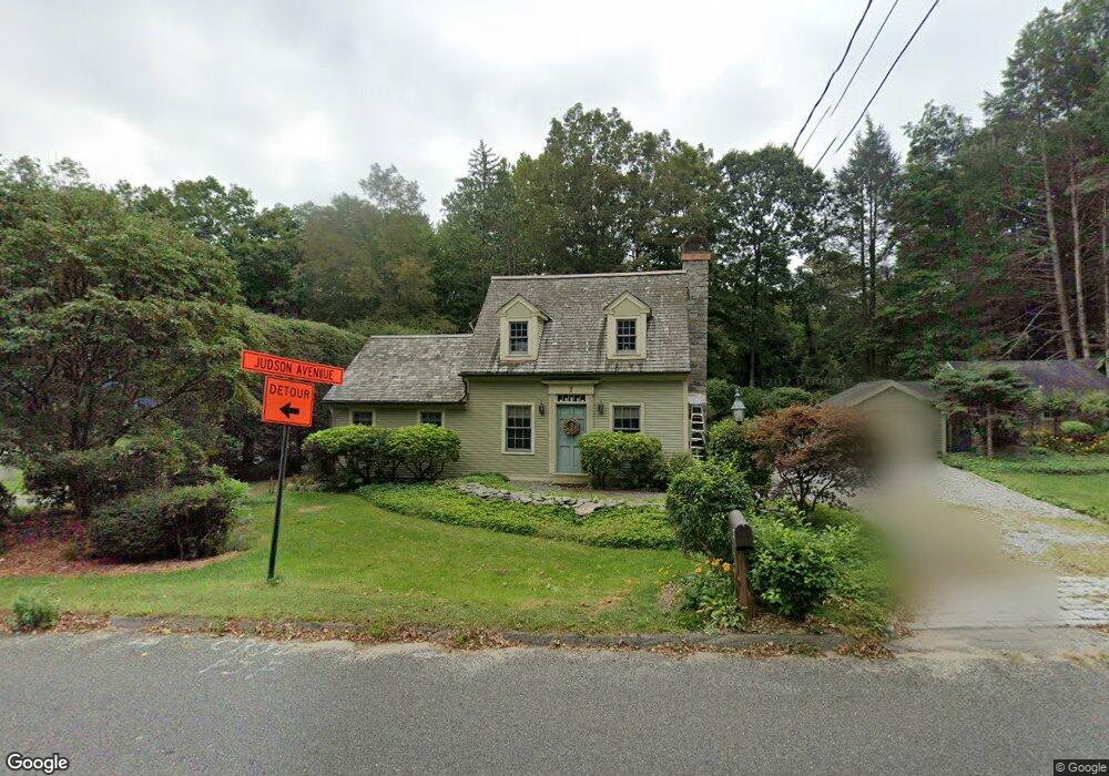
7 Westside Rd Woodbury, CT 06798
Estimated Value: $423,000 - $582,000
2
Beds
3
Baths
1,460
Sq Ft
$332/Sq Ft
Est. Value
About This Home
This home is located at 7 Westside Rd, Woodbury, CT 06798 and is currently estimated at $484,456, approximately $331 per square foot. 7 Westside Rd is a home located in Litchfield County with nearby schools including Mitchell Elementary School, Bethlehem Elementary School, and Woodbury Middle School.
Ownership History
Date
Name
Owned For
Owner Type
Purchase Details
Closed on
Jun 2, 1995
Sold by
Fagan Peter
Bought by
Greco David and Greco Cathy
Current Estimated Value
Home Financials for this Owner
Home Financials are based on the most recent Mortgage that was taken out on this home.
Original Mortgage
$168,000
Outstanding Balance
$89,463
Interest Rate
7.25%
Mortgage Type
Unknown
Estimated Equity
$394,993
Purchase Details
Closed on
Dec 21, 1994
Sold by
Moisan Richard and Moisan Lisa
Bought by
Fagan Peter and Fagan Eleanor
Home Financials for this Owner
Home Financials are based on the most recent Mortgage that was taken out on this home.
Original Mortgage
$110,000
Interest Rate
6.25%
Mortgage Type
Unknown
Purchase Details
Closed on
Sep 21, 1988
Sold by
Leroi Marcel
Bought by
Moisan Richard
Home Financials for this Owner
Home Financials are based on the most recent Mortgage that was taken out on this home.
Original Mortgage
$92,000
Interest Rate
10.51%
Create a Home Valuation Report for This Property
The Home Valuation Report is an in-depth analysis detailing your home's value as well as a comparison with similar homes in the area
Home Values in the Area
Average Home Value in this Area
Purchase History
| Date | Buyer | Sale Price | Title Company |
|---|---|---|---|
| Greco David | $210,000 | -- | |
| Fagan Peter | $205,000 | -- | |
| Moisan Richard | $115,000 | -- |
Source: Public Records
Mortgage History
| Date | Status | Borrower | Loan Amount |
|---|---|---|---|
| Open | Moisan Richard | $168,000 | |
| Previous Owner | Moisan Richard | $110,000 | |
| Previous Owner | Moisan Richard | $159,500 | |
| Previous Owner | Moisan Richard | $92,000 |
Source: Public Records
Tax History Compared to Growth
Tax History
| Year | Tax Paid | Tax Assessment Tax Assessment Total Assessment is a certain percentage of the fair market value that is determined by local assessors to be the total taxable value of land and additions on the property. | Land | Improvement |
|---|---|---|---|---|
| 2025 | $5,435 | $230,090 | $60,270 | $169,820 |
| 2024 | $5,331 | $230,090 | $60,270 | $169,820 |
| 2023 | $4,677 | $160,960 | $60,290 | $100,670 |
| 2022 | $4,695 | $160,960 | $60,290 | $100,670 |
| 2021 | $4,695 | $160,960 | $60,290 | $100,670 |
| 2020 | $4,695 | $160,960 | $60,290 | $100,670 |
| 2019 | $4,695 | $160,960 | $60,290 | $100,670 |
| 2018 | $7,823 | $170,480 | $66,990 | $103,490 |
| 2017 | $4,630 | $170,480 | $66,990 | $103,490 |
| 2016 | $4,482 | $170,480 | $66,990 | $103,490 |
| 2015 | $4,444 | $170,480 | $66,990 | $103,490 |
| 2014 | $4,380 | $170,480 | $66,990 | $103,490 |
Source: Public Records
Map
Nearby Homes
- 2 Linden Rd
- 74 Washington Rd Unit 16
- 34 Transylvania Rd
- 54 Mountain Rd
- 70 Mountain Rd
- 118 Good Hill Rd
- 337 Main St S
- 18 Woodbury Hill
- 101 Old Grassy Hill Rd
- 298 Railtree Hill Rd
- 43 Hoop Pole Hill Rd
- 439 Washington Rd
- 229 Bacon Pond Rd Unit 454
- 509 Main St N
- 148 Flanders Rd
- 74 Middle Quarter Rd
- 523 Main St N
- 174 Weekeepeemee Rd
- 105 Minortown Rd
- 92 Minortown Rd
- 0 Westwood Rd Unit W1078801
- 139 Judson Ave
- B Westside Rd
- 0 Westside Rd Unit W1066552
- 0 Westside Rd Unit W10035116
- 0 Westside Rd Unit V10111182
- 00 Westside Rd
- 5 Westwood Rd
- 18 Westside Rd
- 0 Stone Pit Rd Unit W1044914
- 0 Stone Pit Rd Unit W1044915
- 0 Stone Pit Rd Unit W1074336
- 0 Stone Pit Rd Unit W1074335
- 0 Stone Pit Rd Unit W10008875
- 0 Stone Pit Rd Unit W10008981
- 0 Stone Pit Rd Unit W10054478
- 0 Stone Pit Rd Unit 170432615
- 1 Stone Pit Rd
- 11 Westwood Rd
- 39 River Bend Dr