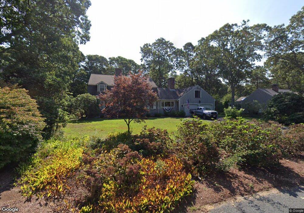
7 Whippoorwill Ln Yarmouth Port, MA 02675
Yarmouth Port NeighborhoodEstimated Value: $1,029,000 - $1,308,000
4
Beds
3
Baths
2,701
Sq Ft
$430/Sq Ft
Est. Value
About This Home
This home is located at 7 Whippoorwill Ln, Yarmouth Port, MA 02675 and is currently estimated at $1,162,030, approximately $430 per square foot. 7 Whippoorwill Ln is a home located in Barnstable County with nearby schools including Dennis-Yarmouth Regional High School.
Ownership History
Date
Name
Owned For
Owner Type
Purchase Details
Closed on
Oct 14, 2022
Sold by
Moran Robert J
Bought by
Robert J Moran T
Current Estimated Value
Purchase Details
Closed on
Oct 11, 2022
Sold by
Moran Ft
Bought by
Moran Robert J
Purchase Details
Closed on
Dec 22, 2014
Sold by
Moran Robert J and Moran Margaret A
Bought by
Moran Ft and Moran Robert J
Purchase Details
Closed on
Nov 9, 2004
Sold by
Lampe Re T and Lampe Elizabeth
Bought by
Moran Margaret A and Moran Robert J
Home Financials for this Owner
Home Financials are based on the most recent Mortgage that was taken out on this home.
Original Mortgage
$500,000
Interest Rate
5.71%
Mortgage Type
Purchase Money Mortgage
Create a Home Valuation Report for This Property
The Home Valuation Report is an in-depth analysis detailing your home's value as well as a comparison with similar homes in the area
Home Values in the Area
Average Home Value in this Area
Purchase History
| Date | Buyer | Sale Price | Title Company |
|---|---|---|---|
| Robert J Moran T | -- | None Available | |
| Moran Robert J | -- | None Available | |
| Moran Ft | -- | -- | |
| Moran Margaret A | $645,000 | -- |
Source: Public Records
Mortgage History
| Date | Status | Borrower | Loan Amount |
|---|---|---|---|
| Previous Owner | Moran Margaret A | $500,000 |
Source: Public Records
Tax History Compared to Growth
Tax History
| Year | Tax Paid | Tax Assessment Tax Assessment Total Assessment is a certain percentage of the fair market value that is determined by local assessors to be the total taxable value of land and additions on the property. | Land | Improvement |
|---|---|---|---|---|
| 2025 | $7,107 | $1,003,800 | $236,600 | $767,200 |
| 2024 | $6,590 | $892,900 | $205,900 | $687,000 |
| 2023 | $6,814 | $840,200 | $194,000 | $646,200 |
| 2022 | $6,664 | $725,900 | $220,500 | $505,400 |
| 2021 | $5,935 | $620,800 | $210,400 | $410,400 |
| 2020 | $5,923 | $592,300 | $210,000 | $382,300 |
| 2019 | $5,662 | $560,600 | $210,000 | $350,600 |
| 2018 | $5,673 | $551,300 | $200,700 | $350,600 |
| 2017 | $5,524 | $551,300 | $200,700 | $350,600 |
| 2016 | $5,502 | $551,300 | $200,700 | $350,600 |
| 2015 | $5,675 | $565,200 | $200,700 | $364,500 |
Source: Public Records
Map
Nearby Homes
- 30 W Woods
- 30 W Woods Cir Unit 30
- 2 Pine Grove
- 23 Dauphine Dr
- 158 Kates Path
- 25 Oak Glen Village Unit 25
- 25 Oak Glen
- 28 Oak Glen
- 19 John Hall Cartway Unit E
- 50 John Hall Cartway
- 50 John Hall Cartway Unit 50
- 19 John Halls Cartpath Village Unit E
- 42 John Hall Cartway Unit 42
- 228 Kates Path
- 17 Kates Path Unit A
- 64 Kates Path
- 17 Nottingham Dr
- 24 Minnetuxet Way
- 21 Boxwood Cir
- 49 Rodoalph's Way
- 15 Whippoorwill Ln
- 1 Whippoorwill Ln
- 10 Gaslight Dr
- 119 Homers Dock Rd
- 125 Homers Dock Rd
- 2 Whippoorwill Ln
- 2 Shell Dr
- 2 Gaslight Dr
- 23 Whippoorwill Ln
- 9 Pheasant Cove Cir
- 15 Gaslight Dr
- 20 Whippoorwill Ln
- 9 Gaslight Dr
- 7 Shell Dr
- 120 Homers Dock Rd
- 1 Windswept Path
- 1 Gaslight Dr
- 19 Pheasant Cove Cir
- 26 Whippoorwill Ln
- 11 Windswept Path