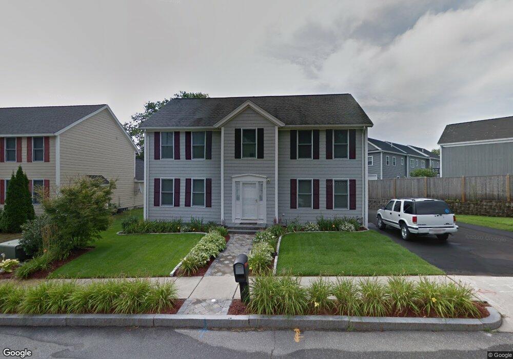
7 Williams Cir Winchester, MA 01890
Estimated Value: $1,247,000 - $1,336,000
4
Beds
3
Baths
2,392
Sq Ft
$538/Sq Ft
Est. Value
About This Home
This home is located at 7 Williams Cir, Winchester, MA 01890 and is currently estimated at $1,286,114, approximately $537 per square foot. 7 Williams Cir is a home located in Middlesex County with nearby schools including Lynch Elementary School, McCall Middle School, and Winchester High School.
Ownership History
Date
Name
Owned For
Owner Type
Purchase Details
Closed on
Jan 15, 2021
Sold by
Burke Jack D and Burke Kimberly C
Bought by
Burke Ft
Current Estimated Value
Purchase Details
Closed on
Jun 11, 2001
Sold by
Williamsville Llc
Bought by
Burke Jack D and Burke Kimberly C
Home Financials for this Owner
Home Financials are based on the most recent Mortgage that was taken out on this home.
Original Mortgage
$450,000
Interest Rate
7.08%
Mortgage Type
Purchase Money Mortgage
Create a Home Valuation Report for This Property
The Home Valuation Report is an in-depth analysis detailing your home's value as well as a comparison with similar homes in the area
Purchase History
| Date | Buyer | Sale Price | Title Company |
|---|---|---|---|
| Burke Ft | -- | None Available | |
| Burke Jack D | $500,000 | -- |
Source: Public Records
Mortgage History
| Date | Status | Borrower | Loan Amount |
|---|---|---|---|
| Previous Owner | Burke Jack D | $450,000 |
Source: Public Records
Tax History
| Year | Tax Paid | Tax Assessment Tax Assessment Total Assessment is a certain percentage of the fair market value that is determined by local assessors to be the total taxable value of land and additions on the property. | Land | Improvement |
|---|---|---|---|---|
| 2025 | $122 | $1,098,200 | $566,900 | $531,300 |
| 2024 | $11,996 | $1,058,800 | $566,900 | $491,900 |
| 2023 | $11,714 | $992,700 | $510,200 | $482,500 |
| 2022 | $11,408 | $911,900 | $439,400 | $472,500 |
| 2021 | $11,154 | $869,400 | $396,900 | $472,500 |
| 2020 | $10,772 | $869,400 | $396,900 | $472,500 |
| 2019 | $10,356 | $855,200 | $382,700 | $472,500 |
| 2018 | $10,048 | $824,300 | $365,000 | $459,300 |
| 2017 | $9,908 | $806,800 | $365,000 | $441,800 |
| 2016 | $9,261 | $792,900 | $365,000 | $427,900 |
| 2015 | $8,860 | $729,800 | $318,200 | $411,600 |
| 2014 | $8,668 | $684,700 | $276,400 | $408,300 |
Source: Public Records
Map
Nearby Homes
- 20 Charles Rd
- 9 Charles Rd
- 171 Swanton St Unit 73
- 15 Englewood Rd
- 20 Arthur St
- 353-355 Washington St
- 237 Swanton St
- 31 Tremont St
- 320 Washington St
- 8 Russell Rd Unit 10
- 200 Swanton St Unit 228
- 200 Swanton St Unit T28
- 22 Oak St
- 3 Golden Terrace
- 0 Mount Pleasant St
- 259 Washington St
- 2 Maria Ct
- 38 Pickering St Unit A
- 40 Pickering St
- 62 Richardson St
- 9 Williams Cir
- 159 Cross St Unit SF
- 159 Cross St
- 159 Cross St Unit 159
- 159 Cross St Unit 1
- 8 Williams Cir
- 8 Williams Cir
- 11 Williams Cir
- 10 Williams Cir
- 3 Holton St
- 3 Holton St
- 167 Cross St Unit 169
- 169 Cross St Unit 169
- 169 Cross St Unit 2
- 167 Cross St Unit 1
- 167 Cross St Unit 2
- 161 Cross St
- 161 Cross St Unit 161
- 165 Cross St
- 149 Cross St
Your Personal Tour Guide
Ask me questions while you tour the home.