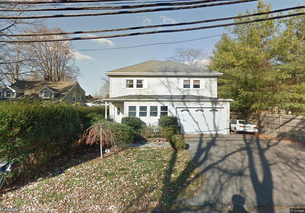
7 Woodside Ave Norwalk, CT 06855
East Norwalk NeighborhoodEstimated Value: $804,000 - $1,205,000
4
Beds
3
Baths
2,200
Sq Ft
$424/Sq Ft
Est. Value
About This Home
This home is located at 7 Woodside Ave, Norwalk, CT 06855 and is currently estimated at $933,870, approximately $424 per square foot. 7 Woodside Ave is a home located in Fairfield County with nearby schools including Marvin Elementary School, Nathan Hale Middle School, and Norwalk High School.
Ownership History
Date
Name
Owned For
Owner Type
Purchase Details
Closed on
Mar 1, 2007
Sold by
Miller Jimmy
Bought by
Lahiri Devashish and Lahiri Nibedita
Current Estimated Value
Home Financials for this Owner
Home Financials are based on the most recent Mortgage that was taken out on this home.
Original Mortgage
$400,000
Interest Rate
6.27%
Purchase Details
Closed on
Aug 2, 2005
Sold by
Lea Hilary
Bought by
Miller Jimmy
Home Financials for this Owner
Home Financials are based on the most recent Mortgage that was taken out on this home.
Original Mortgage
$306,000
Interest Rate
5.67%
Create a Home Valuation Report for This Property
The Home Valuation Report is an in-depth analysis detailing your home's value as well as a comparison with similar homes in the area
Home Values in the Area
Average Home Value in this Area
Purchase History
| Date | Buyer | Sale Price | Title Company |
|---|---|---|---|
| Lahiri Devashish | $523,000 | -- | |
| Lahiri Devashish | $523,000 | -- | |
| Miller Jimmy | $340,000 | -- | |
| Miller Jimmy | $340,000 | -- |
Source: Public Records
Mortgage History
| Date | Status | Borrower | Loan Amount |
|---|---|---|---|
| Open | Miller Jimmy | $387,000 | |
| Closed | Miller Jimmy | $400,000 | |
| Previous Owner | Miller Jimmy | $306,000 |
Source: Public Records
Tax History Compared to Growth
Tax History
| Year | Tax Paid | Tax Assessment Tax Assessment Total Assessment is a certain percentage of the fair market value that is determined by local assessors to be the total taxable value of land and additions on the property. | Land | Improvement |
|---|---|---|---|---|
| 2025 | $10,682 | $446,940 | $172,590 | $274,350 |
| 2024 | $10,523 | $446,940 | $172,590 | $274,350 |
| 2023 | $8,058 | $321,210 | $126,820 | $194,390 |
| 2022 | $7,884 | $321,210 | $126,820 | $194,390 |
| 2021 | $7,699 | $321,210 | $126,820 | $194,390 |
| 2020 | $7,695 | $321,210 | $126,820 | $194,390 |
| 2019 | $7,489 | $321,210 | $126,820 | $194,390 |
| 2018 | $6,200 | $233,030 | $107,730 | $125,300 |
| 2017 | $5,984 | $233,020 | $107,730 | $125,290 |
| 2016 | $6,102 | $239,850 | $107,730 | $132,120 |
| 2015 | $5,912 | $233,030 | $107,730 | $125,300 |
| 2014 | $5,835 | $233,030 | $107,730 | $125,300 |
Source: Public Records
Map
Nearby Homes
- 14 Scofield Place
- 18 Roxbury Rd
- 25 Dairy Farm Rd
- 14 Dairy Farm Rd
- 17 Pequot Dr
- 6 Willow St
- 189 East Ave
- 162 Strawberry Hill Ave
- 12 Pine Hill Ave
- 1 1/2 Colony Place
- 26 Rowan St
- 38 Gregory Blvd
- 16 Katy Ln
- 16 Elton Ct
- 142 East Ave Unit A103
- 142 East Ave Unit 403
- 142 East Ave Unit A304
- 144 East Ave Unit B404
- 142 East Ave Unit A102
- 77 Walter Ave
- 5 Woodside Ave
- 4 Woodside Ave
- 36 N Bridge St
- 34 N Bridge St
- 38 N Bridge St
- 40 N Bridge St
- 30 N Bridge St
- 3 N Bridge St
- 42 N Bridge St
- 48 N Bridge St
- 16 Reboda Ct
- 16 Reboda Ct
- 50 N Bridge St
- 1 N Bridge St
- 24 Reboda Ct
- 48 Scofield Place
- 46 Scofield Place
- 22 Reboda Ct Unit 24
- 10 Reboda Ct Unit 12
- 14 Reboda Ct Unit 16