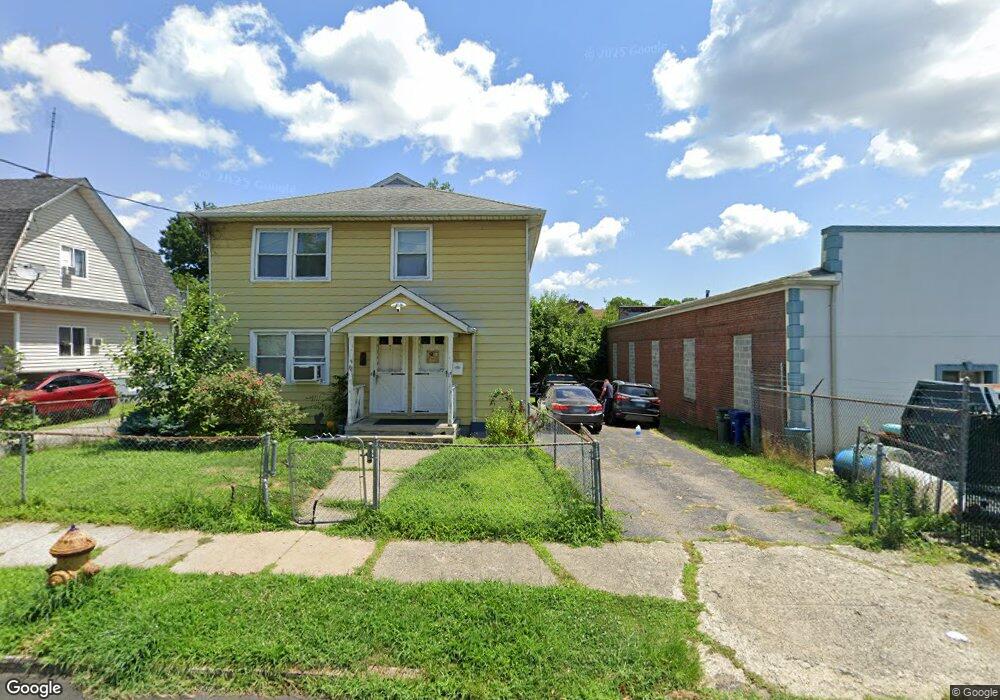
70-72 Sage Ave Bridge Port, CT 06610
Boston Ave-Mill Hill NeighborhoodEstimated Value: $387,196 - $434,000
4
Beds
2
Baths
2,052
Sq Ft
$198/Sq Ft
Est. Value
About This Home
This home is located at 70-72 Sage Ave, Bridge Port, CT 06610 and is currently estimated at $406,799, approximately $198 per square foot. 70-72 Sage Ave is a home located in Fairfield County with nearby schools including Hall School and Harding High School.
Ownership History
Date
Name
Owned For
Owner Type
Purchase Details
Closed on
Jun 20, 2011
Sold by
Arroyo Victor
Bought by
Morales Melissa
Current Estimated Value
Home Financials for this Owner
Home Financials are based on the most recent Mortgage that was taken out on this home.
Original Mortgage
$132,310
Outstanding Balance
$91,681
Interest Rate
4.74%
Estimated Equity
$315,118
Purchase Details
Closed on
May 10, 2006
Sold by
Jabecki Pauline
Bought by
Arroyo Victor
Home Financials for this Owner
Home Financials are based on the most recent Mortgage that was taken out on this home.
Original Mortgage
$218,000
Interest Rate
6.4%
Purchase Details
Closed on
May 2, 1990
Sold by
Lapke Thomas
Bought by
Smith Pauline
Purchase Details
Closed on
Dec 17, 1987
Sold by
Kopcik Michael
Bought by
Lopke Thomas
Create a Home Valuation Report for This Property
The Home Valuation Report is an in-depth analysis detailing your home's value as well as a comparison with similar homes in the area
Home Values in the Area
Average Home Value in this Area
Purchase History
| Date | Buyer | Sale Price | Title Company |
|---|---|---|---|
| Morales Melissa | $146,000 | -- | |
| Morales Melissa | $146,000 | -- | |
| Arroyo Victor | $272,500 | -- | |
| Arroyo Victor | $272,500 | -- | |
| Smith Pauline | $153,000 | -- | |
| Lopke Thomas | $162,000 | -- |
Source: Public Records
Mortgage History
| Date | Status | Borrower | Loan Amount |
|---|---|---|---|
| Open | Lopke Thomas | $132,310 | |
| Closed | Lopke Thomas | $132,310 | |
| Previous Owner | Lopke Thomas | $218,000 |
Source: Public Records
Tax History Compared to Growth
Tax History
| Year | Tax Paid | Tax Assessment Tax Assessment Total Assessment is a certain percentage of the fair market value that is determined by local assessors to be the total taxable value of land and additions on the property. | Land | Improvement |
|---|---|---|---|---|
| 2025 | $6,802 | $156,550 | $47,780 | $108,770 |
| 2024 | $6,802 | $156,550 | $47,780 | $108,770 |
| 2023 | $6,802 | $156,550 | $47,780 | $108,770 |
| 2022 | $6,802 | $156,550 | $47,780 | $108,770 |
| 2021 | $6,802 | $156,550 | $47,780 | $108,770 |
| 2020 | $5,838 | $108,130 | $18,890 | $89,240 |
| 2019 | $5,838 | $108,130 | $18,890 | $89,240 |
| 2018 | $5,879 | $108,130 | $18,890 | $89,240 |
| 2017 | $5,879 | $108,130 | $18,890 | $89,240 |
| 2016 | $5,879 | $108,130 | $18,890 | $89,240 |
| 2015 | $6,127 | $145,190 | $26,660 | $118,530 |
| 2014 | $6,127 | $145,190 | $26,660 | $118,530 |
Source: Public Records
Map
Nearby Homes
- 35 Kent Ave
- 102 Bowe Ave
- 652 Bishop Ave Unit 656
- 415 Bruce Ave
- 1804 Barnum Ave
- 270 East Ave
- 266 Peace St
- 400 East Ave
- 69 Weber Ave
- 1922 Boston Ave Unit 1924
- 2152 Barnum Ave
- 73 Pixlee Place
- 215 Summerfield Ave
- 123 Summerfield Ave
- 123-125 Summerfield Ave
- 216 Clover St
- 3 Granfield Ave
- 260 Success Ave Unit 21
- 32 Franklin Ave
- 401 Granfield Ave Unit 2
- 82 Sage Ave
- 82 Sage Ave Unit 84
- 72 Sage Ave
- 92 Sage Ave
- 79 Sage Ave Unit 81
- 69 Sage Ave Unit 71
- 49 Sage Ave
- 49 Sage Ave Unit 1
- 49 Sage Ave Unit 2R
- 100 Sage Ave
- 93 Sage Ave Unit 3
- 93 Sage Ave Unit 2
- 91 Sage Ave
- 110 Sage Ave
- 103 Sage Ave
- 55 Bowe Ave
- 101 Sage Ave
- 25 Bowe Ave
- 88-92 Kent Ave
- 109 Sage Ave