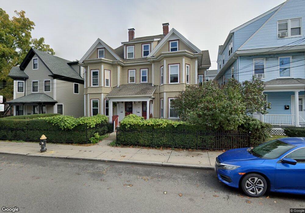
70 Allston St Unit A Allston, MA 02134
Commonwealth NeighborhoodEstimated Value: $546,000 - $825,000
1
Bed
1
Bath
1,248
Sq Ft
$521/Sq Ft
Est. Value
About This Home
This home is located at 70 Allston St Unit A, Allston, MA 02134 and is currently estimated at $650,615, approximately $521 per square foot. 70 Allston St Unit A is a home located in Suffolk County with nearby schools including Match Charter Public School, Boston Green Academy Horace Mann Charter School, and German International School Boston.
Ownership History
Date
Name
Owned For
Owner Type
Purchase Details
Closed on
Mar 26, 1990
Sold by
Mcnamara Marc D
Bought by
Sears Bradford R
Current Estimated Value
Home Financials for this Owner
Home Financials are based on the most recent Mortgage that was taken out on this home.
Original Mortgage
$73,500
Interest Rate
10.15%
Mortgage Type
Purchase Money Mortgage
Purchase Details
Closed on
Nov 30, 1987
Sold by
Spencer Robert C
Bought by
Mcnamara Marc D
Create a Home Valuation Report for This Property
The Home Valuation Report is an in-depth analysis detailing your home's value as well as a comparison with similar homes in the area
Home Values in the Area
Average Home Value in this Area
Purchase History
| Date | Buyer | Sale Price | Title Company |
|---|---|---|---|
| Sears Bradford R | $115,500 | -- | |
| Mcnamara Marc D | $129,900 | -- |
Source: Public Records
Mortgage History
| Date | Status | Borrower | Loan Amount |
|---|---|---|---|
| Open | Mcnamara Marc D | $30,000 | |
| Open | Mcnamara Marc D | $140,000 | |
| Closed | Mcnamara Marc D | $60,000 | |
| Closed | Mcnamara Marc D | $73,500 |
Source: Public Records
Tax History Compared to Growth
Tax History
| Year | Tax Paid | Tax Assessment Tax Assessment Total Assessment is a certain percentage of the fair market value that is determined by local assessors to be the total taxable value of land and additions on the property. | Land | Improvement |
|---|---|---|---|---|
| 2025 | $5,210 | $449,900 | $0 | $449,900 |
| 2024 | $4,478 | $410,800 | $0 | $410,800 |
| 2023 | $4,412 | $410,800 | $0 | $410,800 |
| 2022 | $4,217 | $387,600 | $0 | $387,600 |
| 2021 | $4,136 | $387,600 | $0 | $387,600 |
| 2020 | $4,593 | $434,900 | $0 | $434,900 |
| 2019 | $4,494 | $426,400 | $0 | $426,400 |
| 2018 | $4,178 | $398,700 | $0 | $398,700 |
| 2017 | $3,910 | $369,200 | $0 | $369,200 |
| 2016 | $3,726 | $338,700 | $0 | $338,700 |
| 2015 | $3,982 | $328,800 | $0 | $328,800 |
| 2014 | $3,759 | $298,800 | $0 | $298,800 |
Source: Public Records
Map
Nearby Homes
- 20 Radcliffe Rd Unit 209
- 20 Radcliffe Rd Unit 112
- 83 Glenville Ave
- 14 Radcliffe Rd Unit 1
- 86 Glenville Ave Unit 2
- 53 Quint Ave
- 130 Glenville Ave
- 5 Spofford Rd Unit 17
- 30 Glenville Ave Unit 1
- 1304 Commonwealth Ave Unit 5
- 21 Park Vale Ave Unit 2
- 1419 Commonwealth Ave Unit 503
- 159-161 Allston
- 1408 Commonwealth Ave Unit 20
- 178 Brighton Ave Unit 12
- 85 Brainerd Rd Unit TH7
- 533 Cambridge St Unit 105
- 147 Kelton St Unit 305
- 15 N Beacon St Unit 328
- 15 N Beacon St Unit 412
- 68 Allston St Unit C
- 68 Allston St Unit 70
- 68 Allston St
- 70 Allston St Unit B
- 68 Allston St Unit 70
- 68 Allston St Unit 2
- 70 Allston St
- 68 Allston St
- 70 Allston St Unit 2
- 68 Allston St Unit 1
- 68 Allston St Unit D
- 70 Allston St
- 68 Allston St Unit 68
- 66 Allston St
- 66 Allston St
- 66 Allston St Unit 1
- 66 Allston St Unit 2
- 66 Allston St Unit 302
- 66 Allston St Unit 301
- 66 Allston St Unit 203