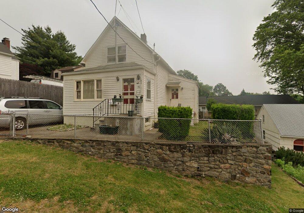
70 Alton Place Fairfield, CT 06825
Tunxis Hill NeighborhoodEstimated Value: $466,000 - $526,000
2
Beds
2
Baths
1,036
Sq Ft
$484/Sq Ft
Est. Value
About This Home
This home is located at 70 Alton Place, Fairfield, CT 06825 and is currently estimated at $501,571, approximately $484 per square foot. 70 Alton Place is a home located in Fairfield County with nearby schools including Mckinley Elementary School, Tomlinson Middle School, and Fairfield Warde High School.
Ownership History
Date
Name
Owned For
Owner Type
Purchase Details
Closed on
Nov 30, 1993
Sold by
Hall Jeanne and Bouchard Olga
Bought by
Adams Marion E and Wargo Jack
Current Estimated Value
Home Financials for this Owner
Home Financials are based on the most recent Mortgage that was taken out on this home.
Original Mortgage
$110,000
Interest Rate
6.72%
Mortgage Type
Unknown
Create a Home Valuation Report for This Property
The Home Valuation Report is an in-depth analysis detailing your home's value as well as a comparison with similar homes in the area
Home Values in the Area
Average Home Value in this Area
Purchase History
| Date | Buyer | Sale Price | Title Company |
|---|---|---|---|
| Adams Marion E | $143,000 | -- | |
| Adams Marion E | $143,000 | -- |
Source: Public Records
Mortgage History
| Date | Status | Borrower | Loan Amount |
|---|---|---|---|
| Open | Adams Marion E | $405,000 | |
| Closed | Adams Marion E | $365,000 | |
| Closed | Adams Marion E | $110,000 |
Source: Public Records
Tax History Compared to Growth
Tax History
| Year | Tax Paid | Tax Assessment Tax Assessment Total Assessment is a certain percentage of the fair market value that is determined by local assessors to be the total taxable value of land and additions on the property. | Land | Improvement |
|---|---|---|---|---|
| 2025 | $6,294 | $221,690 | $172,480 | $49,210 |
| 2024 | $6,185 | $221,690 | $172,480 | $49,210 |
| 2023 | $6,099 | $221,690 | $172,480 | $49,210 |
| 2022 | $6,039 | $221,690 | $172,480 | $49,210 |
| 2021 | $5,981 | $221,690 | $172,480 | $49,210 |
| 2020 | $5,316 | $198,450 | $143,780 | $54,670 |
| 2019 | $5,316 | $198,450 | $143,780 | $54,670 |
| 2018 | $13,503 | $198,450 | $143,780 | $54,670 |
| 2017 | $12,900 | $198,450 | $143,780 | $54,670 |
| 2016 | $5,051 | $198,450 | $143,780 | $54,670 |
| 2015 | $4,911 | $198,100 | $152,460 | $45,640 |
| 2014 | $4,834 | $198,100 | $152,460 | $45,640 |
Source: Public Records
Map
Nearby Homes
- 299 Marlborough Terrace
- 333 Lenox Rd
- 140 Tunxis Hill Cut Off
- 24 Warsaw St
- 74 Soundview Ave
- 62 Soundview Ave
- 244 Tunxis Hill Cut Off
- 42 Fairway Green
- 90 2nd St
- 251 Soundview Ave
- 90 White Oak Rd
- 27 Bloomfield Dr
- 67 Campfield Dr
- 299 Villa Ave
- 151 May St
- 303 Villa Ave
- 155 Moody Ave
- 148 Roseville St
- 152 Roseville St
- 1335 Black Rock Turnpike
- 230 Marlborough Terrace
- 245 Old Stratfield Rd
- 261 Old Stratfield Rd
- 222 Marlborough Terrace
- 256 Marlborough Terrace
- 233 Marlborough Terrace
- 241 Old Stratfield Rd
- 241 Old Stratfield Rd Unit 2
- 252 Marlborough Terrace
- 264 Marlborough Terrace
- 289 Old Stratfield Rd
- 210 Marlborough Terrace
- 287 Old Stratfield Rd
- 287 Old Stratfield Rd Unit 289
- 259 Marlborough Terrace
- 282 Marlborough Terrace
- 305 Old Stratfield Rd
- 231 Old Stratfield Rd
- 194 Marlborough Terrace
- 211 Marlborough Terrace