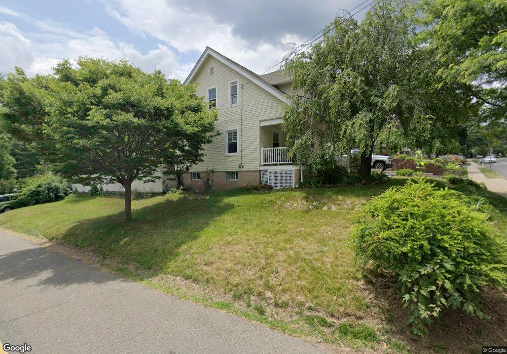
70 Ashwood Ave Summit, NJ 07901
Estimated Value: $810,240 - $1,391,000
--
Bed
--
Bath
2,322
Sq Ft
$437/Sq Ft
Est. Value
About This Home
This home is located at 70 Ashwood Ave, Summit, NJ 07901 and is currently estimated at $1,013,810, approximately $436 per square foot. 70 Ashwood Ave is a home located in Union County with nearby schools including L C Johnson Summit Middle School, Summit Sr High School, and Oak Knoll School of the Holy Child.
Ownership History
Date
Name
Owned For
Owner Type
Purchase Details
Closed on
Mar 10, 2009
Sold by
Nocerino Carmela and Nocerino Robert
Bought by
Nocerino Carmela
Current Estimated Value
Home Financials for this Owner
Home Financials are based on the most recent Mortgage that was taken out on this home.
Original Mortgage
$260,000
Outstanding Balance
$162,585
Interest Rate
4.9%
Mortgage Type
Purchase Money Mortgage
Estimated Equity
$851,225
Purchase Details
Closed on
Jan 17, 2003
Sold by
Frequenza Andrea
Bought by
Frequenza Carmela
Home Financials for this Owner
Home Financials are based on the most recent Mortgage that was taken out on this home.
Original Mortgage
$108,913
Interest Rate
6.09%
Create a Home Valuation Report for This Property
The Home Valuation Report is an in-depth analysis detailing your home's value as well as a comparison with similar homes in the area
Home Values in the Area
Average Home Value in this Area
Purchase History
| Date | Buyer | Sale Price | Title Company |
|---|---|---|---|
| Nocerino Carmela | -- | None Available | |
| Frequenza Carmela | $300,000 | -- |
Source: Public Records
Mortgage History
| Date | Status | Borrower | Loan Amount |
|---|---|---|---|
| Open | Nocerino Carmela | $260,000 | |
| Closed | Frequenza Carmela | $108,913 |
Source: Public Records
Tax History Compared to Growth
Tax History
| Year | Tax Paid | Tax Assessment Tax Assessment Total Assessment is a certain percentage of the fair market value that is determined by local assessors to be the total taxable value of land and additions on the property. | Land | Improvement |
|---|---|---|---|---|
| 2025 | $9,714 | $223,000 | $124,200 | $98,800 |
| 2024 | $9,649 | $223,000 | $124,200 | $98,800 |
| 2023 | $9,649 | $223,000 | $124,200 | $98,800 |
| 2022 | $9,551 | $223,000 | $124,200 | $98,800 |
| 2021 | $9,627 | $223,000 | $124,200 | $98,800 |
| 2020 | $9,723 | $223,000 | $124,200 | $98,800 |
| 2019 | $9,734 | $223,000 | $124,200 | $98,800 |
| 2018 | $9,672 | $223,000 | $124,200 | $98,800 |
| 2017 | $9,734 | $223,000 | $124,200 | $98,800 |
| 2016 | $9,591 | $223,000 | $124,200 | $98,800 |
| 2015 | $9,404 | $223,000 | $124,200 | $98,800 |
| 2014 | $9,161 | $223,000 | $124,200 | $98,800 |
Source: Public Records
Map
Nearby Homes
- 10 Henry St
- 2 Glen Ave
- 103 Park Ave Unit E206
- 103 Park Ave Unit E201
- 7 Valemont Way
- 10 Rowan Rd
- 16 Beauvoir Ave
- 28 Morris Ave Unit G4
- 160 Springfield Ave
- 1 Irving Place
- 109 Mountain Ave
- 34 Ashland Rd
- 30 Prospect St
- 40 Prospect St
- 49 Oakland Place
- 67 Tulip St
- 58 Prospect Hill Ave
- 64 Highlands Ave
- 133 Summit Ave Unit 10
- 84D Troy Dr
- 72 Ashwood Ave
- 74 Ashwood Ave
- 36 Michigan Ave
- 35 Michigan Ave
- 76 Ashwood Ave
- 5 Faitoute Ct
- 68 Ashwood Ave Unit 68A
- 37 Michigan Ave
- 38 Michigan Ave
- 66 Ashwood Ave
- 7 Faitoute Ct
- 39 Michigan Ave
- 78 Ashwood Ave
- 73 Ashwood Ave
- 73 Ashwood Ave Unit Left
- 41 Michigan Ave
- 64 Ashwood Ave
- 75 Ashwood Ave
- 80 Ashwood Ave
- 67 Ashwood Ave