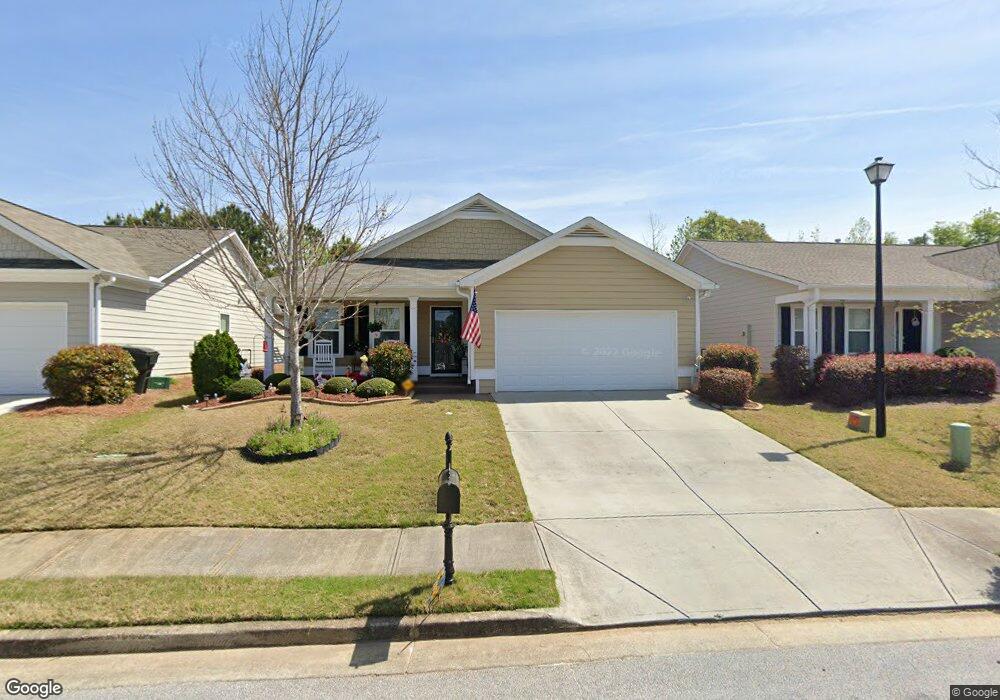
70 Baltusrol Way Unit 27 Covington, GA 30014
Estimated Value: $278,694 - $313,000
3
Beds
2
Baths
1,662
Sq Ft
$177/Sq Ft
Est. Value
About This Home
This home is located at 70 Baltusrol Way Unit 27, Covington, GA 30014 and is currently estimated at $294,424, approximately $177 per square foot. 70 Baltusrol Way Unit 27 is a home located in Newton County with nearby schools including East Newton Elementary School, Cousins Middle School, and Eastside High School.
Ownership History
Date
Name
Owned For
Owner Type
Purchase Details
Closed on
Dec 7, 2016
Sold by
Dubois Susan J
Bought by
Harrison Peggy S
Current Estimated Value
Purchase Details
Closed on
May 12, 2015
Sold by
Nenaprises Llc
Bought by
Dubois Susan J
Home Financials for this Owner
Home Financials are based on the most recent Mortgage that was taken out on this home.
Original Mortgage
$65,000
Interest Rate
3.79%
Mortgage Type
New Conventional
Purchase Details
Closed on
Feb 10, 2015
Sold by
Paulee Partners Lllp
Bought by
Nenaprises Llc
Home Financials for this Owner
Home Financials are based on the most recent Mortgage that was taken out on this home.
Original Mortgage
$106,875
Interest Rate
3.75%
Mortgage Type
New Conventional
Create a Home Valuation Report for This Property
The Home Valuation Report is an in-depth analysis detailing your home's value as well as a comparison with similar homes in the area
Home Values in the Area
Average Home Value in this Area
Purchase History
| Date | Buyer | Sale Price | Title Company |
|---|---|---|---|
| Harrison Peggy S | $148,400 | -- | |
| Dubois Susan J | $143,171 | -- | |
| Nenaprises Llc | $28,000 | -- |
Source: Public Records
Mortgage History
| Date | Status | Borrower | Loan Amount |
|---|---|---|---|
| Previous Owner | Dubois Susan J | $65,000 | |
| Previous Owner | Nenaprises Llc | $106,875 |
Source: Public Records
Tax History Compared to Growth
Tax History
| Year | Tax Paid | Tax Assessment Tax Assessment Total Assessment is a certain percentage of the fair market value that is determined by local assessors to be the total taxable value of land and additions on the property. | Land | Improvement |
|---|---|---|---|---|
| 2024 | $2,606 | $122,680 | $18,000 | $104,680 |
| 2023 | $2,980 | $117,480 | $11,200 | $106,280 |
| 2022 | $2,097 | $88,360 | $11,200 | $77,160 |
| 2021 | $1,846 | $74,800 | $11,200 | $63,600 |
| 2020 | $1,733 | $68,040 | $11,200 | $56,840 |
| 2019 | $1,757 | $67,760 | $11,200 | $56,560 |
| 2018 | $786 | $62,680 | $8,000 | $54,680 |
| 2017 | $1,359 | $57,480 | $8,000 | $49,480 |
| 2016 | $2,305 | $56,080 | $9,600 | $46,480 |
| 2015 | $406 | $9,600 | $9,600 | $0 |
| 2014 | -- | $4,800 | $0 | $0 |
Source: Public Records
Map
Nearby Homes
- 7703 Fawn Cir
- 7762 Fawn Cir
- 130 S Links Dr
- 10110 Malcolm Ct
- 10155 Malcolm Dr
- 10184 Malcolm Dr
- 8193 Monticello St
- 10216 Azalea Dr
- 8 Jackson Rd
- 345 River Walk Farm Unit LOT 5
- 323 River Walk Farm
- 330 River Walk Farm
- 338 River Walk Farm
- 344 River Walk Farm
- 75 Woodfield Rd
- 8239 High Lake Terrace SE
- 210 Kestrel Cir
- 115 Sagebrush Trail
- 13262 Tolstoy Dr
- 10119 Azalea Dr
- 70 Baltusrol Way
- 80 Baltusrol Way Unit 28
- 80 Baltusrol Way
- 60 Baltusrol Way Unit 26
- 60 Baltusrol Way
- 50 Baltusrol Way Unit 25
- 50 Baltusrol Way
- 90 Baltusrol Way Unit 29
- 90 Baltusrol Way
- 65 Baltusrol Way SE
- 65 Baltusrol Way
- 75 Baltusrol Way Unit 62
- 75 Baltusrol Way
- 100 Baltusrol Way Unit 30
- 100 Baltusrol Way
- 40 Baltusrol Way Unit 24
- 40 Baltusrol Way
- 55 Baltusrol Way Unit 60
- 0 Baltusrol Way SE
- 55 Baltusrol Way