Estimated Value: $567,000 - $605,000
7
Beds
4
Baths
5,678
Sq Ft
$103/Sq Ft
Est. Value
About This Home
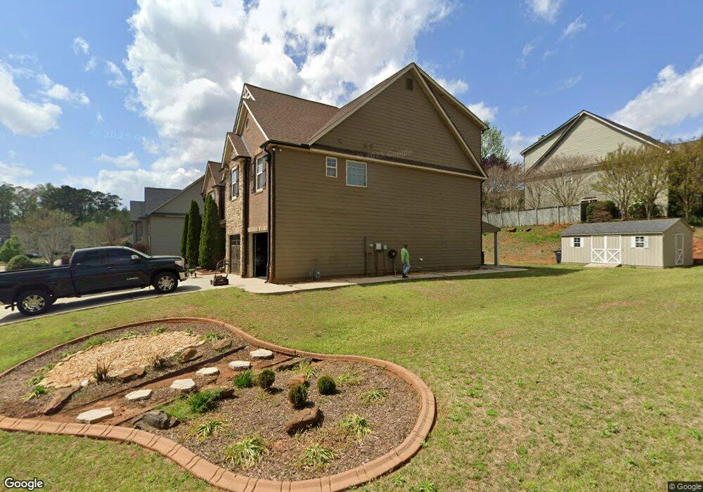
This home is located at 70 Berkford Cir, Hiram, GA 30141 and is currently estimated at $584,405, approximately $102 per square foot. 70 Berkford Cir is a home located in Paulding County with nearby schools including Hiram Elementary School, P. B. Ritch Middle School, and Hiram High School.
Ownership History
Date
Name
Owned For
Owner Type
Purchase Details
Closed on
Dec 3, 2009
Sold by
United Cmnty Bk
Bought by
Barnwell Michael A and Barnwell Michelle P
Current Estimated Value
Home Financials for this Owner
Home Financials are based on the most recent Mortgage that was taken out on this home.
Original Mortgage
$245,373
Outstanding Balance
$160,948
Interest Rate
5.01%
Mortgage Type
FHA
Estimated Equity
$423,457
Create a Home Valuation Report for This Property
The Home Valuation Report is an in-depth analysis detailing your home's value as well as a comparison with similar homes in the area
Home Values in the Area
Average Home Value in this Area
Purchase History
| Date | Buyer | Sale Price | Title Company |
|---|---|---|---|
| Barnwell Michael A | $249,900 | -- |
Source: Public Records
Mortgage History
| Date | Status | Borrower | Loan Amount |
|---|---|---|---|
| Open | Barnwell Michael A | $245,373 |
Source: Public Records
Tax History Compared to Growth
Tax History
| Year | Tax Paid | Tax Assessment Tax Assessment Total Assessment is a certain percentage of the fair market value that is determined by local assessors to be the total taxable value of land and additions on the property. | Land | Improvement |
|---|---|---|---|---|
| 2024 | $6,140 | $250,064 | $16,000 | $234,064 |
| 2023 | $5,588 | $216,864 | $16,000 | $200,864 |
| 2022 | $4,555 | $176,588 | $16,000 | $160,588 |
| 2021 | $3,785 | $132,104 | $16,000 | $116,104 |
| 2020 | $3,970 | $135,508 | $16,000 | $119,508 |
| 2019 | $3,689 | $124,308 | $16,000 | $108,308 |
| 2018 | $3,644 | $122,828 | $16,000 | $106,828 |
| 2017 | $3,957 | $131,392 | $14,000 | $117,392 |
| 2016 | $3,365 | $113,152 | $12,000 | $101,152 |
| 2015 | $3,609 | $119,112 | $12,000 | $107,112 |
| 2014 | $3,560 | $114,636 | $12,000 | $102,636 |
| 2013 | -- | $98,920 | $12,000 | $86,920 |
Source: Public Records
Map
Nearby Homes
- 14 Berkten Ct
- 9 Darbys Run Way
- 24 Darbys Run Way
- 52 Darbys Run Way
- 25 Derby Dr
- 96 Quail Bend Way
- 304 Greystone Pkwy
- 273 Baywood Crossing
- 67 Highgrove Way
- 386 Hill Crest Cir
- 310 Bill Carruth Pkwy
- 289 Highgrove Way
- 322 Lanier Ct
- 146 Rosemont Ct
- 21 Copeland Ln
- 176 Oakland Way
- 98 Baywood Way
- 00 Highland
- 536 Highland Falls Dr
- 194 Prospect Path
- 116 Berkford Cir
- 46 Berkford Cir
- 134 Berkford Cir
- 63 Berkford Cir Unit 4
- 63 Berkford Cir
- 103 Berkford Cir Unit 6
- 103 Berkford Cir
- 75 Berkford Cir Unit 5
- 75 Berkford Cir
- 119 Berkford Cir Unit 7
- 49 Berkford Cir Unit 3
- 49 Berkford Cir
- 95 Berkleigh Trails Dr
- 174 Berkford Cir
- 35 Berkford Cir
- 35 Berkford Cir Unit 4
- 115 Berkleigh Trails Dr
- 135 Berkleigh Trails Dr
- 137 Berkford Cir
- 76 Berkford Cir Unit 5