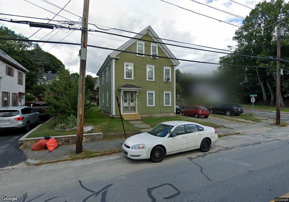
70 Berkley St Taunton, MA 02780
Weir Village NeighborhoodEstimated Value: $410,000 - $610,000
4
Beds
2
Baths
1,728
Sq Ft
$291/Sq Ft
Est. Value
About This Home
This home is located at 70 Berkley St, Taunton, MA 02780 and is currently estimated at $503,409, approximately $291 per square foot. 70 Berkley St is a home located in Bristol County with nearby schools including East Taunton Elementary School, Taunton High School, and Our Lady of Lourdes School.
Ownership History
Date
Name
Owned For
Owner Type
Purchase Details
Closed on
Jun 23, 2017
Sold by
Holton Barbara A and Holton Kathleen A
Bought by
Almeida Carina M
Current Estimated Value
Home Financials for this Owner
Home Financials are based on the most recent Mortgage that was taken out on this home.
Original Mortgage
$100,000
Outstanding Balance
$83,247
Interest Rate
4.05%
Mortgage Type
Unknown
Estimated Equity
$420,162
Purchase Details
Closed on
Mar 20, 2015
Sold by
Est Holton Barbara A and Holton Ralph F
Bought by
Holton Babara A
Home Financials for this Owner
Home Financials are based on the most recent Mortgage that was taken out on this home.
Original Mortgage
$65,000
Interest Rate
3.6%
Mortgage Type
New Conventional
Purchase Details
Closed on
Jan 22, 2010
Sold by
Metzger Charles and Replinski Stanley M
Bought by
Holton Ralph F
Create a Home Valuation Report for This Property
The Home Valuation Report is an in-depth analysis detailing your home's value as well as a comparison with similar homes in the area
Home Values in the Area
Average Home Value in this Area
Purchase History
| Date | Buyer | Sale Price | Title Company |
|---|---|---|---|
| Almeida Carina M | $150,000 | -- | |
| Holton Babara A | -- | -- | |
| Holton Ralph F | $100,000 | -- |
Source: Public Records
Mortgage History
| Date | Status | Borrower | Loan Amount |
|---|---|---|---|
| Open | Almeida Carina M | $100,000 | |
| Previous Owner | Holton Babara A | $65,000 |
Source: Public Records
Tax History Compared to Growth
Tax History
| Year | Tax Paid | Tax Assessment Tax Assessment Total Assessment is a certain percentage of the fair market value that is determined by local assessors to be the total taxable value of land and additions on the property. | Land | Improvement |
|---|---|---|---|---|
| 2025 | $4,459 | $407,600 | $99,500 | $308,100 |
| 2024 | $4,081 | $364,700 | $99,500 | $265,200 |
| 2023 | $3,832 | $318,000 | $99,500 | $218,500 |
| 2022 | $3,447 | $261,500 | $83,000 | $178,500 |
| 2021 | $3,344 | $235,500 | $75,400 | $160,100 |
| 2020 | $3,268 | $219,900 | $75,400 | $144,500 |
| 2019 | $2,998 | $190,200 | $75,400 | $114,800 |
| 2018 | $2,881 | $183,300 | $75,600 | $107,700 |
| 2017 | $2,661 | $169,400 | $71,700 | $97,700 |
| 2016 | $2,556 | $163,000 | $69,600 | $93,400 |
| 2015 | $2,316 | $154,300 | $69,600 | $84,700 |
| 2014 | $2,229 | $152,600 | $67,900 | $84,700 |
Source: Public Records
Map
Nearby Homes
- 6 Southeast St
- 90 E Water St
- 41 Hart Ave
- 195 Pratt St Unit A
- 450 Somerset Ave Unit 2-7
- 450 Somerset Ave Unit 6-6
- 8 Herbert St
- 11 Talbot Ave
- 24 1st St
- 4 Parkin Ct
- 252 Somerset Ave
- 70 Landing Dr Unit 5-L
- 1 Fayal Ave
- 1301 Carriage Ln Unit 1301
- 29 Williams Ave
- 71 Linden St
- 215 High St Unit 21
- 215 High St Unit 20
- 22 Everett St
- 16 Clinton St