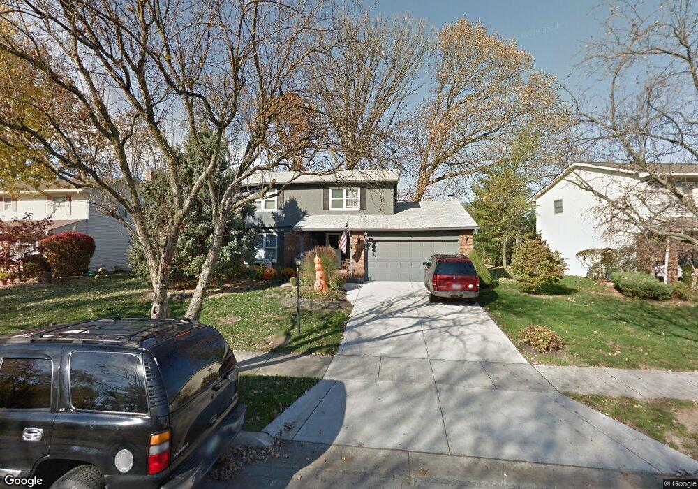
70 Bobby Ln Westerville, OH 43081
Estimated Value: $450,055 - $480,000
4
Beds
3
Baths
2,426
Sq Ft
$192/Sq Ft
Est. Value
About This Home
This home is located at 70 Bobby Ln, Westerville, OH 43081 and is currently estimated at $466,014, approximately $192 per square foot. 70 Bobby Ln is a home located in Franklin County with nearby schools including Mark Twain Elementary School, Walnut Springs Middle School, and Westerville-North High School.
Ownership History
Date
Name
Owned For
Owner Type
Purchase Details
Closed on
Jul 21, 2008
Sold by
Schad Paul and Schad Jane
Bought by
Mcdonald Douglas B and Mcdonald Jessica A
Current Estimated Value
Home Financials for this Owner
Home Financials are based on the most recent Mortgage that was taken out on this home.
Original Mortgage
$205,377
Outstanding Balance
$135,353
Interest Rate
6.5%
Mortgage Type
Purchase Money Mortgage
Estimated Equity
$330,661
Purchase Details
Closed on
Dec 1, 2003
Sold by
Hindman Robert W and Hindman Jerelyn S
Bought by
Schad Paul
Home Financials for this Owner
Home Financials are based on the most recent Mortgage that was taken out on this home.
Original Mortgage
$153,500
Interest Rate
6.01%
Mortgage Type
Purchase Money Mortgage
Purchase Details
Closed on
May 4, 1984
Bought by
Hindman Robert W
Create a Home Valuation Report for This Property
The Home Valuation Report is an in-depth analysis detailing your home's value as well as a comparison with similar homes in the area
Home Values in the Area
Average Home Value in this Area
Purchase History
| Date | Buyer | Sale Price | Title Company |
|---|---|---|---|
| Mcdonald Douglas B | $207,000 | Talon Group | |
| Schad Paul | $191,900 | -- | |
| Hindman Robert W | $94,900 | -- |
Source: Public Records
Mortgage History
| Date | Status | Borrower | Loan Amount |
|---|---|---|---|
| Open | Mcdonald Douglas B | $205,377 | |
| Closed | Schad Paul | $153,500 |
Source: Public Records
Tax History Compared to Growth
Tax History
| Year | Tax Paid | Tax Assessment Tax Assessment Total Assessment is a certain percentage of the fair market value that is determined by local assessors to be the total taxable value of land and additions on the property. | Land | Improvement |
|---|---|---|---|---|
| 2024 | $6,831 | $120,190 | $33,250 | $86,940 |
| 2023 | $6,686 | $120,190 | $33,250 | $86,940 |
| 2022 | $10,568 | $96,430 | $17,150 | $79,280 |
| 2021 | $7,084 | $96,430 | $17,150 | $79,280 |
| 2020 | $7,064 | $96,430 | $17,150 | $79,280 |
| 2019 | $5,747 | $74,060 | $17,150 | $56,910 |
| 2018 | $5,615 | $74,060 | $17,150 | $56,910 |
| 2017 | $5,652 | $74,060 | $17,150 | $56,910 |
| 2016 | $5,778 | $68,920 | $16,940 | $51,980 |
| 2015 | $5,596 | $68,920 | $16,940 | $51,980 |
| 2014 | $5,601 | $68,920 | $16,940 | $51,980 |
| 2013 | $2,663 | $65,625 | $16,135 | $49,490 |
Source: Public Records
Map
Nearby Homes
- 192 Buckeye Ct
- 768 Collingwood Dr
- 589 E College Ave
- 182 Hillcrest Dr
- 200 Matthew Ave
- 150 Matthew Ave
- 417 E Park St
- 371 Delaware Dr
- 368 E College Ave
- 364 E College Ave
- 360 Potawatomi Dr
- 912 Lakeway Ct E
- 539 Cherrington Rd
- 90 Spring Creek Dr
- 969 Farrington Dr
- 0 Cherrington Rd Unit 225023909
- 718 Sugar Ct
- 974 Lakeland Dr
- 73 Keethler Dr S
- 199 E College Ave
- 74 Bobby Ln
- 68 Bobby Ln
- 681 Collingwood Dr
- 685 Collingwood Dr
- 64 Bobby Ln
- 87 Bobby Ln
- 675 Collingwood Dr
- 78 Bobby Ln
- 691 Collingwood Dr
- 77 Bobby Ln
- 80 Debbie Dr
- 101 Debbie Dr
- 699 Collingwood Dr
- 60 Bobby Ln
- 667 Collingwood Dr
- 96 Daniel Dr
- 84 Debbie Dr
- 47 Gladale Dr
- 688 Collingwood Dr
- 682 Collingwood Dr